

Industry Briefing
A single destination for timely, editor-curated robotics news from around the world.

AI-Enhanced Actuation-Compatible Tracking for Miniature Robot Navigation in Vivo
A recent study published in Science Robotics details advancements in AI-driven actuation-compatible tracking systems designed for miniature robots operating in vivo. This innovative approach aims to enhance closed-loop navigation capabilities, enabling more precise movements and interactions within biological environments. The significance of this development lies in its potential applications in medical robotics, where accurate navigation of miniature robots can lead to improved surgical procedures and targeted drug delivery. By integrating AI with actuation systems, these robots can adapt to dynamic biological conditions, thereby increasing their effectiveness in real-world scenarios. Looking ahead, researchers and industry professionals will be monitoring the progress of these technologies as they move towards practical applications in healthcare. The ongoing advancements in AI and robotics could pave the way for groundbreaking solutions in minimally invasive procedures and personalized medicine. No further timeline was disclosed at the time of publication.
Research Article
MilliTrack Introduces AMR+ for Enhanced Robot Navigation Using Millimeter Wave Technology
MilliTrack, a South Korean startup, has developed AMR+, an additional positioning system that utilizes millimeter wave radio signals to enhance robot navigation in challenging environments. Traditional systems relying on cameras and LiDAR often fail in dusty, foggy, or brightly lit conditions, which are common in industrial settings. AMR+ supplements existing navigation systems without replacing them, providing a more reliable source of location data. The significance of AMR+ lies in its ability to improve the accuracy of autonomous mobile robots (AMRs) in environments where conventional SLAM (Simultaneous Localization and Mapping) becomes unreliable. MilliTrack claims that AMR+ can achieve a positioning accuracy of 3 centimeters within a 30-meter range, with a latency of less than 100 milliseconds. This dual-layer positioning approach allows robots to switch between their existing navigation systems and AMR+ as needed, ensuring continuous operational reliability. Looking ahead, MilliTrack plans to launch AMR+ in March 2027, with an expected price of around $1,000 for a tracker and a tag, and $200 for additional tags. The technology has already been deployed in over 30 projects in South Korea, demonstrating its potential to enhance industrial robot navigation without the need for extensive infrastructure changes. No further timeline was disclosed at the time of publication.
Autonomous Mobile Robots Positioning Technology Industrial Automation Millimeter Wave Technology
Light Origins Releases Open-Source LightNav-0 Navigation Model for Monocular Systems
Light Origins has announced the open-sourcing of LightNav-0, a navigation model based on Qwen3-VL-4B. This model was trained using the Real2Sim2Real methodology, incorporating over 2,000 scenes and more than 4,000 hours of Visual Language Annotation (VLA) data. It excels in leading 10 monocular navigation benchmarks with zero-shot body transfer capabilities. The significance of this development lies in its potential to enhance navigation systems across various applications. By leveraging extensive training data and advanced methodologies, LightNav-0 aims to provide robust performance in real-world scenarios, making it a valuable resource for researchers and developers in the field of navigation technology. Looking ahead, stakeholders in the robotics and AI sectors should monitor the adoption and performance of LightNav-0 in practical applications. The open-source nature of this model may encourage further innovation and collaboration, potentially leading to advancements in navigation solutions that utilize monocular systems. No further timeline was disclosed at the time of publication.

New AI Training Technique Enhances Robot Navigation in Crowded Areas
A research team led by Professor Daehee Park at DGIST, in collaboration with KAIST, has developed an innovative AI training method. This technique allows a single compact AI model to predict the movements of nearby individuals while planning safe navigation paths for robots, effectively minimizing performance degradation in both tasks. This advancement is significant as it addresses the challenges faced by robots in crowded environments, enhancing their ability to operate safely and efficiently. The research was presented at the 19th European Conference on Computer Vision (ECCV 2026) in Malmö, Sweden, highlighting its relevance in the field of robotics and AI. Looking ahead, the implications of this research could lead to improved robotic applications in various sectors, particularly in environments where human-robot interaction is critical. No further timeline was disclosed at the time of publication.
Robotics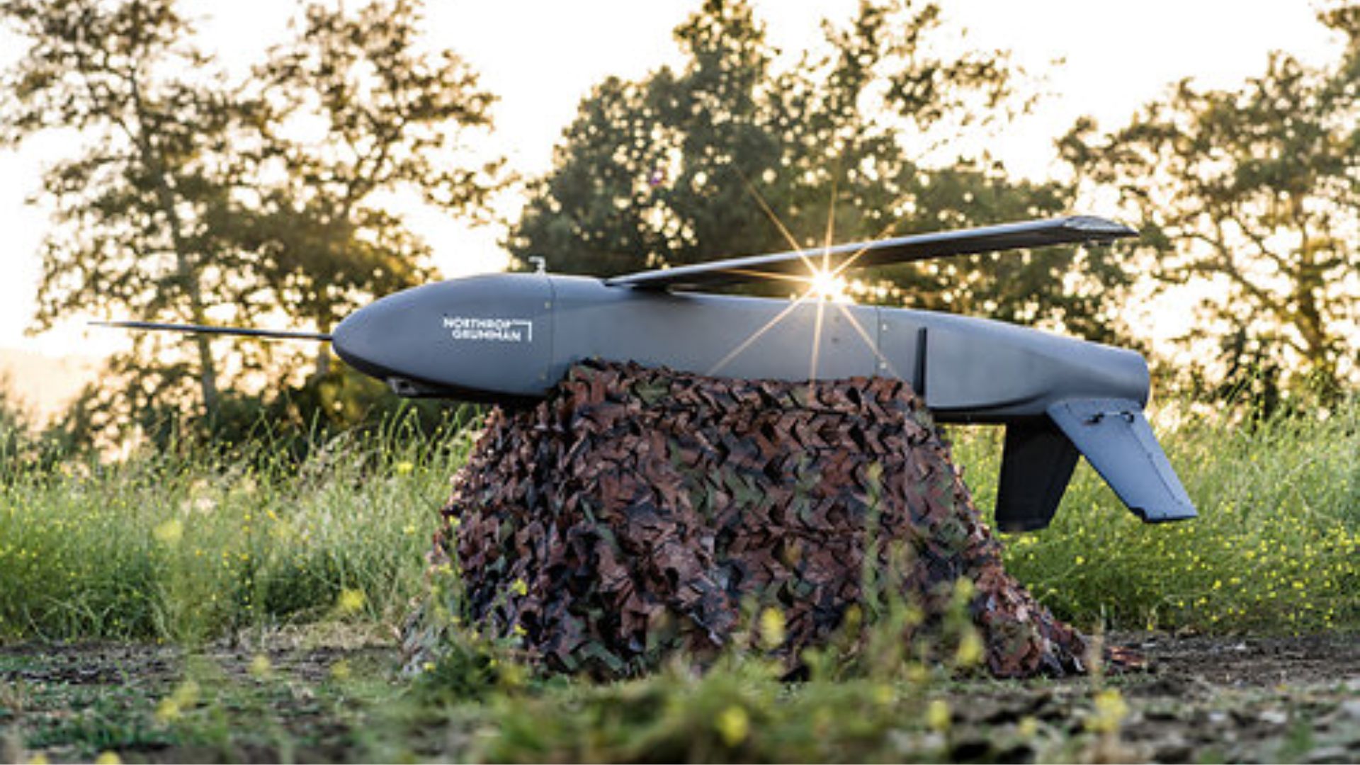
Northrop Grumman's Lumberjack Drone Successfully Tests Quantum Navigation Technology
Sandbox AQ has successfully tested its quantum sensor-based Magnetic Navigation (MagNav) on Northrop Grumman’s Lumberjack drone, marking a significant milestone in unmanned aircraft systems. This test is the first of its kind for an attritable drone, showcasing the potential of quantum navigation in GPS-denied environments, which is increasingly relevant given current military operations. The successful integration of MagNav with Lumberjack's visual navigation system is crucial as the U.S. military seeks alternatives to GPS for navigation and targeting. The ongoing conflicts in Ukraine and West Asia highlight the need for resilient navigation systems that can operate effectively even when GPS signals are jammed or spoofed. This advancement could enhance operational capabilities in contested domains. Looking ahead, the deployment of Sandbox AQ’s AQNav technology in various aircraft platforms could revolutionize military navigation. The ease of integration into existing systems, as demonstrated by the rapid installation on Lumberjack, suggests a promising future for quantum navigation solutions in defense applications. No further timeline was disclosed at the time of publication.
Military
US Defence Innovation Unit Successfully Tests GPS-Free Magnetic Navigation System for Aircraft
The US Defence Innovation Unit (DIU) has completed a successful flight test of a magnetic navigation system designed to guide aircraft without reliance on GPS. This advancement marks a significant step in developing navigation technologies that can operate in environments where GPS signals are weak or unavailable. The ability to navigate aircraft across open oceans without GPS is crucial for enhancing operational capabilities in military and commercial aviation. This technology could provide a reliable alternative for navigation in remote areas, potentially improving safety and efficiency in flight operations. Looking ahead, the implications of this successful test could lead to further developments in navigation systems that enhance aircraft autonomy. No further timeline was disclosed at the time of publication.
News
SFPathFormer Enhances Robot Navigation Using AI Framework and Advanced Techniques
SFPathFormer has significantly improved robot navigation capabilities by integrating frequency-aware perception, dynamic feature selection, and global environmental modeling across four benchmark datasets. This advancement is crucial as it enhances the efficiency and accuracy of vision-based navigation systems in robotics. The importance of this development lies in its potential to optimize how robots perceive and interact with their environments, which is essential for various applications in automation and intelligent manufacturing. By leveraging these advanced techniques, SFPathFormer sets a new standard for performance in robot navigation. Looking ahead, industry professionals should monitor the implementation of SFPathFormer in real-world scenarios and its impact on the robotics landscape. No further timeline was disclosed at the time of publication.
Sonardyne Expands SPRINT-Nav Family for Enhanced Underwater Navigation Across Vehicle Classes
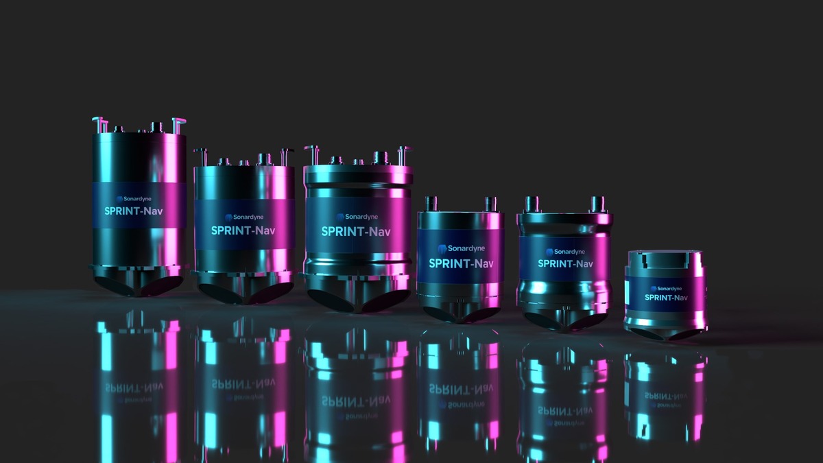
Sonardyne, a Kraken Robotics company, has broadened its SPRINT-Nav technology into a comprehensive family of underwater navigation systems designed for various marine robots. This expansion allows for improved performance in smaller vehicles and extends the operational range of larger platforms, ensuring that all classes of underwater vehicles can benefit from a unified navigation approach. The significance of this development lies in its ability to meet the increasing demands of marine robotics teams, which require reliable navigation for diverse applications such as asset inspection and autonomous missions. The SPRINT-Nav family maintains a shared architecture, enabling seamless integration and operation across different vehicle types, thus simplifying the navigation setup process. Looking ahead, the SPRINT-Nav family is poised to enhance operational efficiency for marine robotics manufacturers and operators. With the ability to easily swap navigation solutions as mission requirements evolve, users can expect improved adaptability and performance. No further timeline was disclosed at the time of publication.
kraken robotics sonardyne sprint-nav subsea vehicles
Innovative Instance Segmentation Method for Navigation Line Extraction in Paddy-Field Weeding Robots
A novel approach utilizing instance segmentation for navigation line extraction has been developed for paddy-field weeding robots. This method enhances the robot's ability to navigate effectively in agricultural environments, improving efficiency in weed management. The significance of this advancement lies in its potential to optimize agricultural practices by enabling robots to perform precise weeding tasks. By employing advanced segmentation techniques, the weeding robots can better identify and navigate around crops, thereby minimizing damage and maximizing yield. Looking ahead, the agricultural robotics sector may see increased adoption of such technologies, which could lead to more autonomous solutions in farming. No further timeline was disclosed at the time of publication.
RESEARCH ARTICLE
Study on Cooperative Navigation Methods for Autonomous Underwater Vehicles in Terrain Mapping
A recent study published in the Journal of Field Robotics explores cooperative navigation methods for autonomous underwater vehicles (AUVs) in terrain mapping. The research focuses on enhancing the accuracy and efficiency of AUVs when mapping underwater environments through collaborative navigation techniques. This research is significant as it addresses the challenges faced by AUVs in accurately mapping complex underwater terrains. By improving navigation methods, the study aims to facilitate better data collection for various applications, including environmental monitoring, underwater exploration, and resource management. Looking ahead, the implications of this research could lead to advancements in AUV technology and its applications in marine research. No further timeline was disclosed at the time of publication.
RESEARCH ARTICLE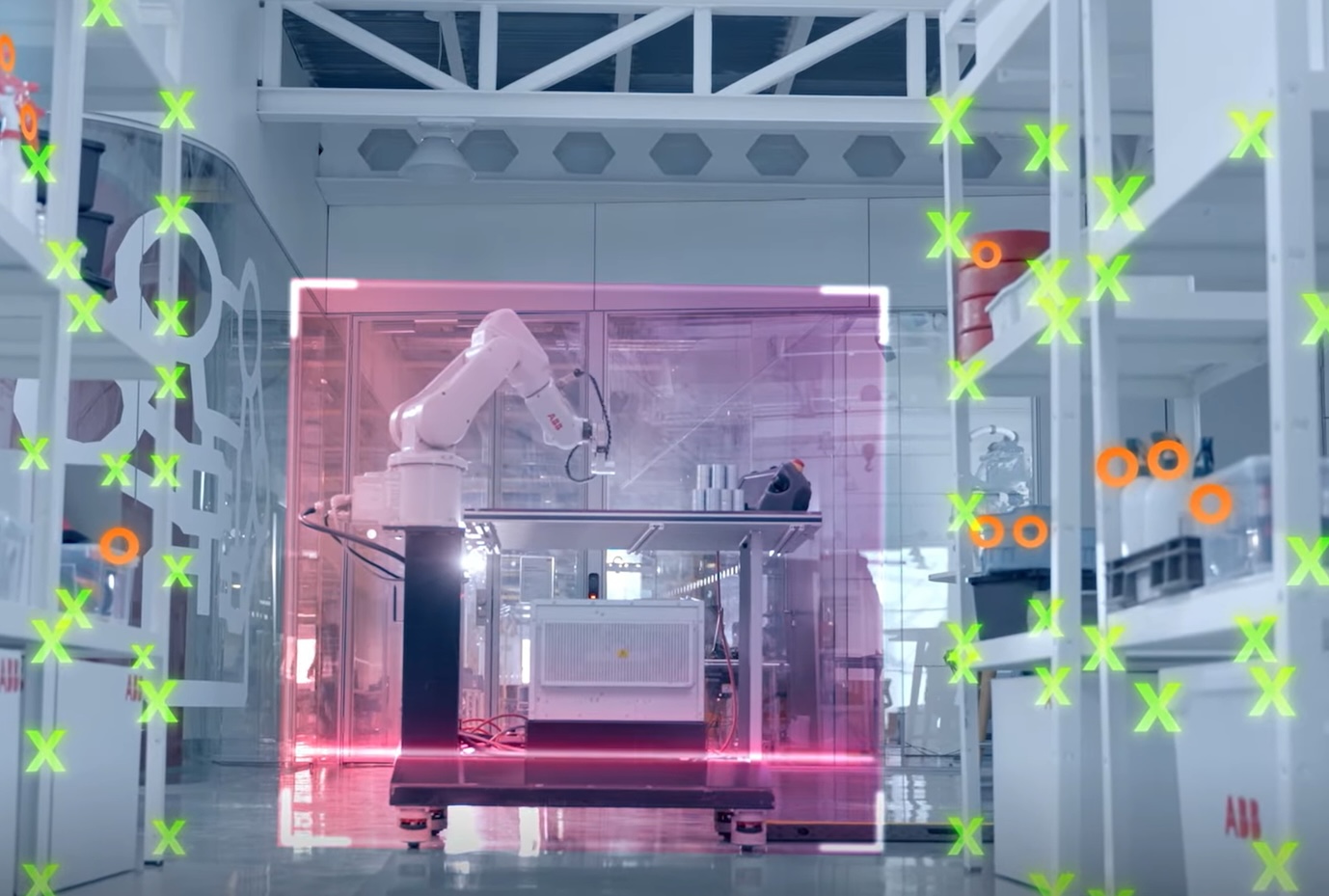
Innovative Navigation Systems Emerge Amidst Battlefield GPS Spoofing Challenges
Recent developments in drone navigation are being driven by the challenges posed by GPS spoofing and other jamming techniques used in warzones. These countermeasures aim to disrupt drone operations, prompting companies to innovate and create navigation systems that can function effectively despite such interference. The significance of these advancements lies in their potential to enhance the reliability and resilience of drone operations in military applications. As drones become increasingly integral to modern warfare, the ability to navigate accurately in jamming environments is crucial for mission success and operational safety. Looking ahead, the focus will be on how these new navigation technologies are integrated into existing drone systems and their performance in real-world scenarios. The ongoing evolution of counter-jamming solutions will be a key area to monitor as the demand for robust drone capabilities continues to grow.
KAIST Unveils Advanced Four-Legged Robot with Autonomous Navigation Technology
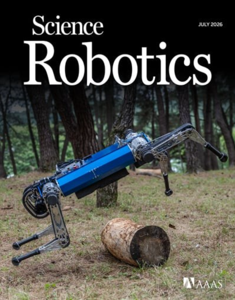
KAIST's mechanical engineering team, led by Professor Park Hai-won, announced a breakthrough in robotic technology on July 16. They developed a four-legged robot capable of autonomously selecting and switching between various gaits in real-time, enabling it to navigate complex outdoor environments with speed and stability. This innovation is significant as it integrates a new control architecture called APT-RL (Action Pre-training Reinforcement Learning based on Transformers), which allows the robot to learn movement through computer simulations rather than traditional motion capture. The robot, named KAIST HOUND, demonstrated its capabilities by traversing diverse terrains, achieving peak speeds of 6 meters per second, faster than an average cyclist. Future developments to watch include the potential applications of this technology in disaster response, defense tasks, and industrial inspections. The research was published in the July issue of the journal Science Robotics, highlighting its importance in advancing the field of robotic control and physical AI.
Four-Legged Robots Robotics Technology AI Autonomous Navigation
Bastian Solutions Highlights the Importance of Flexible AGV Navigation Technology
Bastian Solutions, part of Toyota Automated Logistics, emphasizes the need for adaptable navigation technology in automated guided vehicles (AGVs) as manufacturing and warehouse operations evolve. The company's experience in Georgetown, Kentucky, illustrates the shift from traditional magnetic path following to natural feature navigation, driven by increasing complexity in customer applications. As operations demand greater flexibility and adaptability, the limitations of magnetic guidance systems become more apparent. Bastian's transition to natural feature navigation allows for easier route adjustments and faster commissioning, significantly reducing manual labor and installation time. This change reflects a broader trend in intralogistics where automation is valued not only for reliability but also for its ability to adapt to changing environments. Looking ahead, the emphasis on flexible navigation systems will likely continue to grow as companies face increasing pressures to manage diverse SKUs and frequent process changes. Bastian's choice of BlueBotics for its navigation needs highlights the strategic importance of selecting the right technology to enhance operational efficiency and responsiveness in dynamic settings.
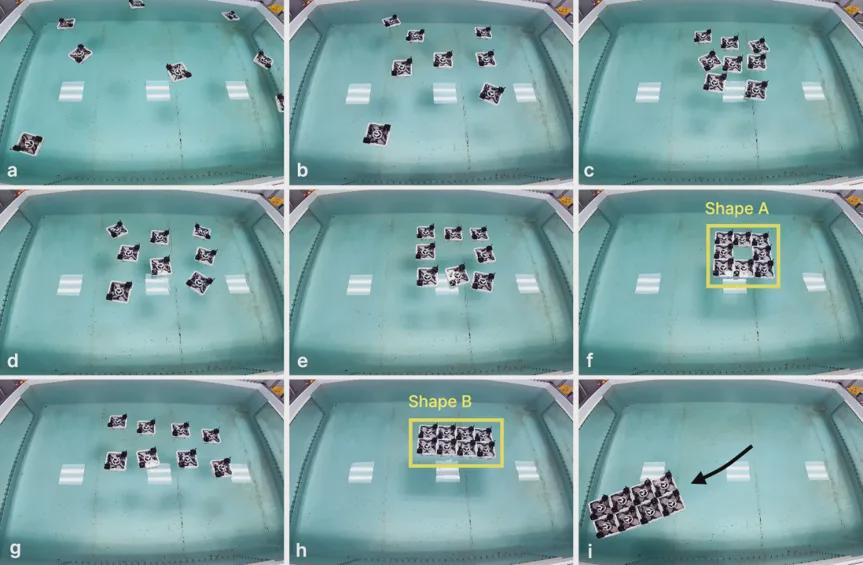
MIT Team Unveils Transformable Robot Fleet for Advanced Water Navigation
A team from MIT, along with collaborators from the University of Wisconsin-Madison, KU Leuven, and Politecnico di Milano, has developed a fleet of eight modular robot boats capable of transforming and navigating water autonomously. Each boat measures 21 cm on each side and can connect to form larger floating platforms, demonstrating advanced coordination without remote control. The significance of this development lies in its potential applications in complex environments where traditional navigation methods may fail. The robots can autonomously handle positioning, collision avoidance, and movement control, adapting their configurations based on tasks, similar to how fire ants form rafts during floods. Looking ahead, the research team has categorized their system as a Modular Self-Reconfigurable Robot (MSRR) system, which allows for dynamic reconfiguration and enhanced functionality. No further timeline was disclosed at the time of publication.
Modular Robotics Autonomous Systems Water Navigation Distributed Control Robotics Research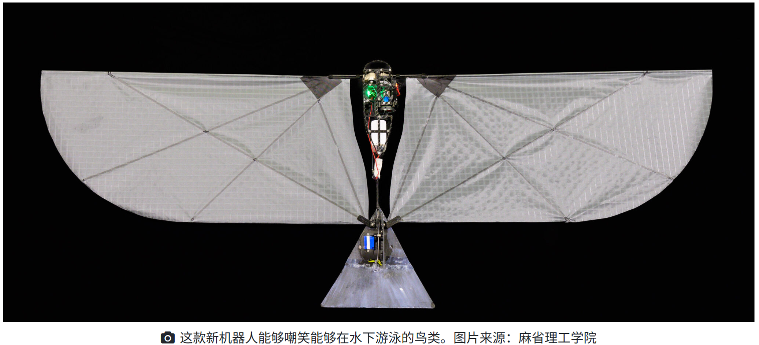
MIT and EPFL Unveil 250g Flapping Robot for Dual Aerial and Aquatic Navigation
MIT and EPFL have developed the Flapping-wing Aerial-Aquatic Vehicle (FAAV), weighing just 250 grams. This innovative robot can navigate both air and water, achieving a cruising speed of 6.3 meters per second in the air and 1 meter per second underwater. Remarkably, it can take off from water using only its wings, without any additional propulsion systems. The significance of the FAAV lies in its ability to overcome the challenges of transitioning between air and water, which have historically hindered the development of amphibious robots. The wings of the FAAV passively deform underwater, allowing for efficient movement and reduced motor load. This design enables the robot to exploit the surface tension of water for takeoff, a feat that has been difficult for previous models reliant on complex propulsion mechanisms. Looking ahead, the research team aims to complete the full flight-dive-flight cycle, which is yet to be validated. The FAAV has already demonstrated its capability to breach the water's surface, marking a significant milestone in the evolution of cross-medium robotic systems. No further timeline was disclosed at the time of publication.
Flapping Robots Aerial-Aquatic Vehicles Robotics Marine Technology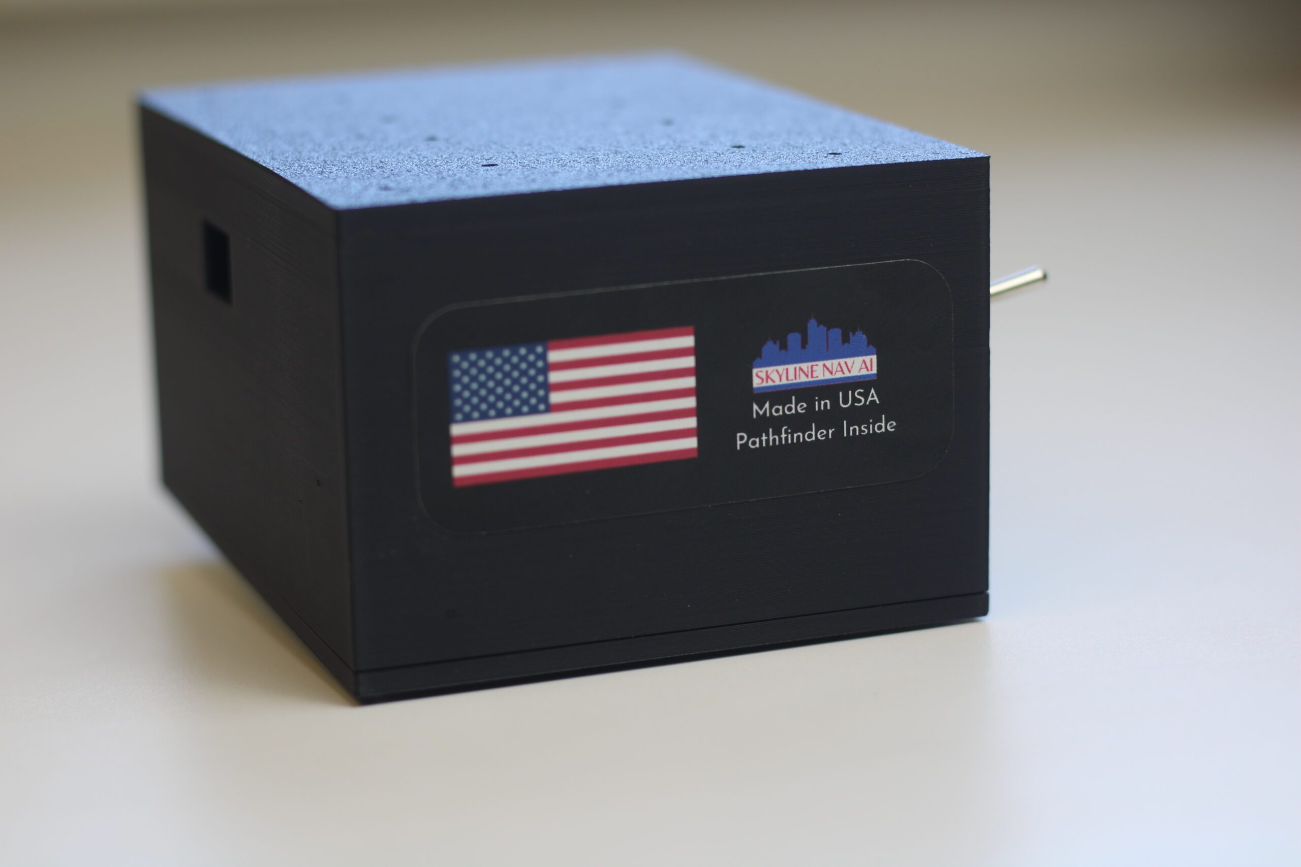
Skyline Nav AI Develops GPS-Independent Navigation Software for Drones
Skyline Nav AI, founded in 2020, specializes in low-cost GPS-independent visual positioning and navigation software aimed at defense and public safety sectors. The company was established in response to the increasing disruption of GPS signals, which can be easily jammed or spoofed, as highlighted by CEO Kanwar Singh's experiences in the Army National Guard. The significance of Skyline's technology is underscored by the growing reliance on drones in modern warfare, particularly in conflicts like those in Ukraine and the Middle East. As adversaries increasingly employ GPS jamming tactics, the need for reliable navigation solutions has become critical. Skyline's products, including the Pathfinder series, are designed to operate effectively in GPS-denied environments, attracting clients such as the U.S. Air Force and NASA. Looking ahead, Skyline Nav AI's innovative approach to drone navigation could reshape operational capabilities in military and public safety applications. The company’s focus on integrating advanced computer vision and machine learning into its products positions it well for future developments in autonomous systems. No further timeline was disclosed at the time of publication.
communications connectivity Drone News Drone News Feeds Feature 1 News
Humanoid Robots Enhance Navigation in Cluttered Environments with Whole-Body AI Control
Humanoid robots, designed with human-like body structures, have the potential to assist in various environments such as homes, offices, and healthcare facilities. However, for effective deployment, these robots must demonstrate the ability to navigate safely through cluttered and dynamic spaces. This capability is essential for their integration into everyday settings where obstacles are common. The ability of humanoid robots to navigate narrow gaps and obstacles is crucial for their functionality in real-world applications. This advancement in whole-body AI control technology is significant as it enhances the robots' adaptability and safety, making them more reliable companions in environments that require interaction with humans and other objects. Looking ahead, the focus will be on further developing these navigation capabilities to ensure that humanoid robots can operate effectively in diverse settings. No further timeline was disclosed at the time of publication.
Robotics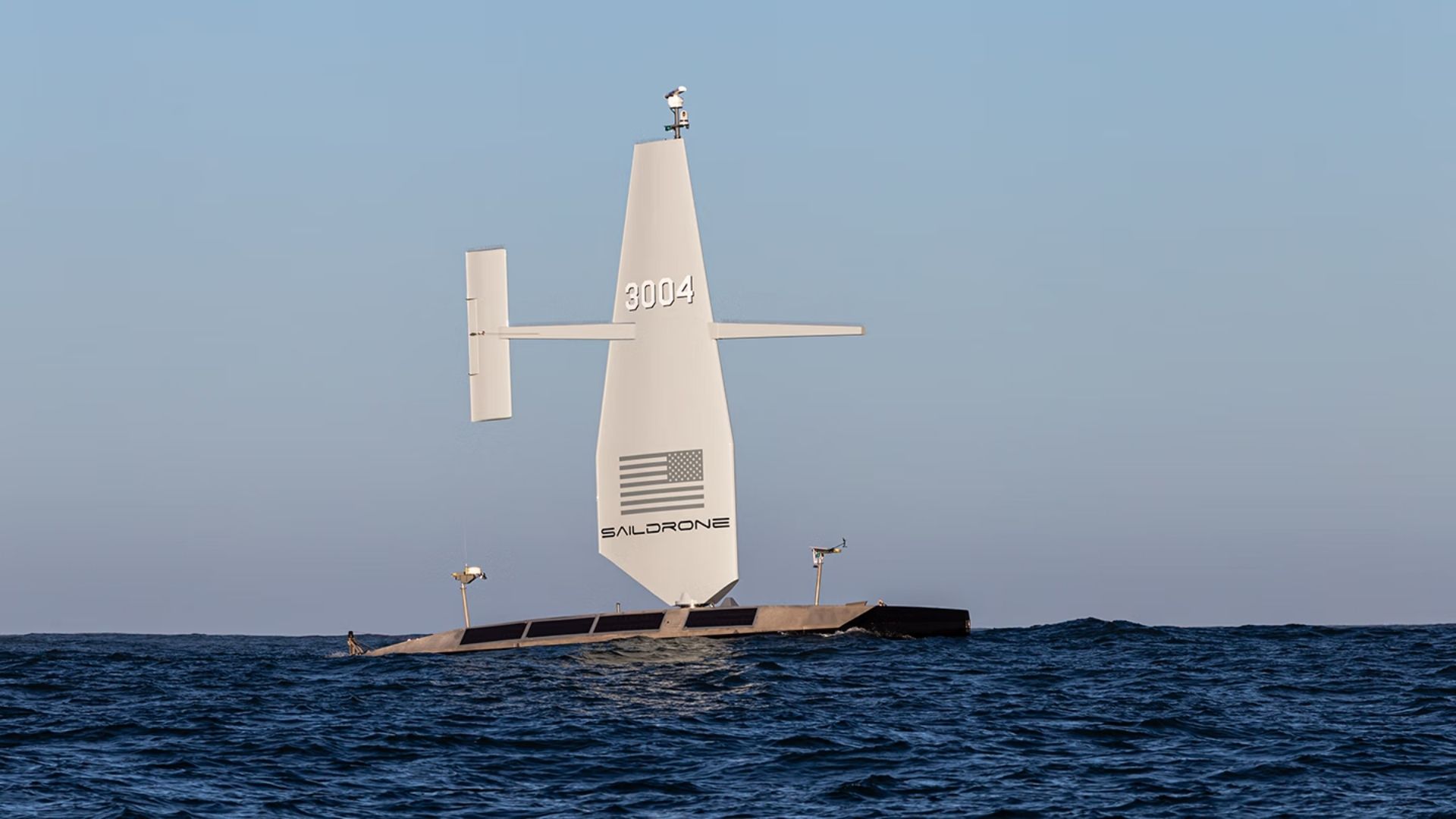
US Navy Awards $10 Million to Saildrone for Atlantic Seabed Mapping with USVs
The US Navy has awarded a $10 million contract to Saildrone to utilize autonomous vessels for mapping the Atlantic Ocean floor. This initiative, assigned by the Naval Oceanographic Office, is set to commence in 2026 and will continue through most of 2027, enhancing military knowledge of critical underwater terrain. This project is significant as it aims to improve safe navigation and support submarine missions, anti-submarine warfare, and critical infrastructure protection. Currently, only 28.7 percent of the world's oceans have been mapped to modern standards, leaving substantial knowledge gaps that can pose operational risks for naval operations. Looking ahead, the deployment of Saildrone's Surveyor unmanned surface vessels will not only provide high-resolution bathymetric data but also measure ocean currents, aiding search-and-recovery operations. No further timeline was disclosed at the time of publication.
Military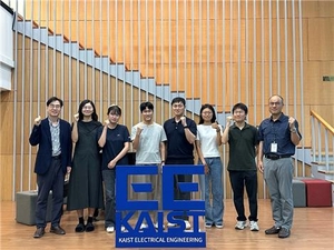
KAIST's Urban Robotics Lab Achieves Top Honors in International Navigation Challenges
KAIST's Urban Robotics Lab secured first and second place in two prestigious international robot navigation challenges. The team developed an AI system that enables robots to self-verify their decisions, ensuring they reach the correct destination. This innovative self-checking technology was instrumental in their success at the competitions held in Malmo, Sweden, and Sydney. The significance of this achievement lies in the advancement of embodied artificial intelligence, which allows robots to better understand human instructions and navigate complex environments. By addressing common navigation errors, such as misidentifying destinations, KAIST's technology enhances the reliability of robotic systems in real-world applications. The competitions were part of the European Conference on Computer Vision 2026 and Robotics: Science and Systems 2026, highlighting the importance of AI in robotics. Looking ahead, the focus will be on further refining the CoRe-VLN system, which utilizes AI to analyze visual and textual data for improved navigation accuracy. No further timeline was disclosed at the time of publication.
All News
Durham University Develops Advanced Drone Navigation System for Safer Flight in Crowded Spaces
Researchers at Durham University have created an innovative drone navigation system that allows autonomous aircraft to navigate through cluttered environments more efficiently. This advancement enhances the speed, smoothness, and safety of drone operations in areas filled with obstacles. The significance of this development lies in its potential applications, including search and rescue missions, infrastructure inspections, and environmental monitoring. By improving drone navigation, this system opens up new opportunities for various industries that rely on aerial technology. Looking ahead, the impact of this navigation system could transform how drones are utilized in complex environments. No further timeline was disclosed at the time of publication.
Robotics
Employing AI for Navigation in Lunar Crater Environments
Navigating unfamiliar terrains can be difficult, particularly in environments like the Moon's surface. The use of AI technology is being explored to enhance navigation capabilities in such challenging landscapes. This advancement is significant as it could lead to improved exploration and research opportunities on the Moon. By utilizing AI for navigation, missions can become more efficient and safer, allowing for better data collection and analysis. Looking ahead, the integration of AI in lunar navigation systems will be crucial for future missions. Continued developments in this area may pave the way for more sophisticated exploration techniques and technologies in extraterrestrial environments. No further timeline was disclosed at the time of publication.
International Team Develops Robots Learning to Navigate Terrain from Stick Insects
An international team from Tohoku University and VISTEC is studying stick insects to enhance robot navigation in challenging terrains. The research focuses on the insect's six legs, which allow for agile movement across various surfaces, surpassing current multi-legged robots in coordination. By employing adversarial inverse reinforcement learning, the team enabled a six-legged robot to autonomously learn to navigate diverse terrains within an hour by observing stick insect locomotion. This research is significant as it proposes a shift from traditional biomimetic approaches that require specific programming for each robot and terrain. Instead, the team aims to extract fundamental movement control principles, allowing robots to adapt to changing environments without extensive reprogramming. This adaptability is crucial for disaster scenarios where uneven surfaces and obstacles are prevalent, particularly in earthquake-prone Japan, where the demand for effective rescue robots is high. Looking ahead, the team plans to validate the learning system's robustness in realistic rubble environments and explore the potential for robots to compensate for lost limbs through continuous learning. The implications of this research could redefine how robots navigate complex terrains, making them more effective in emergency situations.
Robotics Disaster Response Machine Learning Bio-inspired Robotics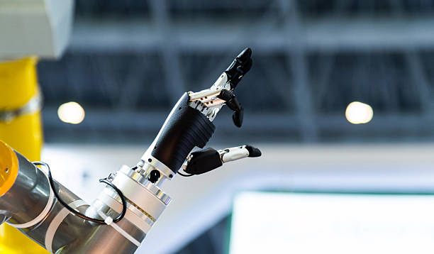
RoboBall: A Novel Inflatable Robot for Moon Exploration and Challenging Terrain Navigation
A team from Texas A&M University has developed RoboBall, a 1.8-meter diameter inflatable robot designed to traverse diverse terrains on the Moon. This innovative approach, which began as a NASA project in 2003, aims to address the critical challenge of tipping over faced by traditional wheeled or legged rovers. RoboBall's spherical design allows it to roll over obstacles while protecting its internal components from harsh lunar conditions. The significance of RoboBall lies in its potential to enhance lunar exploration, particularly in the Moon's south polar region, where permanent shadow areas may contain water ice and ancient geological layers. Scheduled for a paper presentation at an IEEE conference in December 2025, the team is also developing a dual lidar module named Remora to help the robot navigate slopes without compromising its sealed structure. This innovation could provide crucial data for autonomous navigation in challenging environments. As global interest in lunar exploration intensifies, with NASA's $20 billion lunar base plan set for completion by 2032, RoboBall could play a vital role in future missions. The research team is also investigating terrestrial applications for RoboBall, such as disaster response, showcasing the robot's versatility in extreme conditions. No further timeline was disclosed at the time of publication.
Lunar Exploration Robotic Innovation Terrain Navigation Disaster Response Space Robotics
Researchers Develop Six-Legged Robot Mimicking Stick Insect for Uneven Terrain Navigation
Researchers from Tohoku University and VISTEC have created a six-legged robot that learns to walk by imitating stick insect movements. This AI-powered system adapts its walking strategies to navigate various surfaces, potentially enhancing robotic operations in challenging environments such as disaster zones. The significance of this development lies in its ability to overcome limitations of traditional robotic gait systems, which often rely on fixed patterns. By employing adversarial inverse reinforcement learning (AIRL), the robot learns coordination principles from biological data, enabling it to maintain stability even on uneven terrain. Looking ahead, the ability of the robot to adapt to changes, such as losing a leg, demonstrates its potential for real-world applications. The researchers also noted that the learned reward structure could be transferred to different robot models, improving efficiency in training and adaptability across various robotic platforms. No further timeline was disclosed at the time of publication.
AI and Robotics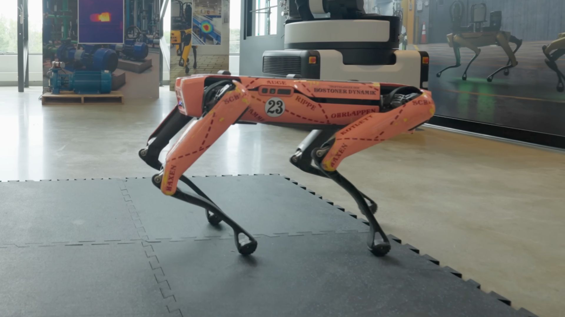
NVIDIA Introduces COMPASS Framework to Enhance Robot Navigation Learning
Researchers have developed NVIDIA's new framework, COMPASS, aimed at simplifying the training of robot navigation systems across various machines and environments. This innovative approach combines AI agents, simulation, reinforcement learning, and automated testing to significantly reduce the time and effort required to adapt navigation policies when changes occur in robots, scenes, or operating conditions. The importance of COMPASS lies in its ability to streamline the development process for robot navigation, which is inherently complex. Traditional methods often require extensive data collection and retraining when robots or environments change. By leveraging a pretrained navigation model and reinforcement learning, COMPASS allows developers to adapt existing policies rather than starting from scratch, thus minimizing workload and improving efficiency. Looking ahead, developers can utilize COMPASS with robots like the Boston Dynamics Spot quadruped, testing in both built-in and complex environments. The framework's integration with NVIDIA’s SAGE-10K dataset and Omniverse NuRec for realistic simulations will be crucial for fine-tuning navigation policies. No further timeline was disclosed at the time of publication.
AI and Robotics
Cyborg Cockroaches Utilize AI for Enhanced Terrain Navigation Speed
Cyborg insects, integrating biological mobility with electronic devices, are being developed to improve navigation capabilities. Recent advancements in AI-powered terrain recognition are enabling these cyborg cockroaches to navigate their environments more efficiently. This innovation is significant as it opens up new possibilities for applications in search-and-rescue missions, infrastructure inspections, and exploration of challenging environments where traditional robots may struggle. The combination of living organisms and technology presents unique advantages in mobility and adaptability. Looking ahead, the continued development of AI technologies in cyborg insects will be crucial to enhancing their operational capabilities. Future milestones may include further improvements in navigation speed and the expansion of their use cases in various sectors. No further timeline was disclosed at the time of publication.
Robotics
3D-Printed Auxetic Metamaterial Robot Developed for Navigating Complex Pipeline Geometries
A new 3D-printed auxetic metamaterial robot has been developed to enhance adaptive navigation in pipelines featuring complex geometries. This innovative design allows the robot to deform and adapt its shape, enabling it to maneuver through challenging environments effectively. The significance of this development lies in its potential applications across various industries, particularly in maintenance and inspection tasks within intricate pipeline systems. By utilizing auxetic materials, the robot can achieve greater flexibility and resilience, which is crucial for navigating tight spaces and avoiding obstacles. Looking ahead, the focus will be on further testing and refinement of the robot's capabilities in real-world scenarios. No further timeline was disclosed at the time of publication.
RESEARCH ARTICLE
Deep Robotics' DR02 Humanoid Robot Demonstrates Stair Climbing and Terrain Navigation
Deep Robotics has unveiled new footage of its DR02 humanoid robot successfully climbing outdoor concrete stairs, showcasing its capability to navigate challenging terrains. This demonstration marks a pivotal moment for the Hangzhou-based company as it advances its development and commercialization strategies, positioning the DR02 for complex real-world tasks. The significance of this demonstration lies in the competitive landscape of Chinese robotics, where investors are keen to see humanoid robots perform reliably in practical environments. The DR02's ability to traverse uneven surfaces and carry equipment, such as a fire extinguisher, highlights its potential for industrial applications and hazardous environments. Looking ahead, Deep Robotics is preparing for a significant financial milestone with its application to raise approximately $367.4 million through an initial public offering on Shanghai’s STAR Market. As the company aims to build on its first-ever net profit of about $4.2 million reported in 2025, the ongoing development of the DR02 will be crucial in attracting investor confidence and demonstrating the robot's capabilities in real-world scenarios.
AI and Robotics
Testing Five Robot Lawnmowers Reveals Significant Improvements in Navigation and Performance
A recent comparison of five robot lawnmowers showcased their advancements in handling challenging landscapes, particularly in coastal South Carolina. While these machines are not yet fully autonomous, they significantly reduce yard maintenance efforts, provided users monitor their operation to prevent mishaps. The improvements in navigation and maneuverability, particularly with the adoption of network RTK technology, have led to better performance and reliability. Users can now enjoy a well-maintained lawn with minimal effort, as these mowers operate quietly and efficiently, creating a professional appearance. Looking ahead, the integration of secondary navigation technologies like lidar and vSLAM will further enhance the reliability of robot lawnmowers. However, challenges remain, and users should remain vigilant to ensure optimal performance and prevent issues in their yards.
Buying Guides Gadgets Reviews Robot Smart Home Smart Home Reviews
MIT Lincoln Laboratory Develops LightHOUSE for Navigation in Cislunar Space
MIT Lincoln Laboratory is developing the Light High-Orbit Utility Signal Emitter (LightHOUSE) to enhance navigation in cislunar space. This initiative aims to address the limitations of current navigation systems, which rely on NASA's Deep Space Network (DSN) and can take hours for orbit determination. The LightHOUSE concept proposes a constellation of high-altitude satellites that will serve as optical beacons, providing timely navigation data to spacecraft. This system could significantly reduce the need for corrective maneuvers and conserve propellant, making it crucial as lunar missions become a strategic priority for national security. As the project progresses, the team is focused on refining the system through analysis and experimentation. The successful implementation of LightHOUSE could revolutionize navigation in cislunar space, offering a reliable alternative to existing ground-based systems and enhancing mission capabilities beyond geosynchronous orbit.
Research Space exploration Satellites Communications Spaceflight Lincoln Laboratory
Alibaba Introduces Over 50 Innovations Across 20+ Apps on HarmonyOS Platform
Alibaba has launched more than 20 applications featuring over 50 innovations native to HarmonyOS. These include Amap's AR walking navigation, DingTalk's AI meeting capabilities through Xiaoyi, and Taobao's immersive browsing experience, alongside Qwen's unified drag-and-drop AI analysis. This significant rollout highlights Alibaba's commitment to enhancing user experience within its ecosystem by leveraging Huawei's HarmonyOS. The integration of advanced features across various applications aims to streamline workflows and improve accessibility for users, showcasing Alibaba's strategic focus on innovation. Looking ahead, industry observers will be keen to see how these new features impact user engagement and adoption rates within Alibaba's ecosystem. No further timeline was disclosed at the time of publication.
Industry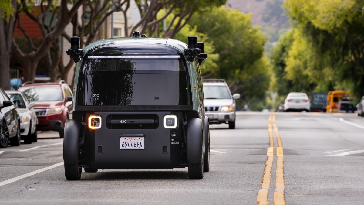
Zoox Issues Software Recall for Robotaxi After Smoke Navigation Incident
Zoox has announced a software recall following an incident in June where one of its robotaxis struggled to navigate a smoke-filled emergency scene. The Amazon-owned company has dispatched a software update to its fleet of 105 vehicles, enhancing the detection and response capabilities for heavy smoke in emergency situations. No injuries were reported during the incident, which involved a Zoox robotaxi encountering heavy smoke that obscured an active fire scene. This recall highlights significant concerns regarding the ability of autonomous vehicles to respond appropriately to emergency situations. The National Highway Traffic Safety Administration (NHTSA) has emphasized the need for self-driving car companies to address functional insufficiencies in their systems. The incident prompted Zoox to conduct an investigation and engage with NHTSA regarding the severity and root causes of the issue, leading to the software update. Looking ahead, Zoox is expanding its testing in cities like Las Vegas and San Francisco, with plans for a commercial launch pending NHTSA approval for exemptions from certain safety standards. The company has faced recalls in the past, indicating ongoing challenges in ensuring the safety and reliability of its autonomous vehicle technology. No further timeline was disclosed at the time of publication.
Transportation autonomous vehicles robotaxis self-driving cars zoox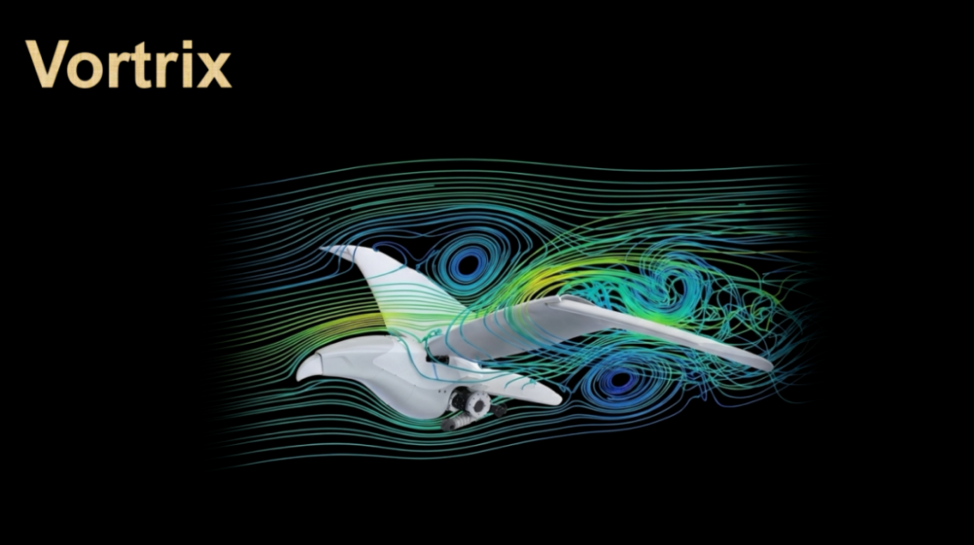
Post-00s PhD Team Secures Funding for Biomimetic Flapping Robot Development
A team of PhD students born after 2000 has developed a biomimetic flapping robot capable of fluid navigation, announced by Eagle Eye Intelligent Wings. The company recently completed a Series A funding round, raising tens of millions of yuan, led by Yuanhe Puhua with participation from Futen Capital and Houxue Capital. This marks the third funding round for the company within three months since its establishment 15 months ago. The funding will primarily support the mass production of their first consumer product, the 'Eagle X,' and the development of the next-generation flapping robot and fluid simulation engine. Founded in March 2025 in Shenzhen, Eagle Eye Intelligent Wings is among the early companies focusing on embodied intelligent flapping robots. The core team consists of over ten members from Shanghai Jiao Tong University, all born after 2000, with notable achievements in research. The 'Eagle X' has completed over 3,000 hours of flight testing and is set to launch on Kickstarter in Q3 of this year. The next-generation product will feature approximately 15 degrees of freedom, allowing for independent wing adjustments. The Vortrix fluid simulation engine is expected to be opened for external use, enhancing training for flying robots and optimizing aerodynamics for fixed-wing aircraft and wind turbine blades. No further timeline was disclosed at the time of publication.
Biomimetic Robots AI Fluid Dynamics Robotics Drone Technology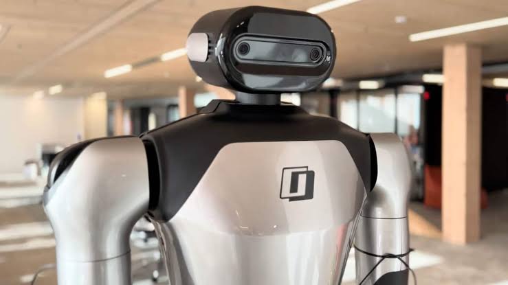
Mistral AI Introduces Robostral Navigate for Autonomous Robotic Navigation
Mistral AI has launched Robostral Navigate, the first AI model specifically designed for robotic navigation. This marks a significant shift for the French company, which has previously focused on large language models, as it ventures into Physical AI. The goal is to enable robots to understand natural language instructions, interpret their surroundings using a standard RGB camera, and plan routes without relying on complex sensor infrastructures. The introduction of Robostral Navigate is important as it simplifies the navigation process, traditionally reliant on multiple technologies like LiDAR and depth cameras, which are costly and complex to integrate. By utilizing only RGB images and natural language commands, Mistral AI's approach could significantly reduce costs for robot manufacturers. An RGB camera is much cheaper than industrial LiDAR sensors, making this technology more accessible. Robostral Navigate operates on a model with 8 billion parameters, balancing computational power and operational efficiency. This size allows for faster execution on embedded platforms with limited resources, crucial for timely navigation decisions. Mistral AI trained the model on nearly 400,000 trajectories across over 6,000 simulated environments, showcasing its potential for real-world applications. No further timeline was disclosed at the time of publication.
À la une IA Industrie Robotique AMR benchmark R2R-CE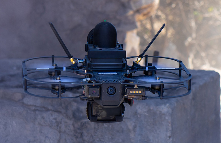
XTEND Receives U.S. Patent for Drone Autonomy Technology Enhancing Mission Efficiency
XTEND Reality Inc. has secured a U.S. patent for its autonomous navigation technology, specifically U.S. Patent No. 12,222,735, which allows drones to navigate toward operator-designated destinations without reliance on the surrounding environment. This patent, also granted in Israel, supports the company's mission to enhance drone autonomy in complex operational settings, reducing operator workload and improving mission execution reliability. The significance of this patent lies in its ability to enable drones to adapt their navigation in real-time while maintaining focus on mission objectives. As autonomous operations grow in defense, security, and public safety sectors, this technology positions XTEND favorably in a competitive landscape, reinforcing its software foundation, XOS, for next-generation autonomous systems. Looking ahead, XTEND is set to participate in the Gauntlet II phase of the U.S. Department of War's Drone Dominance Program, which will test autonomous systems in August at Fort Carson, Colorado. No further timeline was disclosed at the time of publication regarding additional developments related to this patent or upcoming projects.
Controllers Defense / Security Investments Mergers & Acquisitions News Unmanned Aerial Systems / Drones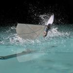
MIT and EPFL Develop Flapping-Wing Robot for Air and Water Navigation
Engineers from MIT and EPFL have created a flapping-wing aerial-aquatic vehicle (FAAV) inspired by puffins. Weighing under 300 grams, the robot features a central fuselage, flexible wings, and a steerable tail. Field tests in Lake Geneva demonstrated its ability to swim and then take flight, showcasing its dual-medium capabilities. This innovation is significant for oceanography and marine biology, as it allows for cost-effective data collection from both air and water. The FAAV can fly at speeds of 6 meters per second and swim at 1 meter per second, providing a versatile tool for researchers. The design mimics the natural mechanics of birds, which maintain similar physical dynamics in both environments by adjusting their speed. Looking ahead, the team aims to refine the robot's ability to breach the water's surface, a challenging transition requiring a precise 70-degree pitch. No further timeline was disclosed at the time of publication, but the potential applications for environmental monitoring and research are substantial.
AI and Robotics
Mistral AI Launches First Robot Navigation Model: Single Camera with 8 Billion Parameters
Mistral AI has introduced its inaugural robot model, Robostral Navigate, designed for autonomous navigation in complex environments. This new robot employs a single RGB camera and responds to natural language commands, achieving a notable success rate of 76.6%. By eliminating the reliance on lidar and depth sensors, Mistral AI presents a cost-effective solution tailored for commercial applications, particularly in warehousing and logistics. The efficiency of Robostral Navigate is further bolstered by advanced training techniques and algorithms, marking a significant step forward in robotics technology.
Robot Navigation AI Technology Computer Vision Autonomous Robots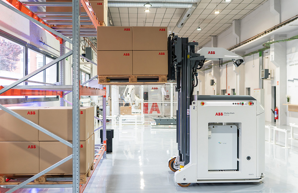
ABB Robotics includes vSLAM navigation in F712 autonomous forklift
The Flexley Stacy F712 forklift uses vision to navigate, works with other robots, and complies with safety standards, says ABB Robotics. The post ABB Robotics includes vSLAM navigation in F712 autonomous forklift appeared first on The Robot Report.
Automotive Autonomous Mobile Robots (AMRs) Cameras / Imaging / Vision Logistics Manufacturing Mobility / Navigation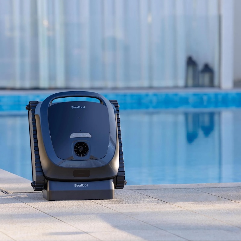
How AI Navigation is Improving the Performance of Robotic Pool Cleaners
Robotic pool cleaners have evolved beyond traditional metrics such as suction power and debris collection, with a significant emphasis now placed on navigation capabilities. Previously, these devices were primarily evaluated based on their ability to pick up dirt and debris, but advancements in technology have shifted the focus to how effectively they can navigate a pool's surface. A robot that operates randomly may clean certain areas thoroughly while neglecting others, leading to inconsistent cleaning results. This change in evaluation criteria reflects a growing understanding that efficient navigation is crucial for maximizing the overall performance of pool cleaning robots. As manufacturers continue to innovate, the integration of sophisticated navigation systems is becoming a key factor in the design and functionality of these devices, ensuring a more comprehensive cleaning experience for pool owners.
Artificial Intelligence Environment Technology AI navigation ai robotics AquaSense 2 Ultra
Learning flight navigation like a honey bee
In June 2026, a groundbreaking study published in Science Robotics highlights significant advancements in robotic technology aimed at enhancing human-robot collaboration. Researchers from leading universities and tech companies have developed a new generation of robots equipped with advanced artificial intelligence, enabling them to perform complex tasks alongside human workers more efficiently. This initiative is driven by the increasing demand for automation in various industries, particularly in manufacturing and healthcare, where precision and reliability are paramount. The study outlines how these robots can adapt to dynamic environments, learn from human interactions, and improve their performance over time, thereby reducing the risk of workplace accidents and increasing productivity. The research team conducted extensive field tests in factories and hospitals to evaluate the robots' capabilities in real-world scenarios. The results demonstrated a marked improvement in task execution speed and accuracy when robots and humans worked in tandem, showcasing the potential for these technologies to transform traditional workflows. As industries continue to evolve, the implications of this research could lead to a new era of collaboration between humans and machines, addressing labor shortages and enhancing operational efficiency. The findings underscore the importance of ongoing innovation in robotics, paving the way for future developments that could redefine the nature of work across various sectors.
Editors' Choice
Research on Orchard Navigation Path Planning Based on 3D LiDAR SLAM Considering Terrain Roughness
A recent study published in the Journal of Field Robotics highlights advancements in autonomous robotic systems designed for agricultural applications. Researchers from a consortium of universities and tech companies conducted the study to address the growing need for efficient farming solutions amid rising labor costs and food demand. The research, which began in early 2023, took place across various agricultural sites in California, focusing on the integration of robotics in crop monitoring and harvesting. The team developed a prototype robot equipped with advanced sensors and machine learning algorithms, enabling it to navigate fields and collect data on crop health. This innovation aims to enhance productivity and reduce the reliance on manual labor, which has become increasingly scarce. The researchers conducted extensive field tests to evaluate the robot's performance and adaptability to different farming conditions. The findings suggest that these autonomous systems could significantly improve yield and reduce waste, addressing both economic and environmental challenges in agriculture. The study underscores the potential of robotics to transform traditional farming practices, paving the way for more sustainable and efficient food production methods in the future.
RESEARCH ARTICLE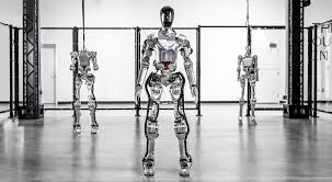
Multi‐Robot Collaborative Navigation Framework Based on 3D Voronoi Partitioning in Uneven and Unstructured Environments
A recent study published in the Journal of Field Robotics highlights advancements in autonomous robotic systems designed for agricultural applications. Researchers from various institutions collaborated to develop innovative algorithms that enhance the efficiency and accuracy of these robots in crop monitoring and management. The study, released in early October 2023, emphasizes the growing need for automation in agriculture due to labor shortages and the increasing demand for food production. The research was conducted across multiple farms in the Midwest, where the team tested the robots' capabilities in real-world conditions. By integrating machine learning techniques, the robots can now analyze crop health, detect pests, and optimize resource usage, significantly reducing the environmental impact of farming practices. This initiative aims to address the challenges faced by farmers, particularly in light of climate change and the need for sustainable agriculture. The findings suggest that implementing these robotic systems can lead to improved yields and reduced operational costs, ultimately benefiting both farmers and consumers. As the agricultural sector continues to evolve, the integration of such technologies is seen as a crucial step toward a more sustainable future.
RESEARCH ARTICLE
Taiwan unveils AI drone navigation system that flies through GPS jamming
Taiwan’s Aerospace Industrial Development Corporation (AIDC), a state-backed entity, has introduced an innovative AI-powered navigation system aimed at enhancing the capabilities of its aerospace technology. This announcement was made during a press conference held on October 15, 2023, in Taichung, Taiwan. The new system is designed to improve the safety and efficiency of aircraft operations, reflecting AIDC's commitment to advancing the nation’s aerospace industry amid growing global competition. By integrating artificial intelligence into navigation processes, AIDC aims to streamline flight operations and reduce the risk of human error. The development of this technology comes as part of Taiwan's broader strategy to bolster its defense capabilities and maintain technological sovereignty in the face of regional tensions.

Award Registration! Top Scholars Discuss Micro Robots and Autonomous Navigation Innovations
A recent Cell Press Live event brought together three prominent experts to explore the latest advancements in autonomous navigation technologies. The discussion covered a range of applications, including self-driving cars, drones, and innovative drug delivery systems. Scheduled for a future date, the event offers free registration for attendees eager to gain insights into cutting-edge research in micro-robotics, light-driven robots, and optimization frameworks for enhancing autonomous systems. This initiative aims to inform and engage the public in the rapidly evolving field of autonomous technology, showcasing how these innovations can transform various industries.
Micro Robots Autonomous Navigation Soft Robotics AI Drug Delivery Systems
Autonomous Navigation in Large‐Scale Underground Environments Based on a Purely Topological Understanding of Tunnel Networks
In June 2026, the Journal of Field Robotics published a significant study exploring advancements in robotic technology, specifically focusing on autonomous navigation systems. Researchers from leading universities and tech companies collaborated to investigate the effectiveness of these systems in various environments, including urban areas and remote terrains. The study aimed to address the growing demand for efficient and reliable robotic solutions in fields such as agriculture, disaster response, and transportation. By conducting extensive field tests, the team evaluated how these robots adapt to dynamic conditions and obstacles, ultimately enhancing their operational capabilities. The findings highlight the potential for improved safety and efficiency in robotic applications, paving the way for broader adoption in real-world scenarios. This research not only contributes to the academic discourse on robotics but also offers practical insights for industries looking to integrate autonomous systems into their operations.
RESEARCH ARTICLE
Kalman Filter–Based Sensor Fusion for Navigation of Holonomic Unmanned Ground Vehicles
In a recent study published in the Journal of Field Robotics, researchers explored advancements in robotic navigation systems, focusing on their application in complex environments. The study, which appeared in the June 2026 issue, highlights innovations that enhance the ability of robots to navigate through challenging terrains, such as urban landscapes and disaster-stricken areas. Conducted by a team of engineers and roboticists, the research aims to address the growing demand for autonomous systems capable of performing tasks in unpredictable settings. By integrating advanced algorithms and machine learning techniques, the team demonstrated significant improvements in navigation efficiency and accuracy. The findings are particularly relevant as industries increasingly rely on robotics for tasks ranging from search and rescue operations to urban planning. The researchers conducted extensive field tests to validate their models, showcasing the robots' ability to adapt to dynamic obstacles and varying environmental conditions. This work not only contributes to the field of robotics but also underscores the potential for these technologies to enhance safety and effectiveness in critical situations. As the demand for intelligent robotic systems continues to rise, this research marks a significant step forward in the evolution of autonomous navigation.
RESEARCH ARTICLE
Beyond satellites: Why FOG inertial navigation is the new imperative for land warfare
The landscape of military navigation is undergoing a significant transformation as counterspace threats and electronic warfare challenge the previously uncontested dominance of GPS technology. Exail is at the forefront of this shift, introducing its Fiber Optic Gyro (FOG) technology, which offers enhanced stability and serves as a reliable "source of truth" for land maneuvering and precision targeting in environments where Global Navigation Satellite Systems (GNSS) are compromised. This innovation is crucial for modern military operations, enabling forces to maintain operational effectiveness despite the increasing prevalence of electronic warfare tactics. As the battlefield evolves, Exail’s advancements in navigation technology are poised to play a vital role in ensuring that military units can navigate and execute missions with precision and confidence, even in the most challenging conditions.
Land Warfare Sponsored Post Army autonomy electronic warfare (EW) Exail
Robot Navigation Learns Faster Through Greedy Replay
A significant advancement in autonomous navigation has been achieved by GER-RL, a leading research initiative focused on enhancing robotic movement. This development emphasizes the importance of prioritizing valuable experiences, which enables robots to navigate complex environments more quickly, safely, and efficiently. By leveraging advanced algorithms and machine learning techniques, the project aims to improve the operational capabilities of robots in various settings, potentially transforming industries that rely on automation. This breakthrough comes at a time when the demand for sophisticated robotic systems is on the rise, driven by the need for increased efficiency and safety in tasks ranging from manufacturing to logistics. The research team continues to refine these technologies to ensure that robots can adapt to dynamic situations, ultimately paving the way for a new era of intelligent automation.

Robots could learn to predict, plan navigation with new ‘bio-inspired’ framework
A recent study highlights the advanced capabilities of robot vacuums in home cleaning. Researchers observed that when placed in a living room, these devices effectively create detailed maps of their surroundings, allowing them to navigate and clean efficiently. This development comes as more households adopt smart home technology, seeking convenience and improved cleaning solutions. The study, conducted in various residential settings, demonstrates how robot vacuums utilize sensors and algorithms to optimize their cleaning paths. As the demand for automated home care increases, manufacturers are focusing on enhancing these technologies to meet consumer expectations for efficiency and thoroughness.
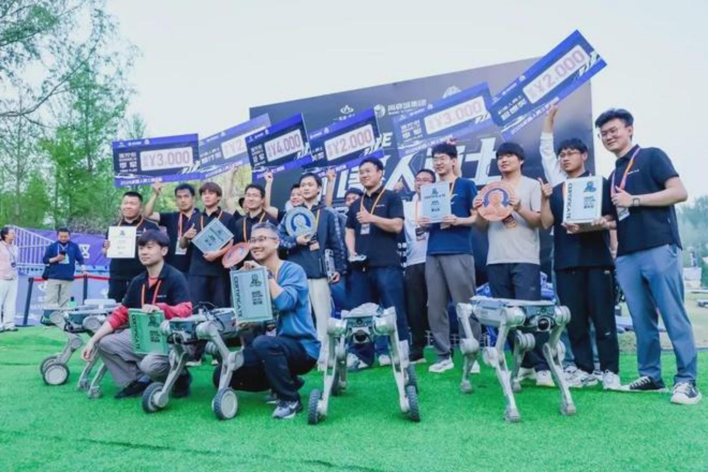
Warrior Challenge: The Biggest Winner in the 'No-Man's Land'! How GENISOM AI Overcame the Crucial Barrier of Autonomous Navigation
At the recent Warrior Challenge, GENISOM AI's quadruped robot, Tongchui M1, demonstrated exceptional performance in autonomous navigation, securing multiple awards. The competition, which took place in a series of complex environments, underscored the significance of real-world adaptability in robotics. Notably, Tongchui M1 successfully completed all ten challenging tasks without the need for remote control, showcasing its advanced capabilities and innovative technology. This achievement highlights the growing potential of autonomous systems in navigating intricate terrains and performing tasks independently.
Quadruped Robots Autonomous Navigation Robotics Competitions AI TechnologyRobotics needs a service framework.
RSF defines a common language for robot service capability, lifecycle operations, certification pathways, and service-provider networks.
Join the RobotToday community on LinkedIn
Daily robotics news, in-depth analysis, conference highlights, and discussions with professionals worldwide.







