

Industry Briefing
A single destination for timely, editor-curated robotics news from around the world.
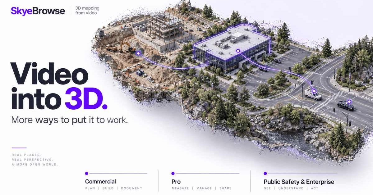
SkyeBrowse Introduces New Pricing Plans for Drone 3D Mapping Solutions
SkyeBrowse has revamped its pricing structure for its drone 3D modeling platform, introducing three distinct plans: Commercial, Pro, and Public Safety & Enterprise. These plans are tailored to meet the varying needs of teams utilizing 3D models for applications such as construction, inspections, and tactical operations. The new pricing tiers reflect the different levels of functionality required by users. The Commercial plan, priced at $24.99 per model monthly, focuses on basic mapping and documentation, while the Pro plan, costing $49.99 monthly, adds advanced features like exports and AI tools. The Public Safety & Enterprise tier, at $199 annually, encompasses all available features. As SkyeBrowse continues to enhance its platform, users should monitor how these pricing changes impact adoption across various sectors, particularly in industries that rely heavily on 3D modeling for operational efficiency. No further timeline was disclosed at the time of publication.
News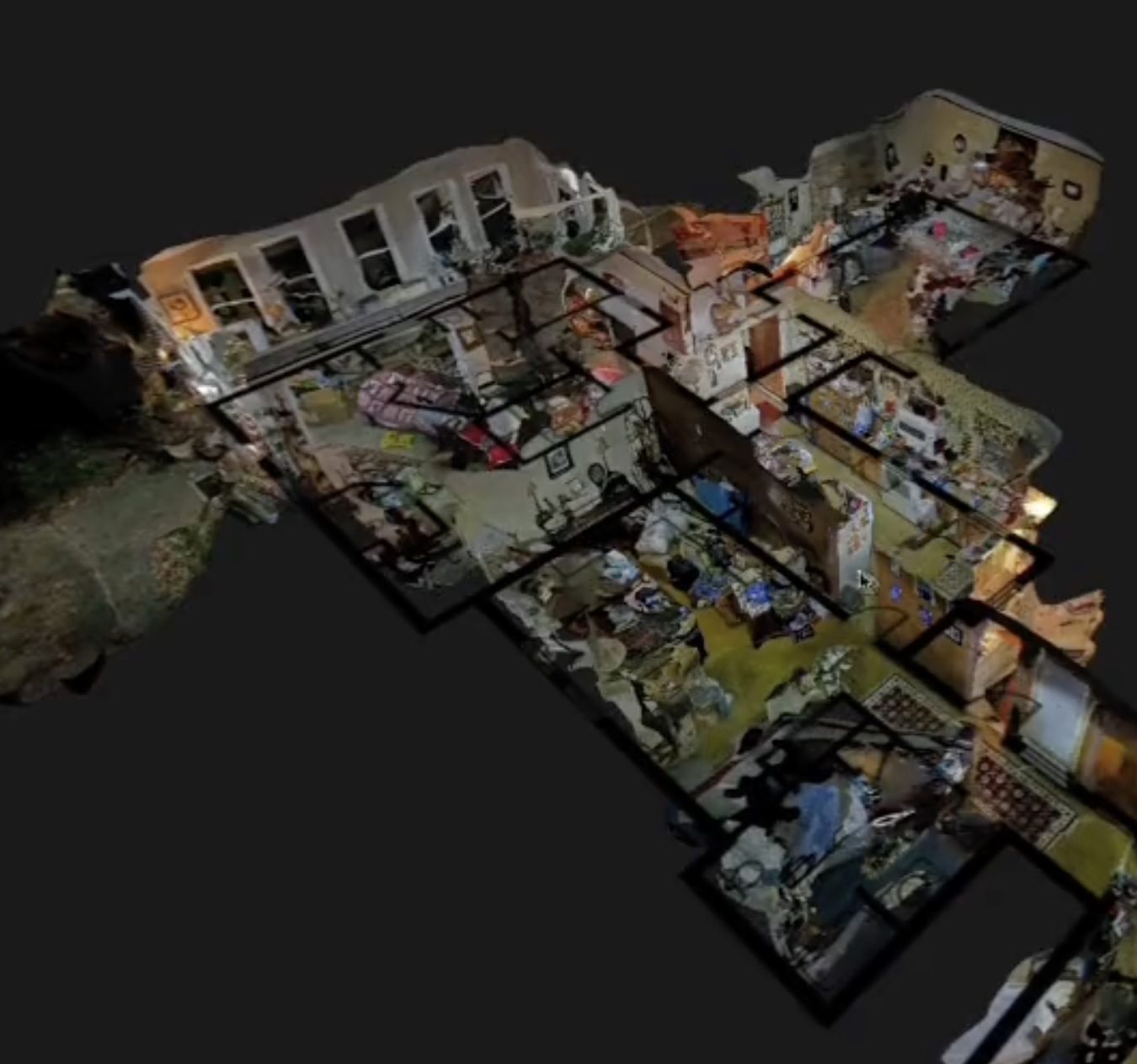
SkyeBrowse Introduces Flexible Per-Model Pricing for 3D Drone Mapping Solutions
SkyeBrowse has launched a new pricing structure aimed at enhancing flexibility for 3D drone mapping among commercial users, public safety agencies, and larger organizations. The new model features three plans: Commercial at $24.99 per model, Pro at $49.99 per model, and Public Safety & Enterprise at $199 per model per year, allowing customers to pay based on finished models rather than monthly subscriptions. This pricing strategy is significant as it lowers the barrier for smaller operators to access advanced 3D mapping capabilities without the need for an enterprise subscription. The plans offer varying features, including different processing qualities, storage periods, and tools tailored to specific user needs, reflecting SkyeBrowse's commitment to simplifying drone program scalability. Looking ahead, SkyeBrowse aims to continue enhancing user experience by focusing on simplicity and efficiency in drone operations. New features such as the Import Custom 3D Model tool and Case Gallery are designed to improve functionality for users, particularly in public safety applications. No further timeline was disclosed at the time of publication.
Applications Drone News Drone News Feeds Mapping News 3D drone mapping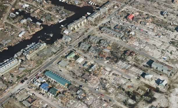
SimActive CEO Discusses Evolving Defense Mapping Workflows at INTERGEO 2023
At the INTERGEO show in Munich, SimActive CEO Philippe Simard highlighted the increasing importance of speed, usability, and data integration in defense mapping. He emphasized that the value lies not just in the maps themselves but in the actionable information derived from them, particularly in defense scenarios where timely decisions are crucial. Simard pointed out that the geospatial industry is evolving to provide tools that automate the extraction of intelligence from mapping data. This shift is vital for defense organizations, which often face rapidly changing conditions on the ground. He noted that while drones have simplified data collection, processing speed remains a bottleneck, with many products taking too long to deliver actionable insights. Looking ahead, Simard indicated that the demand for rapid, accurate mapping solutions will continue to grow, especially for applications like damage assessment and line-of-sight analysis. He stressed that while speed is essential, accuracy remains critical, albeit with different standards depending on the application, particularly in defense contexts.
Applications Defense defense DL Exclusive Drone News Drone News Feeds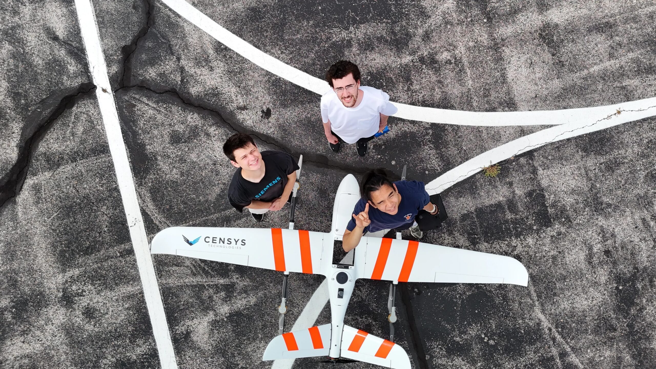
AIVE AI Systems Enhances Geospatial Data Access with Innovative Mapping Solutions
At the upcoming 2026 INTERGEO event in Munich, AIVE Systems will showcase its AI-driven software that simplifies the creation of georeferenced 2D maps from drone imagery. This innovation targets users who require geographic context without needing intricate 3D models, expanding its applications beyond wildfire detection. AIVE's technology stems from the FLARE-X project, a collaboration led by The University of Texas at Austin, which focused on autonomous wildfire risk mapping and detection. The software developed by AIVE aims to support various sectors, including infrastructure inspection, public safety, agriculture, and border patrol, by providing essential environmental insights. The company's initial offerings, Atlas GEO Cloud and Atlas GEO QGIS, utilize fewer images to generate maps, differentiating from traditional methods that rely on precise positioning tools. AIVE's approach automates the mapping process, making it accessible for users without extensive expertise. No further timeline was disclosed at the time of publication.
DL Exclusive Drone News Drone News Feeds Education Mapping News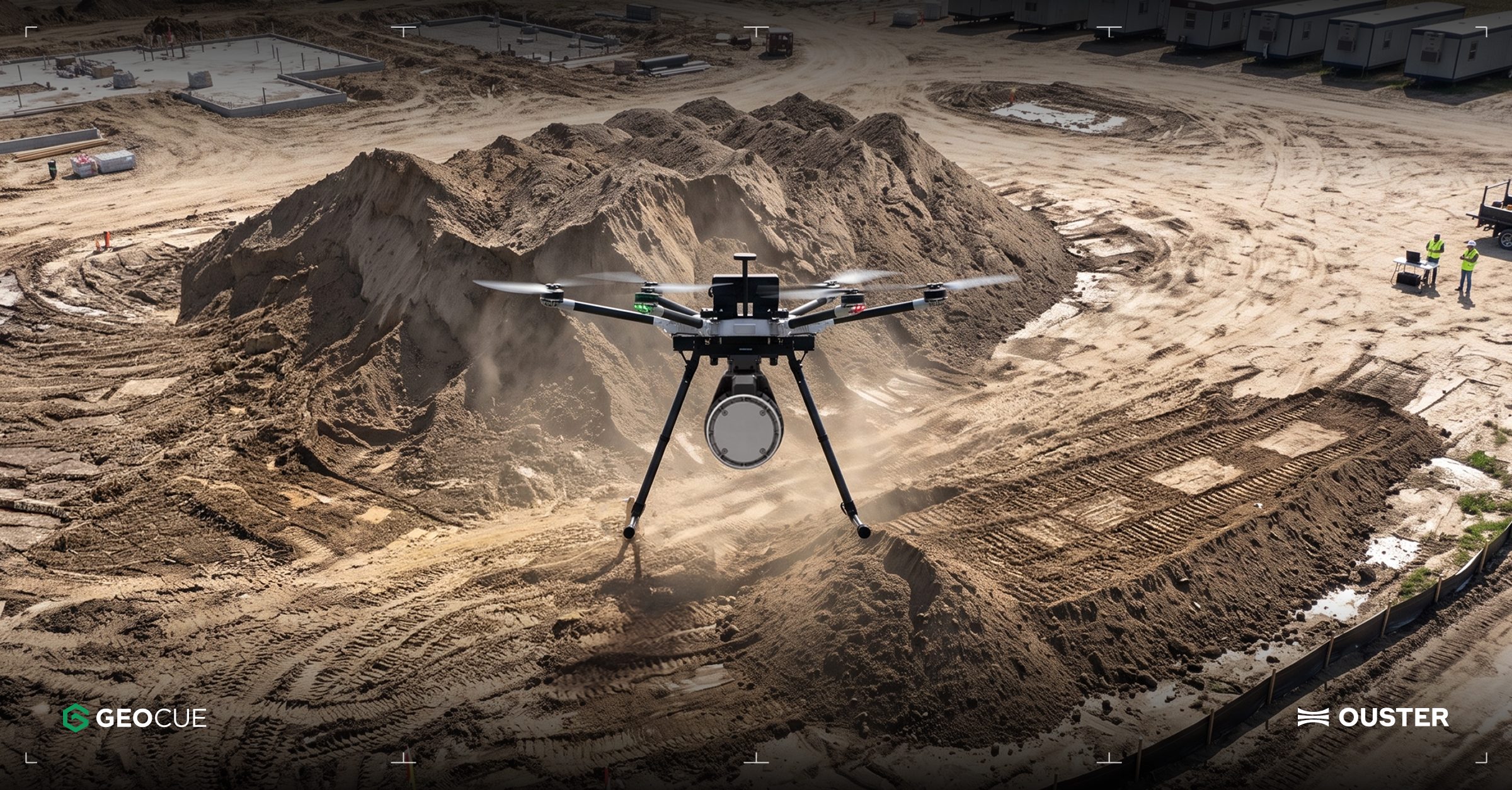
Ouster Partners with Flyability and GeoCue to Enhance Drone Mapping with Lidar Technology
Ouster has announced two significant partnerships aimed at expanding the use of lidar technology in commercial drone operations. The collaboration with Flyability focuses on integrating Ouster's lidar into the Elios 3 drone, which is designed for inspections in confined spaces like mine shafts and wastewater tunnels. Meanwhile, the partnership with GeoCue will see Ouster's Rev8 OS1 Max lidar integrated into TrueView drone mapping systems for utility surveying. These partnerships highlight the growing importance of lidar in enhancing drone capabilities, particularly in challenging environments where traditional GPS and cameras may fail. The Elios 3 drone, equipped with Ouster's compact OS0 lidar, enables real-time localization and collision avoidance, making it suitable for hazardous inspections. Ouster's CEO, Angus Pacala, emphasized the operational value of digital lidar in environments that conventional systems cannot easily access. Looking ahead, Flyability is evaluating Ouster's Rev8 lidar technology for future applications, which promises improved range, resolution, and color data. The companies plan to showcase their advancements at INTERGEO 2026 in Munich, Germany, from September 15-17, demonstrating how lidar is transforming the documentation of complex industrial environments.
Applications Drone News Drone News Feeds Inspection LiDAR News
Simultaneous Localization and Mapping Algorithm for Robotic Grinding of Wind Turbine Blades Using Visual and Inertial Measurement Fusion
A new algorithm has been developed for robotic grinding of wind turbine blades, integrating visual point-line and inertial measurement unit fusion for simultaneous localization and mapping. This advancement aims to enhance the precision and efficiency of robotic operations in the renewable energy sector. The significance of this algorithm lies in its potential to improve the grinding process of wind turbine blades, which is crucial for maintaining their performance and longevity. By utilizing advanced localization and mapping techniques, the algorithm can facilitate more accurate and automated grinding, ultimately contributing to better energy production. Looking ahead, the implementation of this algorithm could lead to broader applications in robotic maintenance and manufacturing processes within the renewable energy industry. No further timeline was disclosed at the time of publication.
RESEARCH ARTICLE
Study on Cooperative Navigation Methods for Autonomous Underwater Vehicles in Terrain Mapping
A recent study published in the Journal of Field Robotics explores cooperative navigation methods for autonomous underwater vehicles (AUVs) in terrain mapping. The research focuses on enhancing the accuracy and efficiency of AUVs when mapping underwater environments through collaborative navigation techniques. This research is significant as it addresses the challenges faced by AUVs in accurately mapping complex underwater terrains. By improving navigation methods, the study aims to facilitate better data collection for various applications, including environmental monitoring, underwater exploration, and resource management. Looking ahead, the implications of this research could lead to advancements in AUV technology and its applications in marine research. No further timeline was disclosed at the time of publication.
RESEARCH ARTICLE
PROMO-Orchard: A Semantic-Enhanced Framework for Dual-Robot Mapping in Orchards
The article discusses PROMO-Orchard, a new framework designed for dual-robot simultaneous localization and mapping (SLAM) in orchard environments. This framework enhances the mapping process by integrating semantic information, allowing for more accurate and efficient navigation and mapping by the robots. The significance of PROMO-Orchard lies in its potential to improve agricultural robotics, particularly in precision farming. By enabling dual robots to work collaboratively, the framework can optimize tasks such as crop monitoring and management, which are crucial for increasing productivity and sustainability in orchards. Looking ahead, the adoption of PROMO-Orchard could lead to advancements in agricultural automation. As the framework gains traction, it will be important to monitor its implementation in real-world scenarios and its impact on the efficiency of agricultural operations. No further timeline was disclosed at the time of publication.
RESEARCH ARTICLE
SimActive's Correlator3D Facilitates Extensive Green Hydrogen Mapping in Southern Chile
SimActive's Correlator3D photogrammetry software has been instrumental in a large-scale mapping initiative for green hydrogen development in southern Chile. Geo4D, a Chilean geospatial firm, utilized the software to process high-resolution aerial imagery over an area exceeding 100,000 hectares, producing essential geospatial products like orthomosaics and digital terrain models. This project underscores the challenges of large-area aerial mapping, particularly in remote regions like Patagonia, where adverse weather conditions hinder data collection. SimActive's Correlator3D proved vital in processing Phase One imagery, enabling Geo4D to deliver accurate mapping products despite difficult image-matching conditions, as highlighted by Geo4D's CEO, Francisco Ramos. Looking ahead, the advancements in Correlator3D, including improved processing capacity and workflow efficiency, will be crucial for future projects. The software's capabilities in handling high-resolution imagery from various platforms, including drones and crewed aircraft, position it as a key tool for geospatial applications in energy and infrastructure sectors.
Applications Canada Drone News Featured - Surveying Mapping News
BMT Partners with Seabed 2030 to Enhance Ocean Mapping in Asia Pacific and Globally
BMT has officially joined the Seabed 2030 Project, a collaborative initiative aimed at mapping the world's oceans. This partnership will leverage BMT's extensive maritime expertise to support the project's goal of creating a comprehensive ocean map, which is crucial for understanding marine risks and opportunities. The Seabed 2030 Project, endorsed by the UN Ocean Decade, seeks to compile all ocean floor data into the freely available GEBCO Ocean Map. Despite its significance, much of the ocean remains unmapped, which hinders decision-making in marine environments. BMT's involvement is expected to enhance collaboration within the geospatial and maritime communities, accelerating the mapping process. As BMT expands its maritime capabilities across Australia and the Asia Pacific, this partnership will integrate its knowledge in maritime design and environmental solutions with Seabed 2030's mission. No further timeline was disclosed at the time of publication.
bmt usv ocean mapping
Oshen Demonstrates Seabed-Mapping Capabilities of Sail-Powered Robots in U.S. Navy Trial
Oshen has successfully demonstrated the seabed-mapping capabilities of its sail-powered robots during a trial conducted by the U.S. Navy. This trial showcased the robots' ability to efficiently map underwater terrains, which is crucial for various naval operations and environmental assessments. The significance of this trial lies in the potential applications of Oshen's technology for the U.S. Navy and other maritime organizations. Accurate seabed mapping is essential for navigation, resource exploration, and environmental monitoring, making these robots a valuable asset in maritime operations. Looking ahead, the continued development and testing of Oshen's sail-powered robots may lead to broader adoption in both military and commercial sectors. No further timeline was disclosed at the time of publication.

DJI Terra 5.3.0 Update Introduces AI, Thermal Mapping, and 3D Enhancements
DJI has launched a major update to its Terra mapping software, introducing features such as thermal mapping, video-based reconstruction, and an AI assistant. This update aims to enhance the efficiency of creating maps, 3D models, and inspection reports from drone imagery, making it easier for users to analyze data. The significance of this update lies in its ability to streamline workflows for various industries, including solar inspections and firefighting. The new thermal infrared reconstruction allows users to generate 2D thermal maps that integrate visible-light imagery with thermal data, simplifying post-flight analysis by providing comprehensive visual and thermal information. Looking ahead, the integration of video file support for visible-light projects and Rolling Shutter reconstruction will further enhance the capabilities of DJI Terra. No further timeline was disclosed at the time of publication.
News
Voyis and EIVA Launch Geo-Located Camera Mapping for Voyis VSLAM with EIVA NaviSuite
Voyis and EIVA, companies under the Covelya Group, have unveiled a significant enhancement to their Voyis VSLAM technology, powered by EIVA NaviSuite. This update, announced recently, introduces absolute geo-located mapping for real-time camera-based 3D reconstruction, specifically tailored for subsea inspection and metrology. The new feature allows point clouds generated by VSLAM to be directly projected into global coordinates from the outset of an inspection mission, improving accuracy and efficiency in underwater assessments. This advancement aims to streamline operations in subsea environments, enhancing the capabilities of professionals in the field.
voyis eiva geo-located camera-based mapping voyis vslam eiva navisuite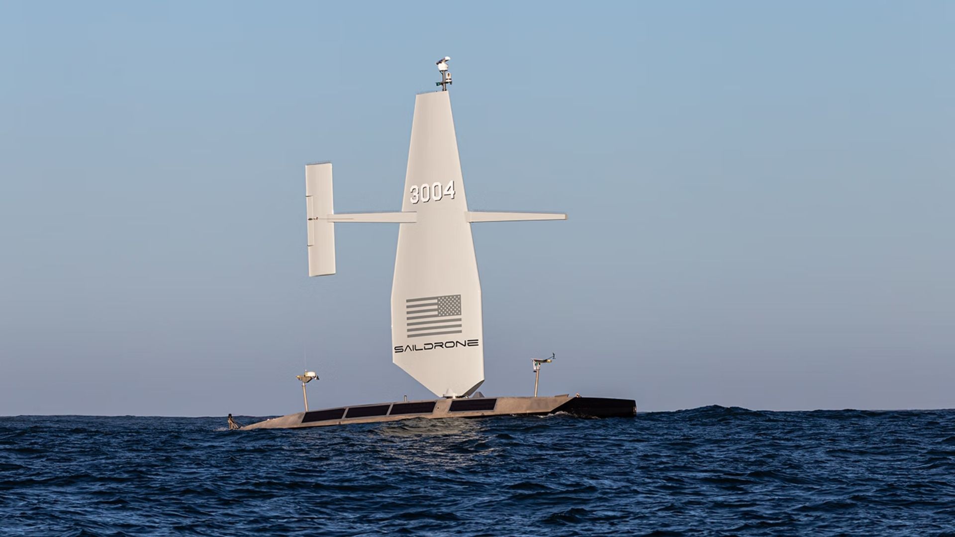
US Navy Awards $10 Million to Saildrone for Atlantic Seabed Mapping with USVs
The US Navy has awarded a $10 million contract to Saildrone to utilize autonomous vessels for mapping the Atlantic Ocean floor. This initiative, assigned by the Naval Oceanographic Office, is set to commence in 2026 and will continue through most of 2027, enhancing military knowledge of critical underwater terrain. This project is significant as it aims to improve safe navigation and support submarine missions, anti-submarine warfare, and critical infrastructure protection. Currently, only 28.7 percent of the world's oceans have been mapped to modern standards, leaving substantial knowledge gaps that can pose operational risks for naval operations. Looking ahead, the deployment of Saildrone's Surveyor unmanned surface vessels will not only provide high-resolution bathymetric data but also measure ocean currents, aiding search-and-recovery operations. No further timeline was disclosed at the time of publication.
Military
Google DeepMind Launches AlphaGenome Atlas Mapping 9 Billion DNA Variants
Google DeepMind has announced the public release of the AlphaGenome Atlas, an online repository that provides pre-computed predictions for all 9 billion possible single-letter changes to the human genome. This tool simplifies the process for researchers, allowing them to access predictions without needing to write code or run complex models themselves. The significance of the AlphaGenome Atlas lies in its potential to enhance our understanding of gene regulation and its implications for disease. As noted by genomicist Carl de Boer, comprehending how DNA variations affect gene activity is crucial for disease research. The Atlas aims to accelerate biological research by helping scientists prioritize experiments based on the model's predictions. Looking ahead, the Atlas could serve as a valuable resource for researchers in fundamental biology and treatment development. However, it is important to note that the predictions have limitations, particularly in the context of diseases associated with multiple genetic variants. No further timeline was disclosed at the time of publication.
Genome Google-deepmind Genetics Ai-models
Ouster Expands into Drone Mapping and Autonomous Vehicles with Physical AI Technology
Ouster is advancing its technology that enables machines to perceive and navigate their environments, contributing to the growth of physical AI. The company is entering the drone mapping sector through a collaboration with GeoCue, while John Deere is integrating Ouster sensors into its GUSS autonomous vehicles. This expansion is significant as it highlights the increasing demand for physical AI solutions across various industries. Ouster's CEO, Angus Pacala, emphasized the company's commitment to exploring new markets and addressing the evolving needs for advanced sensing technologies in automation. Looking ahead, industry stakeholders should monitor Ouster's developments in drone mapping and its partnership with John Deere. No further timeline was disclosed at the time of publication.

Innovative Hybrid Robot Skin Integrates EIT Mapping with Pneumatic Force Sensing
A new prototype hybrid robot skin has been developed, integrating electrical impedance tomography (EIT) location mapping with pneumatic force sensing. This innovative design features a rigid base, four soft air-tight pads, a continuous piezoresistive layer, and 32 boundary electrodes, all produced through advanced 3D printing and spray coating techniques. This development is significant as it enhances the robot's ability to perceive its environment and respond to physical interactions, which is crucial for applications in humanoid robotics and other fields. The combination of EIT and pneumatic sensing allows for more precise location mapping and force detection, potentially improving the functionality and safety of robotic systems in various environments. Looking ahead, the implications of this technology could lead to more adaptive and responsive robotic systems. As researchers continue to refine this hybrid skin, it will be important to monitor advancements in its application across different robotic platforms and industries. No further timeline was disclosed at the time of publication.
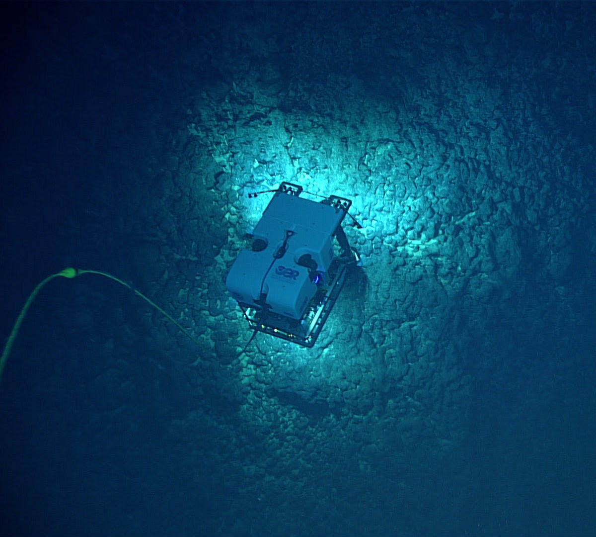
NOAA and Partners to Conduct Expeditions for Deep-Sea Mapping in American Samoa
NOAA Ocean Exploration, alongside its partners, is set to conduct two significant expeditions in the waters surrounding American Samoa during the summer and fall of 2026. These expeditions aim to map and characterize the deep seafloor in a region prioritized for offshore critical mineral exploration, generating publicly available data to enhance understanding of mineral potential and support decision-making. The importance of these expeditions lies in their potential to uncover unknown marine habitats and mineral resources vital for national prosperity and security. NOAA's Principal Deputy Assistant Secretary Erik Noble emphasized the commitment to providing scientific research that supports commerce, while Captain William Mowitt highlighted the need for authoritative science to guide responsible marine resource management. The first expedition will occur from August to September 2026, followed by a second from late September to October 2026, utilizing advanced mapping technology and observational sensors aboard the NOAA Ship Okeanos Explorer. Real-time ROV operations will be streamed online, allowing public engagement and transparency in the exploration process. No further timeline was disclosed at the time of publication.
noaa exploration mapping deep water rov
JOUAV Demonstrates Real-Time Drone Mapping for Landslide Response in Chongqing
On July 17, JOUAV showcased its JOS-P200 drone system in Pengshui County, Chongqing, aiding emergency responders by providing a 3D map of a landslide area. The system delivered high-resolution imagery and a detailed model within an hour, allowing command centers to assess terrain and hazards before deploying personnel. This innovation is significant as it enhances safety and efficiency in disaster response, particularly in challenging environments where traditional access is limited. The JOS-P200's ability to produce real-time maps helps incident commanders make informed decisions regarding resource allocation and risk management. Looking ahead, JOUAV's technology could revolutionize emergency response strategies, especially in larger incidents where their CW-15 VTOL UAV can cover extensive areas quickly. No further timeline was disclosed at the time of publication.
Applications Asia Disaster Response Drone News Drone News Feeds Mapping
China Achieves 3D Mapping of Typhoon Noul Using Drone Swarm Technology
China has successfully created a three-dimensional map of Typhoon Noul from its inception to its conclusion using a swarm of drones. This innovative approach marks a significant advancement in meteorological technology, showcasing the capabilities of drone swarms in real-time environmental monitoring. The development is crucial as it enhances the accuracy of weather predictions and disaster response strategies, potentially saving lives and resources during severe weather events. By employing drone technology, China demonstrates its commitment to leveraging advanced tools for better understanding and managing natural disasters. Looking ahead, the implications of this technology could extend beyond meteorology, influencing various sectors that rely on real-time data collection and analysis. No further timeline was disclosed at the time of publication.
AI and Robotics
DJI Drones Enhance Safety by Mapping Everest's Khumbu Icefall in 2026
DJI's recent case study highlights the use of its Matrice 4E drone and DJI Terra software by Airlift Technology to map the Khumbu Icefall during the 2026 Everest climbing season. This innovative approach provided Sherpas with a detailed 3D map of the hazardous terrain, significantly improving safety for climbers. The Khumbu Icefall is a critical and perilous section of the Everest climbing route, known for its deep crevasses and unstable ice formations. Traditionally, Sherpas would navigate this dangerous area on foot to establish safe paths. However, the drone's ability to survey the icefall in just three and a half hours allowed for a more efficient and safer mapping process. Looking ahead, the repeated drone surveys not only enhance climber safety but also offer valuable data for scientists studying glacier dynamics. This deployment marks a significant advancement in high-altitude expedition planning, with potential implications for future climbing seasons and environmental research.
News
Developing Reliable Monocular Visual SLAM for Underwater Bionic Robotic Fish Using Image Enhancement and Deep Feature Matching
Recent advancements in monocular visual simultaneous localization and mapping (SLAM) have been applied to underwater bionic robotic fish. This approach integrates image enhancement techniques with deep feature matching to improve the robustness of navigation and mapping in aquatic environments. The significance of this development lies in its potential to enhance the operational capabilities of underwater robotic systems. By leveraging advanced image processing and machine learning techniques, the integration aims to address challenges faced in underwater navigation, such as low visibility and dynamic environments. Looking ahead, further research and testing will be crucial to refine these techniques and ensure their effectiveness in real-world underwater applications. No further timeline was disclosed at the time of publication.
RESEARCH ARTICLE
Robotic Reaction Mapping Uncovers Hidden Reactivity in Biginelli Reaction
Recent advancements in robotic reaction mapping and chemical AI have unveiled a surprising pseudo-seven-component transformation in the Biginelli reaction, a process that has been studied for over a century. This discovery is significant as it enhances the understanding of the Biginelli reaction, potentially leading to new applications in organic synthesis and pharmaceuticals. The integration of robotics and AI in chemical research demonstrates the evolving landscape of chemical discovery. Looking ahead, researchers may explore further implications of this transformation and its applications in various fields. No further timeline was disclosed at the time of publication.
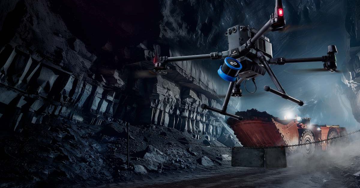
Emesent Secures $17 Million to Enhance AI-Driven Drone Operations and Expand Manufacturing
Emesent, an Australian drone mapping company, has raised $17 million to boost its AI-powered autonomous operations. This funding includes a $7 million venture debt facility from the National Reconstruction Fund Corporation and a $10 million equity round from notable investors such as Main Sequence and QIC Ventures. The investment aims to enhance the capabilities of drones in complex environments with minimal human intervention. The significance of this funding lies in Emesent's strategy to focus on software advancements alongside hardware improvements. The company plans to develop its Cortex AI autonomy software and Aura cloud platform, which will enable drones to operate in GPS-denied areas and process 3D mapping data efficiently. Emesent's existing Hovermap LiDAR payload is already utilized in over 200 mine sites globally, showcasing its established presence in the industrial drone sector. Looking ahead, Emesent intends to expand its manufacturing capabilities in Queensland while pursuing growth in international markets. CEO Charles Miller emphasized the importance of this investment in enhancing AI and autonomy for industries such as mining and defense. No further timeline was disclosed at the time of publication for the anticipated developments from this funding round.
News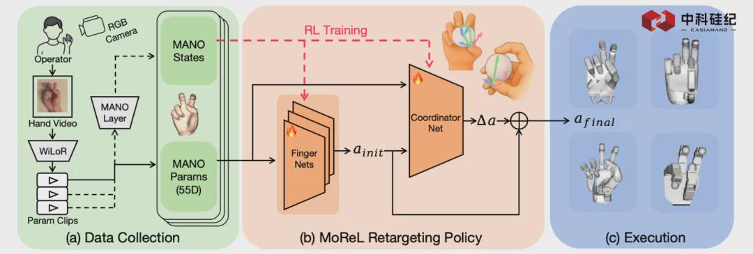
Breaking Through Data Bottlenecks: Si 0.5 Enables Millisecond Mapping from Human to Dexterous Hands
Zhongke Silicon Memory has unveiled MoReL, an innovative modular reinforcement learning framework designed to enhance embodied intelligence by facilitating real-time mapping of human hand movements to a variety of dexterous robotic hands. This significant advancement, announced recently, aims to tackle the prevalent issues of data scarcity and compatibility that have hindered the effective control of robotic systems. By enabling precise and efficient manipulation across different robotic platforms, MoReL eliminates the necessity for extensive reconfiguration, thereby streamlining the integration of human-like dexterity in robotics. This development marks a pivotal step forward in the field, promising to enhance the functionality and adaptability of robotic hands in various applications.
Robotic Manipulation Reinforcement Learning Dexterous Robotics Human-Robot Interaction
A Review on Search and Rescue Robots in Complex Scenarios: Key Technologies of Simultaneous Localisation and Mapping
A recent study published in the Journal of Field Robotics highlights the advancements in autonomous robotic systems designed for agricultural applications. Researchers from various institutions collaborated to explore innovative technologies that enhance efficiency and sustainability in farming practices. The findings, released in early October 2023, emphasize the growing need for automation in agriculture to address labor shortages and improve crop yields. The research team conducted extensive field tests to evaluate the performance of these robotic systems in real-world farming scenarios. By integrating artificial intelligence and machine learning, the robots demonstrated the ability to perform tasks such as planting, monitoring, and harvesting with remarkable precision. This technological progress aims to support farmers in overcoming challenges posed by climate change and increasing food demand. The study underscores the importance of developing reliable and cost-effective robotic solutions that can be easily adopted by farmers. As the agricultural sector faces mounting pressures, the implementation of these advanced technologies could significantly transform traditional farming methods, leading to more sustainable practices and enhanced productivity.
SURVEY ARTICLE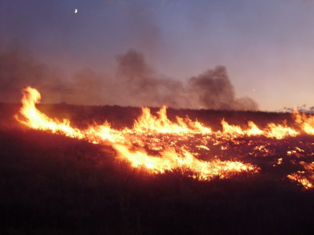
Landair Surveys Uses SimActive Correlator3D for Planned Burns Mapping in Australia
Landair Surveys, an Australian geospatial firm, is utilizing SimActive's Correlator3D software to create orthomosaics from aerial imagery. This initiative is part of their efforts in wildfire prevention and land management, specifically for planned burns mapping projects across Australia. The Montreal-based software developer announced this collaboration, highlighting that the workflow aims to enhance the efficiency of geospatial outputs. The use of advanced aerial imagery technology is expected to improve land management strategies and contribute to effective wildfire prevention measures.
Digital Twins Disaster Response Drone News Drone News Feeds Fire Firefighter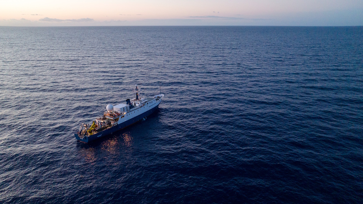
Ocean Exploration Trust Launches Expedition with New Mapping Sonar to Explore Deeper than Ever!
The Ocean Exploration Trust (OET) launched its Exploration Vessel (E/V) Nautilus today for the inaugural expedition of 2026, marking a significant advancement in deep-sea exploration. This expedition, named Pacific Mapping (NA178), features the first operational deployment of the newly installed Kongsberg EM 304 MKII multibeam sonar technology, which enhances the vessel's capability to explore ocean depths more effectively than ever before. The initiative aims to expand our understanding of the Pacific Ocean's underwater landscapes and ecosystems, leveraging cutting-edge technology to gather critical data. The expedition underscores OET's commitment to marine research and exploration, as it seeks to uncover the mysteries of the ocean and contribute to scientific knowledge.
ocean exploration trust’s (oet) e/v nautilus expedition 2026
Autonomous seeking and mapping coral reef biodiversity hotspots with a multimodal AUV
In a groundbreaking study published in the May 2026 issue of Science Robotics, researchers have unveiled a new robotic system designed to assist in complex surgical procedures. This innovative technology, developed by a team of engineers and medical professionals, aims to enhance precision and reduce recovery times for patients undergoing surgery. The research was conducted at a leading medical institution, where the team tested the robotic system in a series of simulated surgeries. The results demonstrated significant improvements in accuracy compared to traditional surgical methods, showcasing the potential for robots to play a crucial role in the operating room. The motivation behind this development stems from the increasing demand for minimally invasive surgical techniques that can lead to quicker patient recovery and lower risk of complications. By integrating advanced robotics with surgical practices, the team hopes to address these challenges and improve overall patient outcomes. The robotic system operates through a combination of artificial intelligence and real-time data analysis, allowing it to adapt to the unique requirements of each surgical procedure. This adaptability is expected to empower surgeons, providing them with enhanced tools to perform intricate tasks with greater confidence. As the medical community continues to explore the integration of robotics in healthcare, this study represents a significant step forward in the evolution of surgical practices, potentially transforming the landscape of modern medicine.
Research Article
BM3D‐Based Optical Flow Tracking for Enhanced Visual Simultaneous Localization and Mapping Systems in Mobile Robotics
The Journal of Field Robotics has recently published an early view article highlighting advancements in robotic technology. This publication, released in October 2023, showcases innovative research that aims to enhance the capabilities of field robots in various applications, including agriculture, search and rescue, and environmental monitoring. The research is driven by the growing need for automation and efficiency in these sectors, as well as the increasing complexity of tasks that robots are expected to perform. The findings suggest that integrating advanced algorithms and machine learning techniques can significantly improve the performance and adaptability of robotic systems in real-world scenarios. This research not only contributes to the academic field but also has practical implications for industries looking to leverage robotics for improved operational efficiency and safety.
RESEARCH ARTICLE
US Army Corps of Engineers Awards Fugro Five‑year Contract for Critical Infrastructure Mapping
Fugro has been awarded a five-year indefinite-delivery, indefinite-quantity (IDIQ) contract by the US Army Corps of Engineers (USACE) to deliver surveying and mapping services. This contract, which supports both civil works and military infrastructure programs, will be effective immediately and will cover projects across the United States and internationally. The initiative aims to enhance USACE’s management of essential waterways, flood-risk systems, and military facilities. By providing timely and high-quality geospatial data, Fugro will play a crucial role in informing infrastructure planning, risk management, and operational readiness in various complex and demanding environments.

Beacon Biosignals is mapping the brain during sleep
Jake Donoghue, a PhD graduate from MIT, and former MIT researcher Jarrett Revels have launched a company focused on developing an AI-driven platform aimed at diagnosing and treating diseases. This innovative initiative seeks to leverage advanced artificial intelligence technologies to enhance medical decision-making and improve patient outcomes. The platform is currently in development, with the founders drawing on their extensive research backgrounds to create a solution that addresses critical challenges in healthcare. By integrating AI into the diagnostic process, the company aims to streamline the identification of diseases and facilitate more effective treatment plans. The project reflects a growing trend in the medical field, where technology is increasingly being utilized to augment traditional healthcare practices.
Startups Alumni/ae Alzheimer's Parkinson's Disease Neuroscience
Multi-Resolution Mapping Improves Autonomous Robot Exploration Efficiency
A team of researchers has developed a groundbreaking multi-resolution exploration method aimed at improving robotic navigation in complex and unfamiliar environments. This innovative approach enhances the efficiency and adaptability of robots, enabling them to better navigate obstacles and varying terrain. The research, which was conducted in late 2023, addresses the growing need for advanced robotic systems capable of operating in unpredictable settings, such as disaster zones or remote exploration areas. By employing this new method, robots can dynamically adjust their navigation strategies based on real-time data, ultimately increasing their effectiveness in completing tasks. The findings promise to significantly advance the field of robotics, paving the way for more autonomous and resilient machines in the future.
Real‐Time Monocular 2D Occupancy Grid Mapping for Autonomous Navigation of Ground Robots
In May 2026, researchers published a significant study in the Journal of Field Robotics, focusing on advancements in robotic technology. The study, appearing in Volume 43, Issue 3, pages 1844-1860, highlights innovative methodologies for enhancing the efficiency and autonomy of field robots. Conducted by a team of experts in robotics and artificial intelligence, the research aims to address the growing demand for automation in various industries, including agriculture and disaster response. The findings reveal new algorithms that improve navigation and decision-making processes for robots operating in complex environments. This research is particularly relevant as industries increasingly seek to integrate robotic solutions to optimize operations and reduce human risk in hazardous situations. By employing advanced machine learning techniques, the team demonstrated how robots can adapt to dynamic conditions, thereby increasing their effectiveness in real-world applications. The study's implications extend beyond theoretical advancements, as it provides practical frameworks for deploying robots in challenging scenarios. As the field of robotics continues to evolve, this research contributes to the ongoing dialogue about the future of automation and its potential to revolutionize traditional practices across multiple sectors.
RESEARCH ARTICLE
Real‐Time Terrain Traversability Analysis and Mapping for Autonomous Robotics in Dynamic Environments: Fusing Appearance‐ and Geometry‐Based Approaches
In a recent study published in the Journal of Field Robotics, researchers explored advancements in robotic technologies aimed at enhancing agricultural efficiency. The study, which appears in the May 2026 issue, highlights innovative approaches to integrating robotics into farming practices to address labor shortages and improve crop yields. Conducted by a team of experts in robotics and agriculture, the research was carried out in various agricultural settings to assess the effectiveness of these technologies in real-world applications. The findings suggest that the implementation of autonomous robots can significantly streamline farming operations, reduce costs, and increase productivity. This research is particularly timely as the agricultural sector faces increasing challenges due to a declining workforce and the need for sustainable practices. The study emphasizes the potential of robotics to transform the industry, paving the way for smarter, more efficient farming solutions.
RESEARCH ARTICLE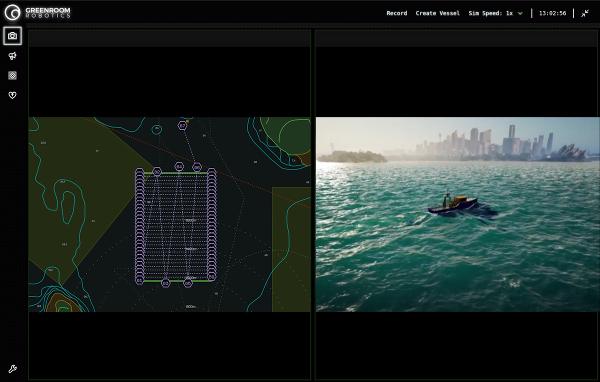
Seabed 2030 and Greenroom Robotics Announce Partnership to Support Global Ocean Mapping
The Nippon Foundation-GEBCO Seabed 2030 Project has formed a partnership with Greenroom Robotics, an Australian company specializing in artificial intelligence and autonomy for maritime operations. This collaboration aims to enhance the safety, efficiency, and environmental sustainability of maritime activities through advanced perception and autonomy software. The announcement highlights the growing importance of innovative technologies in supporting responsible maritime practices as the project continues its mission to map the world's seabed by 2030.
seabed 2030 greenroom robotics partnership global ocean mapping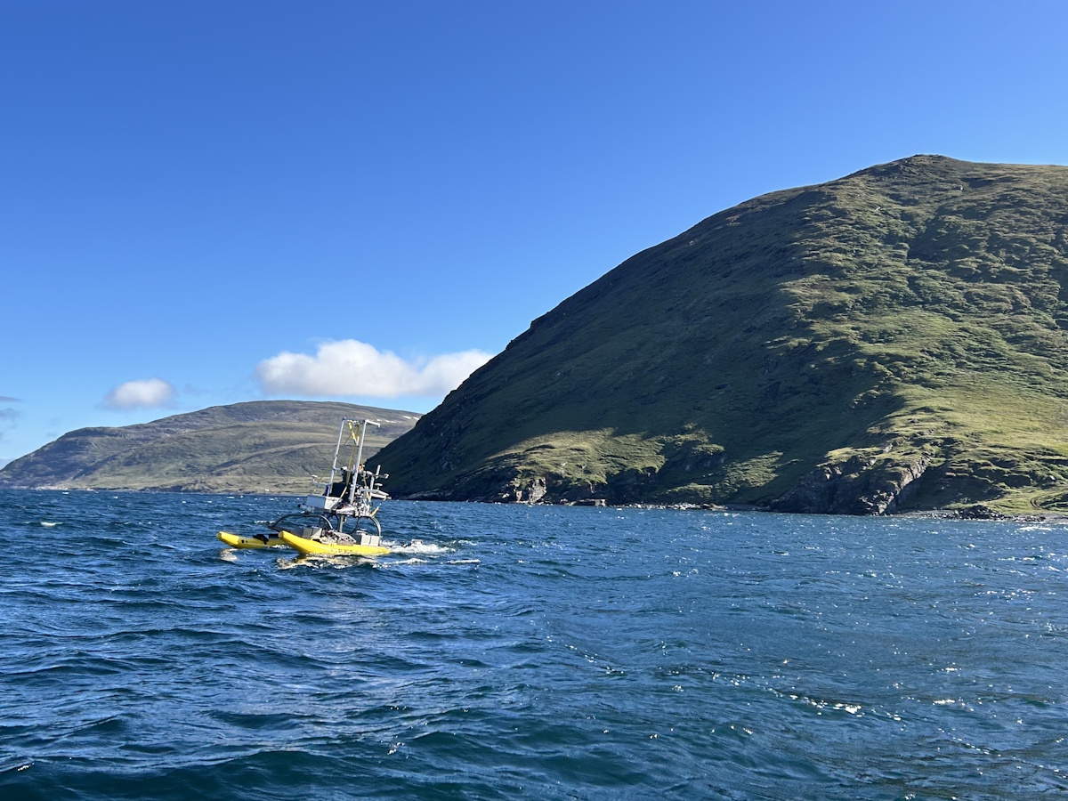
Mapping the Unmappable: Sulmara Discover and the Nunavik EAUFON-3 Project
Seaforth Geosurveys is undertaking the Nunavik EAUFON-3 Project, which aims to assess the seabed in Ungava Bay, Canada, for the installation of a fibre-optic cable. This initiative is set against the backdrop of the Arctic's harsh environment and the shallow waters that complicate traditional surveying methods. The project highlights the need for innovative approaches to overcome the unique challenges posed by the region's conditions.
arctics sulmara discover nunavik eaufon-3 project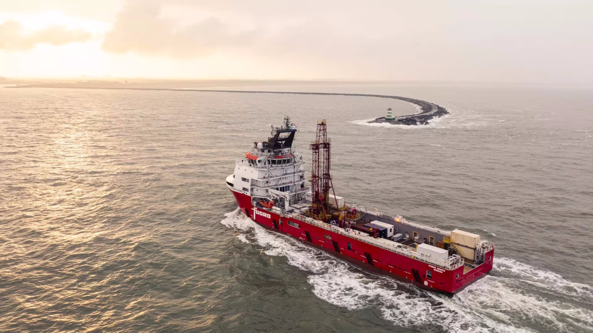
Fugro Reinforces its Role as Major Contributor to UN Ocean Decade Initiative for Seabed Mapping
Fugro has reaffirmed its commitment to the Nippon Foundation-GEBCO Seabed 2030 project, a key initiative under the United Nations Ocean Decade, during the Oceanology International event held in London. As the Ocean Decade approaches its midpoint, the company is enhancing its contribution by expanding the fleet of vessels involved in the Seabed 2030 project. Notably, Fugro's largest vessels, which are primarily engaged in geotechnical surveys, will now also participate in the collection of vital ocean-floor data, complementing the efforts of the existing geophysical fleet. This expansion aims to accelerate the mapping of the world's seabeds, supporting global efforts to better understand and protect oceanic environments.
fugro un ocean decade initiative for seabed mapping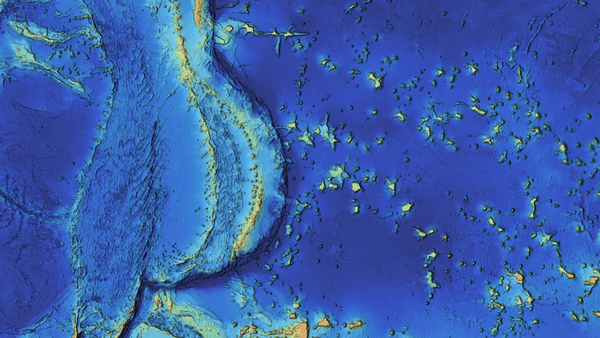
Mapping the Mariana Islands: Saildrone Partners with Woolpert to Survey Critical Maritime Region for NOAA
The Mariana Trench, home to Challenger Deep, the deepest point in the world's oceans at 10,935 meters (35,876 feet), remains one of the least explored and most geologically significant areas on Earth. This underwater marvel, located in the western Pacific Ocean, continues to intrigue scientists and researchers due to its profound depths and unique geological features. Efforts to map and study this region are crucial for understanding oceanic processes and biodiversity, as well as the effects of climate change on deep-sea ecosystems. As exploration technologies advance, researchers aim to uncover the mysteries of the trench and its surrounding islands, shedding light on the fundamental workings of our planet’s oceans.
mapping mariana islands saildrone woolpert survey noaa
3D Mobile Mapping for Digital Twins: Camera Features That Ensure Accuracy
Recent advancements in surveillance technology have transformed urban environments into rich sources of visual data, essential for creating digital twins of cities. These digital replicas rely heavily on high-quality imagery captured by cameras installed in various public spaces, including streets and buildings. However, experts warn that if the visual data collected is inadequate or flawed, the integrity and functionality of the entire digital model can be compromised. This reliance on precise imagery underscores the importance of maintaining and upgrading surveillance systems to ensure accurate representations of urban landscapes. As cities increasingly adopt these technologies, the challenge remains to balance effective data collection with privacy concerns, prompting ongoing discussions among policymakers and technology developers.

Automated Multispectral Terrain Mapping Using Drones and Robotics
Recent advancements in drone technology have significantly enhanced the use of multispectral data, which is increasingly recognized for its role in informing scientific and operational decision-making. Unlike traditional aerial and satellite imaging, drone-based multispectral surveys offer superior detail, flexibility in timing, and improved accuracy. This innovative approach allows researchers and organizations to gather measurable insights more efficiently, ultimately leading to better-informed decisions across various fields. The growing reliance on drone technology for data collection underscores the importance of accurate and timely information in addressing complex challenges.
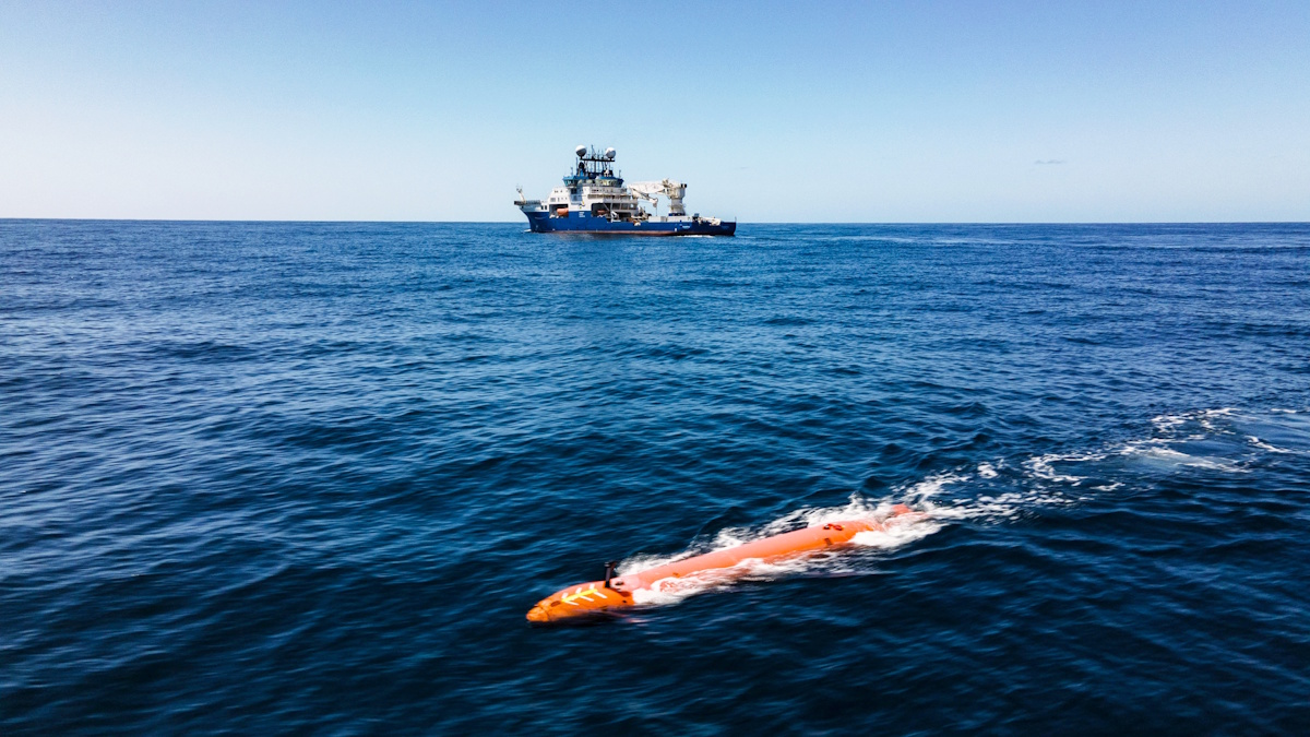
Schmidt Ocean Institute Advances R/V Falkor (too)’s Mapping Capabilities
The Schmidt Ocean Institute has successfully mapped an impressive 2 million square kilometers of seafloor, a vast area comparable to the size of Greenland. This achievement was announced recently as part of the institute's ongoing efforts to enhance underwater exploration. In a bid to improve the capabilities of its research vessel, R/V Falkor (too), the institute implemented two significant upgrades this year. These enhancements included a complete redesign of the ship's bow and the integration of advanced Autonomous Underwater Vehicles (AUVs), recognized as the gold standard in underwater mapping technology. These developments are expected to significantly bolster the institute's ability to conduct detailed and efficient seafloor mapping, furthering its mission to explore and understand the ocean's depths.
schmidt ocean institute (soi) r/v falkor (too) mapping capabilities kongsberg hugin superior auv
Saildrone Completes Pioneering Mapping Mission of Cayman Islands’ EEZ
Saildrone, a leader in autonomous deep-water mapping, has successfully completed a mission to map the exclusive economic zone of the Cayman Islands. Over approximately 300 days, the company utilized its Saildrone Surveyor uncrewed surface vehicle to survey around 90,000 square kilometers of seabed, reaching depths of up to 7,000 meters. The mission included over 900 sound-velocity profile casts to ensure the accuracy of the bathymetric data collected. A key focus of the survey was on four significant fishing banks—60 Mile Bank, Lawfords Bank, Pickle Bank, and 12 Mile Bank—which are vital for biodiversity and support local fisheries, tourism, and recreational activities. These areas also serve as indicators of the overall health of the Cayman Islands' marine ecosystem. The successful completion of this mapping mission is expected to enhance understanding and management of the region's marine resources.
saildrone pioneering mapping mission
NOAA-Led Ocean Mapping Expedition in Cook Islands Hailed as a Resounding Success
The Exploration Vessel Nautilus, operated by the Ocean Exploration Trust, has successfully concluded a pioneering three-week mission to map and explore the Exclusive Economic Zone (EEZ) of the Cook Islands. This initiative, which took place recently, was spearheaded by the National Oceanic and Atmospheric Administration (NOAA) through its Ocean Exploration program, with additional support from a grant provided to the Ocean Exploration Cooperative Institute (OECI). The mission represents a significant advancement in the collaboration between the United States and the Cook Islands, aimed at enhancing marine resource management in the region. By employing advanced mapping technologies and conducting in-depth explorations, the project not only contributes to scientific knowledge but also fosters stronger partnerships in sustainable ocean stewardship.
noaa ocean exploration trust
Alibaba’s mapping unit Amap reportedly to enter global robotaxi market
Amap, the digital mapping and navigation service owned by Alibaba, is set to venture into the robotaxi market as part of its global expansion strategy. According to a report from Sina Tech, this initiative is viewed internally as a strategic business move aimed at driving significant growth for the company. Amap's entry into the robotaxi sector reflects its ambition to diversify and enhance its service offerings in the rapidly evolving transportation landscape. The company is expected to leverage its expertise in digital mapping and real-time navigation to establish a competitive presence in this emerging market.
News Feed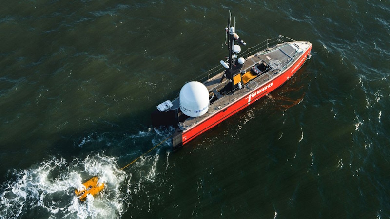
Fugro and NOAA partner to advance remote deep-ocean mapping
Fugro, a leading geotechnical and survey company, has partnered with NOAA Ocean Exploration to establish a five-year Cooperative Research and Development Agreement (CRADA). This collaboration aims to design and implement remote and uncrewed technologies that will enhance deep-ocean mapping and characterization. Announced recently, this public-private partnership seeks to address significant data deficiencies in the deep ocean, one of the planet's least explored regions. By improving access to vital information, the initiative is expected to facilitate informed decision-making regarding offshore energy development, marine resource management, and national security. The deployment of these advanced technologies is anticipated to play a crucial role in advancing our understanding of the deep sea and its resources.
fugro noaa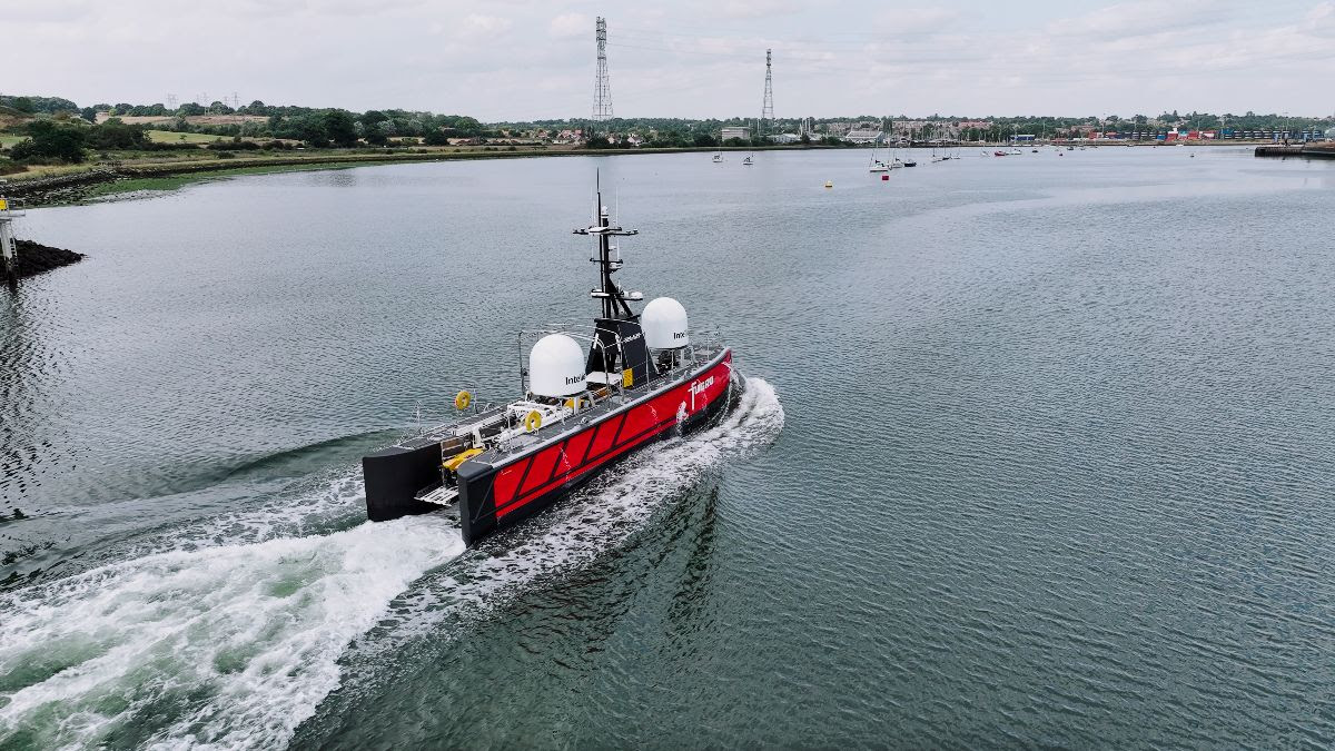
Fugro Selected for Pioneering USV Seabed Mapping Initiative in Norway
Fugro has secured a contract with the Norwegian Hydrographic Service (NHS) to assist in the 2025 MAREANO seabed mapping program. This initiative marks a significant milestone as it will be the first time MAREANO employs uncrewed surface vessel (USV) technology for data collection. Fugro plans to utilize its newly developed 18-meter Blue Eclipse® USV for this purpose. The adoption of this innovative technology aims to promote lower carbon emissions in seabed mapping while ensuring the acquisition of high-quality data essential for the responsible management and preservation of Norway’s marine resources.
fugro usv seabed mapping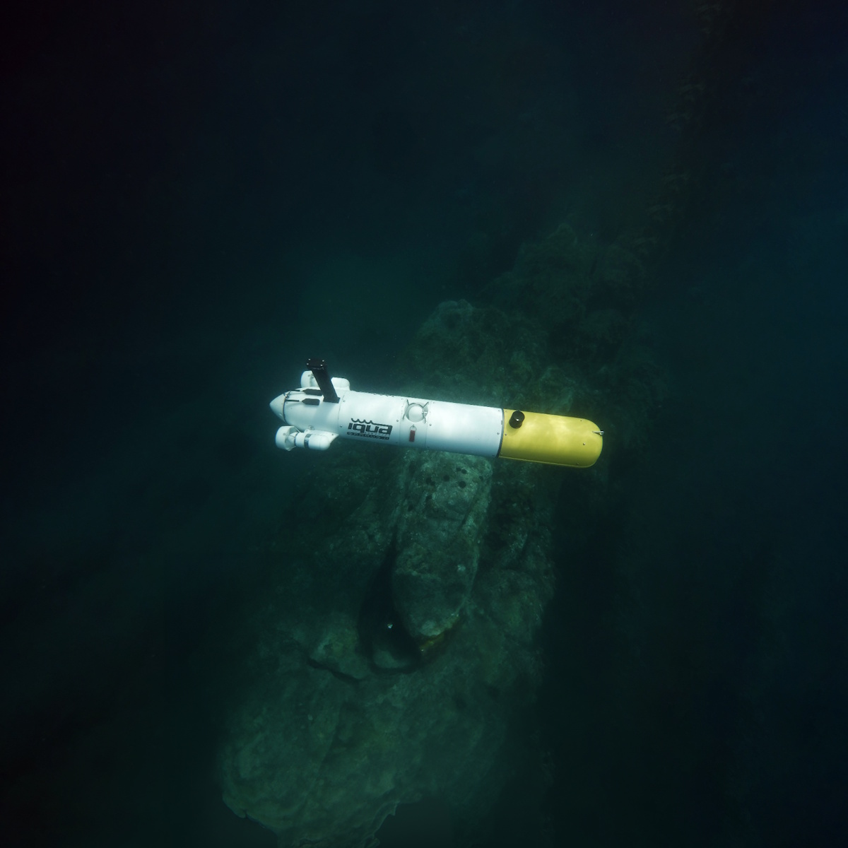
Multimodal Mapping for Exploration and Inspection with the SPARUS II AUV
Micro and small autonomous underwater vehicles (AUVs) are increasingly recognized for their ability to integrate various sensors and navigation systems, making them particularly suitable for operations in coastal waters. Their deployment and operation are straightforward, which enhances their appeal for marine exploration. However, successful exploration and mapping of survey targets often necessitate the use of multiple sensing techniques. Furthermore, there is a growing demand for close-range, high-resolution inspections, a task that has traditionally been handled by remotely operated vehicles (ROVs). This shift highlights the evolving capabilities of AUVs in marine applications, as they seek to meet the complex requirements of underwater surveying and inspection.
multimodal mapping exploration inspection sparus ii auv iqua robotics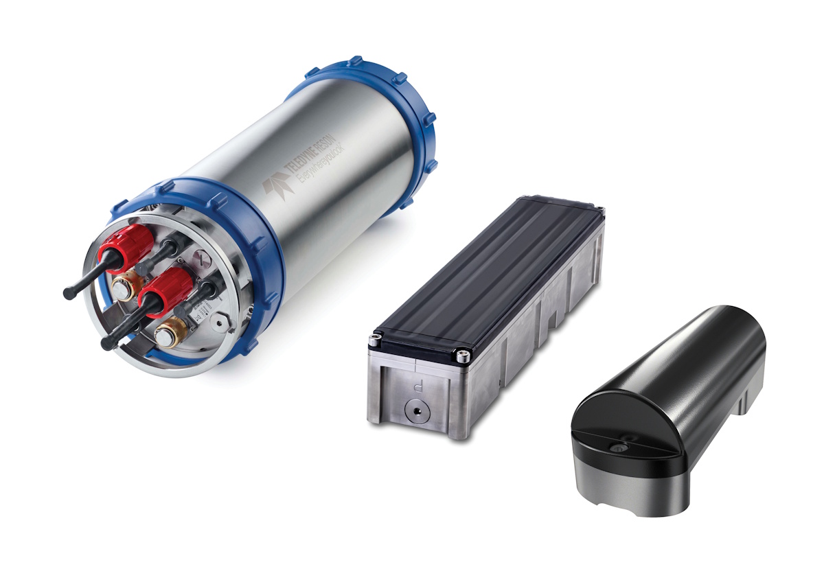
Teledyne Marine Launches SeaBat T51-S Multibeam, Setting a New Standard in High Resolution Subsea Mapping
Teledyne Marine has unveiled the SeaBat T51-S multibeam echosounder, the newest addition to its SeaBat T-series, aimed at enhancing subsea exploration capabilities. This advanced echosounder is specifically engineered for deployment on remotely operated vehicles (ROVs) and autonomous underwater vehicles (AUVs), facilitating deep-sea exploration and underwater surveys. The launch follows the success of the flagship SeaBat T51-R, reflecting Teledyne Marine's commitment to innovation in marine technology. The SeaBat T51-S is expected to significantly improve data collection and mapping in challenging underwater environments, supporting various marine research and commercial applications.
teledyne marine seabat t51-s multibeam subsea mapping
Fugro Leads Large-scale Seafloor Mapping Project to Protect Florida’s Coast
Fugro is enhancing its involvement in the Florida Seafloor Mapping Initiative (FSMI), a long-term project led by the Florida Department of Environmental Protection (DEP) aimed at mapping the state’s seafloor to bolster coastal resilience, infrastructure planning, and environmental protection. Following its earlier contribution of 14,000 square kilometers of airborne lidar data, the company is now undertaking vessel-based surveys covering an additional 42,000 square kilometers off the coast of Florida. This expansion is part of a broader strategy to provide critical data that will support sustainable coastal management and environmental stewardship in the region.
fugro large-scale seafloor mapping florida coastRobotics needs a service framework.
RSF defines a common language for robot service capability, lifecycle operations, certification pathways, and service-provider networks.
Join the RobotToday community on LinkedIn
Daily robotics news, in-depth analysis, conference highlights, and discussions with professionals worldwide.







