Industry Briefing
A single destination for timely, editor-curated robotics news from around the world.
'It's quite a bit more than we expected': Satellite reveals immense scale of GPS signal tampering
An experimental satellite has successfully mapped the extent of GPS jamming across Europe and the Middle East, marking a significant advancement in space-based monitoring technology. This groundbreaking achievement was reported recently, showcasing the satellite's ability to detect and analyze interference in GPS signals from a vantage point in space. The initiative aims to enhance understanding of the growing issue of GPS jamming, which poses risks to navigation and communication systems. By employing advanced sensors and data processing techniques, the satellite collected and transmitted detailed information about the locations and intensity of jamming activities. This development is crucial for improving the resilience of GPS-dependent services and ensuring the reliability of navigation systems in the affected regions.
Satellites Space Exploration
LandSpace Successfully Launches Improved Zhuque-2 Rocket, Marking Milestone in Chinese Commercial Space Race
On June 9, Chinese commercial aerospace company LandSpace successfully launched its upgraded Zhuque-2E Y6 rocket, marking a significant milestone in its efforts to develop reusable rocket technology. The launch took place as part of the company's ongoing Zhuque-3 program, which aims to enhance capabilities in the competitive space industry. During this mission, the rocket delivered two satellites into orbit, demonstrating LandSpace's growing expertise in satellite deployment and propulsion systems. This achievement not only showcases the company's advancements in aerospace technology but also positions it strategically in the rapidly evolving global space market.
Technology
NASA Satellites Track Harmful Algae With AI
NASA has developed an artificial intelligence tool that utilizes satellite data to detect harmful algal blooms, a significant environmental concern for coastal communities. This innovative technology aims to enhance response times and improve protective measures for both local economies and ecosystems. By analyzing satellite imagery, the AI can quickly identify the presence of these blooms, which can pose health risks to marine life and humans alike. The initiative is part of NASA's broader commitment to leveraging advanced technology for environmental monitoring and public safety. As coastal areas increasingly face the challenges posed by climate change and pollution, this tool represents a proactive approach to safeguarding vulnerable regions.

Japan’s IHI begin to benefit from ICEYE SAR imagery
IHI, a prominent player in Japan's aerospace industry, has successfully integrated two operational ICEYE synthetic aperture radar (SAR) satellites into its operations, with plans to deploy two additional satellites in the near future. This advancement marks a significant step for IHI, enhancing its capabilities in satellite technology and data acquisition. The deployment of these satellites is expected to bolster IHI's position in the aerospace sector, allowing for improved monitoring and analysis of various environmental and industrial applications. The initiative reflects IHI's commitment to advancing its technological offerings and responding to the growing demand for satellite-based data solutions.
News
Beyond satellites: Why FOG inertial navigation is the new imperative for land warfare
The landscape of military navigation is undergoing a significant transformation as counterspace threats and electronic warfare challenge the previously uncontested dominance of GPS technology. Exail is at the forefront of this shift, introducing its Fiber Optic Gyro (FOG) technology, which offers enhanced stability and serves as a reliable "source of truth" for land maneuvering and precision targeting in environments where Global Navigation Satellite Systems (GNSS) are compromised. This innovation is crucial for modern military operations, enabling forces to maintain operational effectiveness despite the increasing prevalence of electronic warfare tactics. As the battlefield evolves, Exail’s advancements in navigation technology are poised to play a vital role in ensuring that military units can navigate and execute missions with precision and confidence, even in the most challenging conditions.
Land Warfare Sponsored Post Army autonomy electronic warfare (EW) Exail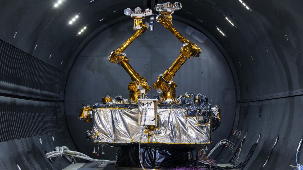
DARPA readies robotic deep-space repair satellite for 2026 launch
The Defense Advanced Research Projects Agency (DARPA) is set to launch a mission this summer to extend the operational lifespan of geosynchronous satellites beyond their typical expiration dates. This initiative aims to address the growing need for sustainable satellite operations in space, allowing for continued functionality and service without the immediate need for replacement. By testing innovative technologies and methods, DARPA seeks to enhance the longevity of these critical assets, which play a vital role in communication, weather monitoring, and national security. The upcoming mission represents a significant step towards ensuring that satellites can remain in service for years longer than previously anticipated.
Satellites Space Exploration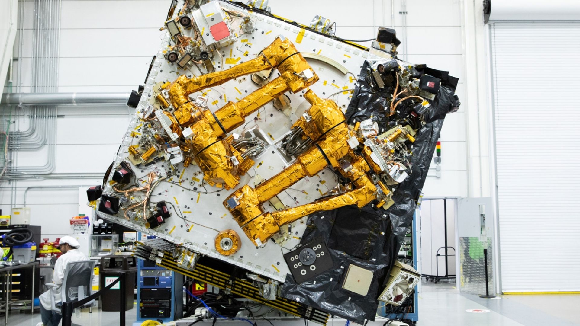
DARPA`s orbital robotic servicing satellite set for 2026 launch
The Defense Advanced Research Projects Agency (DARPA) is set to launch its Robotic Servicing of Geosynchronous Satellites (RSGS) program this summer. This initiative aims to enhance the capabilities of satellites in geosynchronous orbit by enabling robotic servicing, which includes maintenance, upgrades, and repairs. The program is designed to address the growing need for satellite longevity and functionality in an increasingly crowded orbital environment. By employing advanced robotics technology, DARPA seeks to extend the operational life of critical satellite assets, thereby ensuring continued communication and data services. The launch of RSGS represents a significant step forward in satellite servicing, with the potential to revolutionize how space assets are managed and maintained.
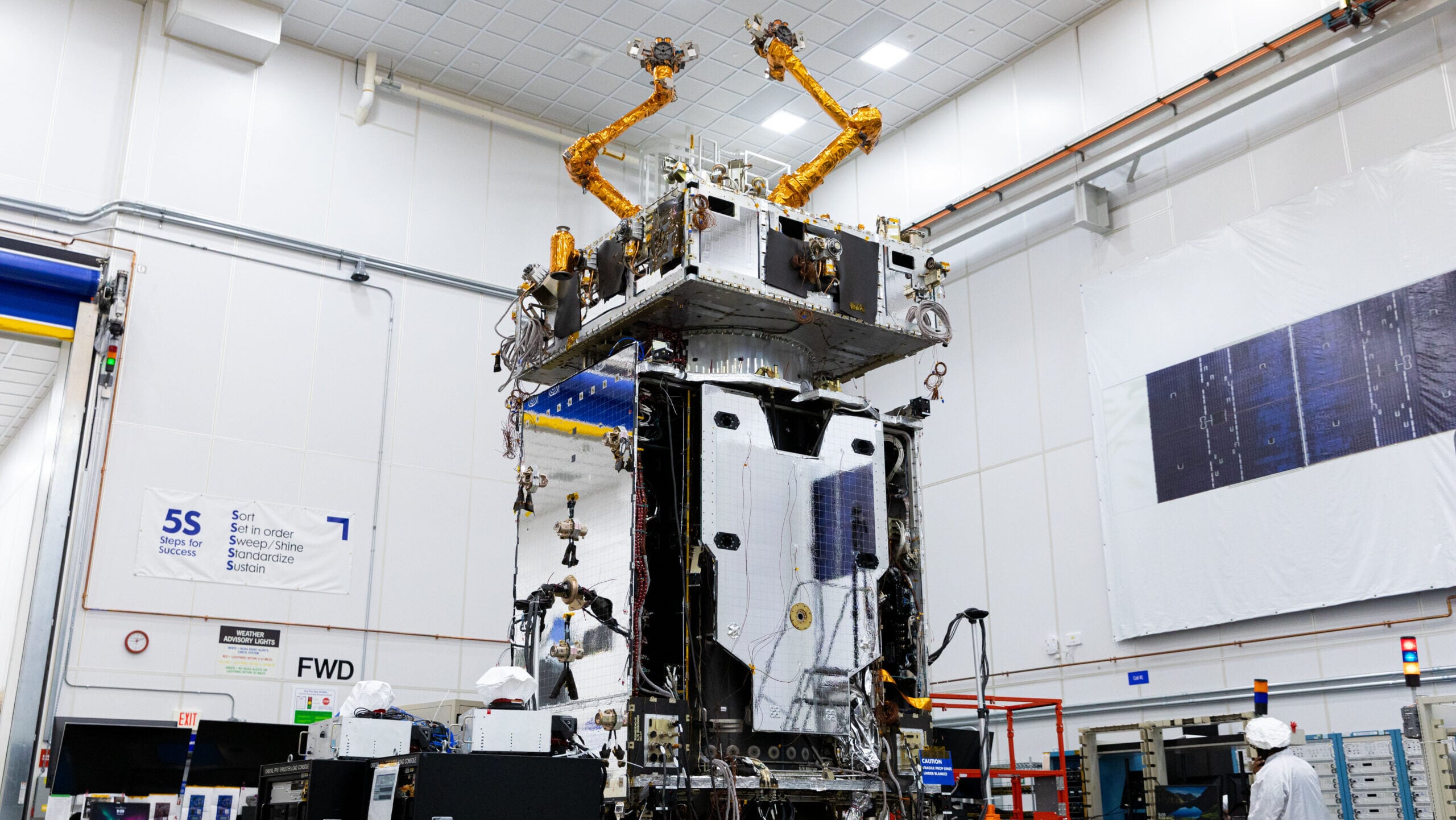
DARPA’s robotic servicing spacecraft to finally fly this summer
The Robotic Servicing of Geosynchronous Satellites mission, a collaboration between DARPA and Northrop Grumman, is set to establish the United States' first on-orbit servicing capability for satellites. This groundbreaking initiative aims to enhance satellite maintenance and repair, extending the operational lifespan of critical space assets. Company officials announced the mission's significance, highlighting its potential to revolutionize satellite operations and reduce costs associated with launching new satellites. The project is expected to take place in the coming months, marking a pivotal advancement in space technology and satellite management.
Space darpa Defense Advanced Research Projects Agency Naval Research Laboratory Northrop Grumman on-orbit refueling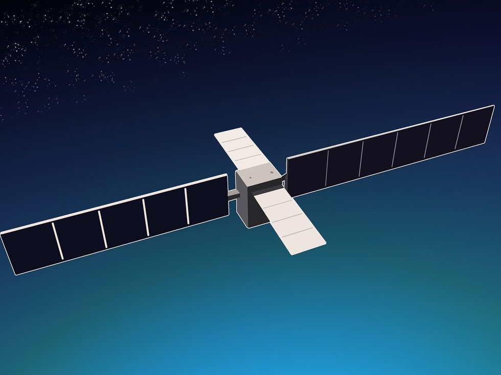
Startup Wants to Run AI Inference From Space
The rapid growth of large language models is driving a global surge in energy demand for data centers, prompting operators to seek alternative power sources. Among them is Orbital Inc., a Los Angeles-based startup that recently emerged from stealth mode to announce plans for space-based data centers. Backed by venture capital firm Andreessen Horowitz, Orbital aims to utilize solar energy from a constellation of small satellites in low Earth orbit to power AI inference workloads, such as chatbots. Orbital's founder and CEO, Euwyn Poon, emphasizes the limitations of terrestrial energy sources, stating, “There simply isn’t enough capacity here [on Earth], and the only way is up.” The company envisions a network of up to 10,000 satellites, each equipped with GPU server racks powered by solar panels. The first test of this concept is scheduled for 2027, with a prototype satellite launch aboard a SpaceX Falcon 9 rocket. While Orbital's approach aims to reduce launch costs and improve efficiency, it faces significant engineering challenges, including radiation effects on GPUs, thermal management in space, and maintenance difficulties. Experts like Dr. Amit Verma from Texas A&M University caution that the operational feasibility of such systems will depend on the specific applications they support. Despite these hurdles, Orbital plans to finalize its satellite designs by 2026 and establish a manufacturing facility by 2028, with the goal of tapping into major AI firms as customers. Poon remains optimistic about overcoming technical challenges, asserting that their engineering efforts will pave the way for the future of space-based data processing.
Data-center Space Ai Inferencing
GITAI Selected by U.S. Space Force for Space-Based Interceptor Program
GITAI has unveiled its latest innovation, a satellite platform equipped with a robotic arm designed for on-orbit operations. This development, which showcases GITAI's commitment to advancing space technology, aims to enhance the efficiency and capabilities of satellite missions. The announcement was made in October 2023, highlighting the company's ongoing efforts to revolutionize the way satellites are operated in space. By integrating robotic technology into satellite systems, GITAI seeks to address the growing demand for more versatile and autonomous operations in the increasingly crowded orbital environment. The platform is expected to facilitate a range of tasks, from maintenance to assembly, thereby reducing the need for human intervention and lowering mission costs. This breakthrough positions GITAI at the forefront of the aerospace industry, as it continues to push the boundaries of what is possible in space exploration and satellite management.

AI Processing of Earth Images Can Now Run in Space
Planet Labs, a California-based Earth observation company, has successfully implemented AI image processing aboard its Pelican-4 multispectral satellite, marking a significant advancement in satellite technology. The satellite captured an image of an airport in Alice Springs, Australia, where an AI model autonomously identified and highlighted over a dozen aircraft on the tarmac. This achievement comes after 18 months of development aimed at enabling real-time object classification from space, which could revolutionize the Earth observation industry by providing immediate insights to users. Currently, Planet Labs operates hundreds of Dove and SuperDove CubeSats, alongside its Pelican satellites, which offer high-resolution imaging capabilities. The Pelican-4, launched into orbit in 2025, utilizes onboard AI algorithms to analyze images rapidly, delivering results to users within minutes. This efficiency addresses previous delays in data processing that could hinder timely responses to critical situations, such as wildfires. Looking ahead, Planet Labs plans to enhance its satellite fleet with a new model called the Owl, equipped with advanced AI detection capabilities. This network of satellites aims to create a system that autonomously monitors the planet and flags potential issues in real-time. The company envisions a future where powerful AI models could provide instant textual updates on detected anomalies, further streamlining Earth monitoring efforts. The space-based AI detection service is expected to be available to customers within the next six to nine months, as Planet Labs continues to collaborate with Google on projects that could expand data-processing capabilities in orbit.
Earth-observation Ai Computer-vision Satellites
Managing traffic in space
Associate Professor Richard Linares is addressing the growing challenge of satellite navigation in congested orbits. As the number of satellites in space continues to rise, the risk of collisions increases, making safe navigation crucial for space operations. Linares, an expert in aerospace engineering, is developing innovative strategies and technologies to enhance the safety and efficiency of satellite movements. His work is particularly timely, given the rapid expansion of satellite constellations and the increasing interest in space exploration and commercial ventures. By leveraging advanced algorithms and data analysis, Linares aims to create systems that can predict potential collisions and facilitate safer maneuvering of satellites in crowded orbital paths. This initiative not only aims to protect existing satellites but also to ensure the sustainability of space activities for future generations.
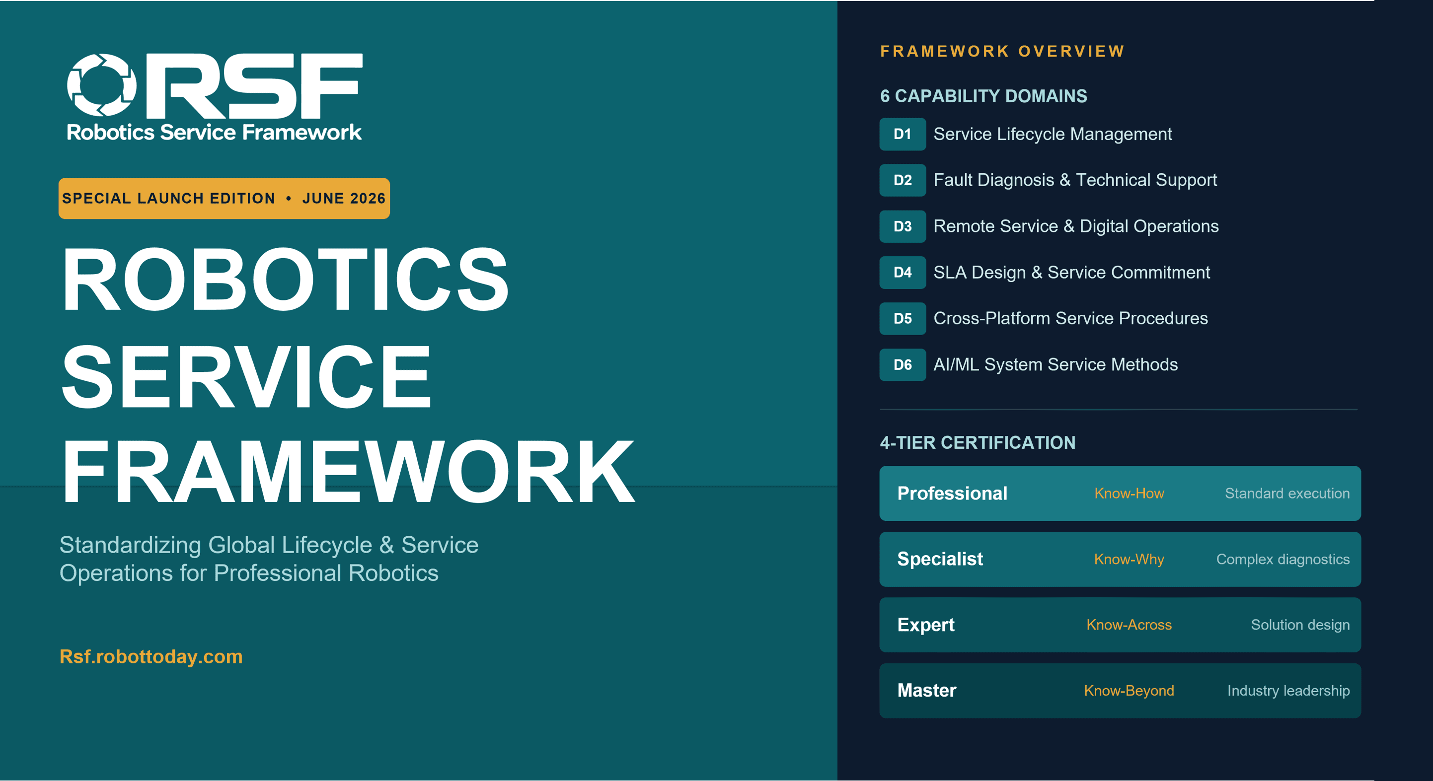
Profile Faculty Satellites Pollution Aeronautical and astronautical engineering automationRobotics needs a service framework.
RSF defines a common language for robot service capability, lifecycle operations, certification pathways, and service-provider networks.