

Industry Briefing
A single destination for timely, editor-curated robotics news from around the world.
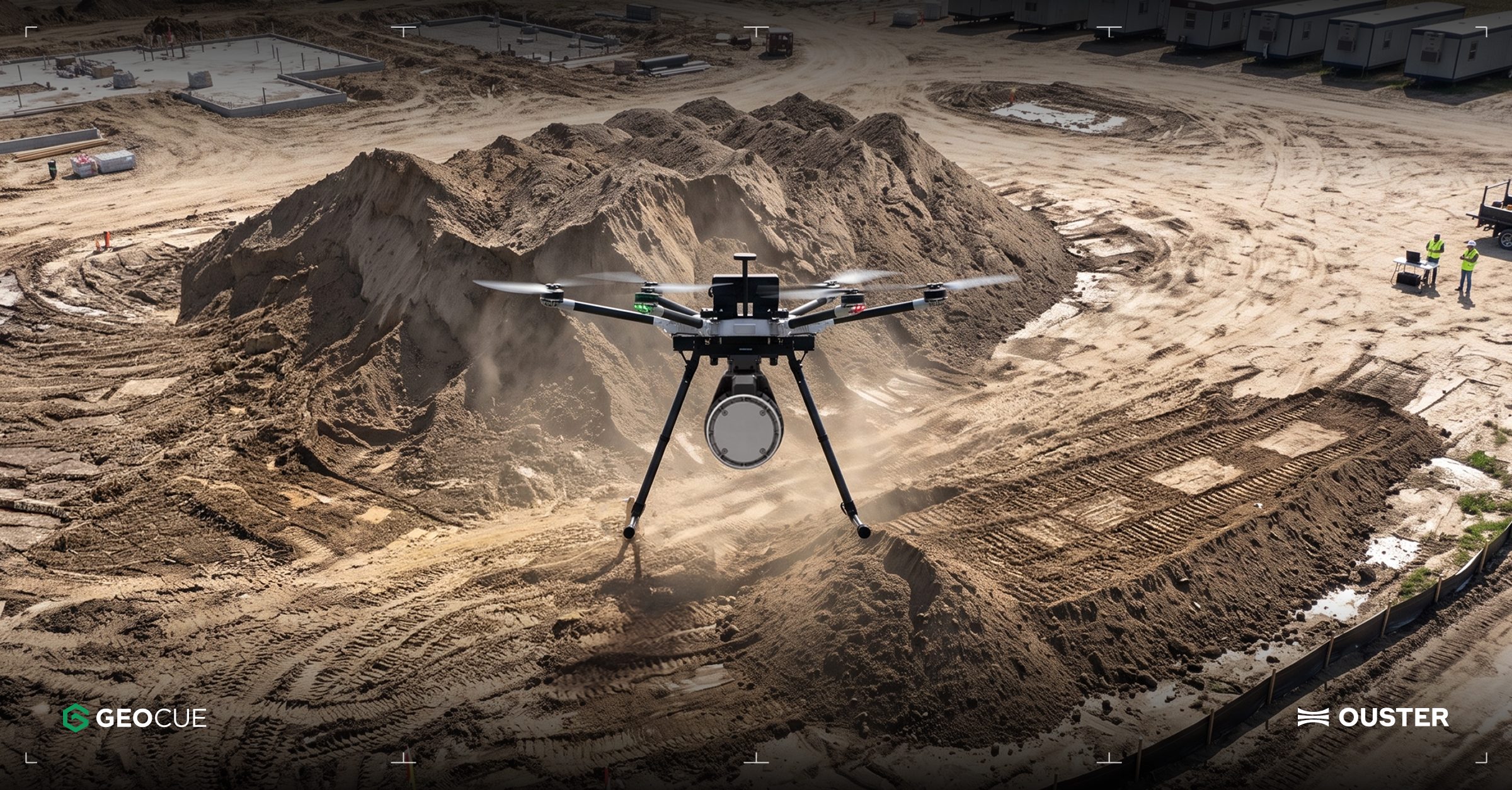
Ouster Partners with Flyability and GeoCue to Enhance Drone Mapping with Lidar Technology
Ouster has announced two significant partnerships aimed at expanding the use of lidar technology in commercial drone operations. The collaboration with Flyability focuses on integrating Ouster's lidar into the Elios 3 drone, which is designed for inspections in confined spaces like mine shafts and wastewater tunnels. Meanwhile, the partnership with GeoCue will see Ouster's Rev8 OS1 Max lidar integrated into TrueView drone mapping systems for utility surveying. These partnerships highlight the growing importance of lidar in enhancing drone capabilities, particularly in challenging environments where traditional GPS and cameras may fail. The Elios 3 drone, equipped with Ouster's compact OS0 lidar, enables real-time localization and collision avoidance, making it suitable for hazardous inspections. Ouster's CEO, Angus Pacala, emphasized the operational value of digital lidar in environments that conventional systems cannot easily access. Looking ahead, Flyability is evaluating Ouster's Rev8 lidar technology for future applications, which promises improved range, resolution, and color data. The companies plan to showcase their advancements at INTERGEO 2026 in Munich, Germany, from September 15-17, demonstrating how lidar is transforming the documentation of complex industrial environments.
Applications Drone News Drone News Feeds Inspection LiDAR News
Ouster Expands into Drone Mapping and Autonomous Vehicles with Physical AI Technology
Ouster is advancing its technology that enables machines to perceive and navigate their environments, contributing to the growth of physical AI. The company is entering the drone mapping sector through a collaboration with GeoCue, while John Deere is integrating Ouster sensors into its GUSS autonomous vehicles. This expansion is significant as it highlights the increasing demand for physical AI solutions across various industries. Ouster's CEO, Angus Pacala, emphasized the company's commitment to exploring new markets and addressing the evolving needs for advanced sensing technologies in automation. Looking ahead, industry stakeholders should monitor Ouster's developments in drone mapping and its partnership with John Deere. No further timeline was disclosed at the time of publication.

China Achieves 3D Mapping of Typhoon Noul Using Drone Swarm Technology
China has successfully created a three-dimensional map of Typhoon Noul from its inception to its conclusion using a swarm of drones. This innovative approach marks a significant advancement in meteorological technology, showcasing the capabilities of drone swarms in real-time environmental monitoring. The development is crucial as it enhances the accuracy of weather predictions and disaster response strategies, potentially saving lives and resources during severe weather events. By employing drone technology, China demonstrates its commitment to leveraging advanced tools for better understanding and managing natural disasters. Looking ahead, the implications of this technology could extend beyond meteorology, influencing various sectors that rely on real-time data collection and analysis. No further timeline was disclosed at the time of publication.
AI and RoboticsRobotics needs a service framework.
RSF defines a common language for robot service capability, lifecycle operations, certification pathways, and service-provider networks.
Join the RobotToday community on LinkedIn
Daily robotics news, in-depth analysis, conference highlights, and discussions with professionals worldwide.







