Industry Briefing
A single destination for timely, editor-curated robotics news from around the world.
SkyeBrowse Introduces Flexible Per-Model Pricing for 3D Drone Mapping Solutions
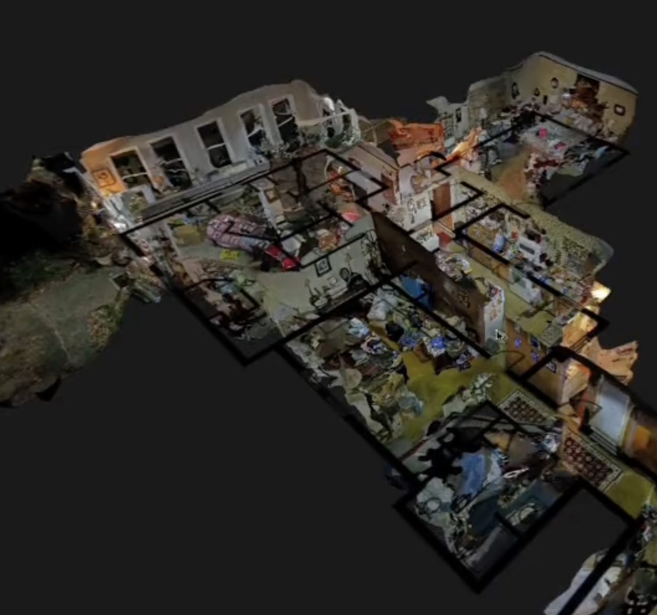
SkyeBrowse has launched a new pricing structure aimed at enhancing flexibility for 3D drone mapping among commercial users, public safety agencies, and larger organizations. The new model features three plans: Commercial at $24.99 per model, Pro at $49.99 per model, and Public Safety & Enterprise at $199 per model per year, allowing customers to pay based on finished models rather than monthly subscriptions. This pricing strategy is significant as it lowers the barrier for smaller operators to access advanced 3D mapping capabilities without the need for an enterprise subscription. The plans offer varying features, including different processing qualities, storage periods, and tools tailored to specific user needs, reflecting SkyeBrowse's commitment to simplifying drone program scalability. Looking ahead, SkyeBrowse aims to continue enhancing user experience by focusing on simplicity and efficiency in drone operations. New features such as the Import Custom 3D Model tool and Case Gallery are designed to improve functionality for users, particularly in public safety applications. No further timeline was disclosed at the time of publication.
Applications Drone News Drone News Feeds Mapping News 3D drone mapping
China Achieves 3D Mapping of Typhoon Noul Using Drone Swarm Technology
China has successfully created a three-dimensional map of Typhoon Noul from its inception to its conclusion using a swarm of drones. This innovative approach marks a significant advancement in meteorological technology, showcasing the capabilities of drone swarms in real-time environmental monitoring. The development is crucial as it enhances the accuracy of weather predictions and disaster response strategies, potentially saving lives and resources during severe weather events. By employing drone technology, China demonstrates its commitment to leveraging advanced tools for better understanding and managing natural disasters. Looking ahead, the implications of this technology could extend beyond meteorology, influencing various sectors that rely on real-time data collection and analysis. No further timeline was disclosed at the time of publication.
AI and Robotics
DJI Terra 5.3.0 Update Introduces AI, Thermal Mapping, and 3D Enhancements
DJI has launched a major update to its Terra mapping software, introducing features such as thermal mapping, video-based reconstruction, and an AI assistant. This update aims to enhance the efficiency of creating maps, 3D models, and inspection reports from drone imagery, making it easier for users to analyze data. The significance of this update lies in its ability to streamline workflows for various industries, including solar inspections and firefighting. The new thermal infrared reconstruction allows users to generate 2D thermal maps that integrate visible-light imagery with thermal data, simplifying post-flight analysis by providing comprehensive visual and thermal information. Looking ahead, the integration of video file support for visible-light projects and Rolling Shutter reconstruction will further enhance the capabilities of DJI Terra. No further timeline was disclosed at the time of publication.
News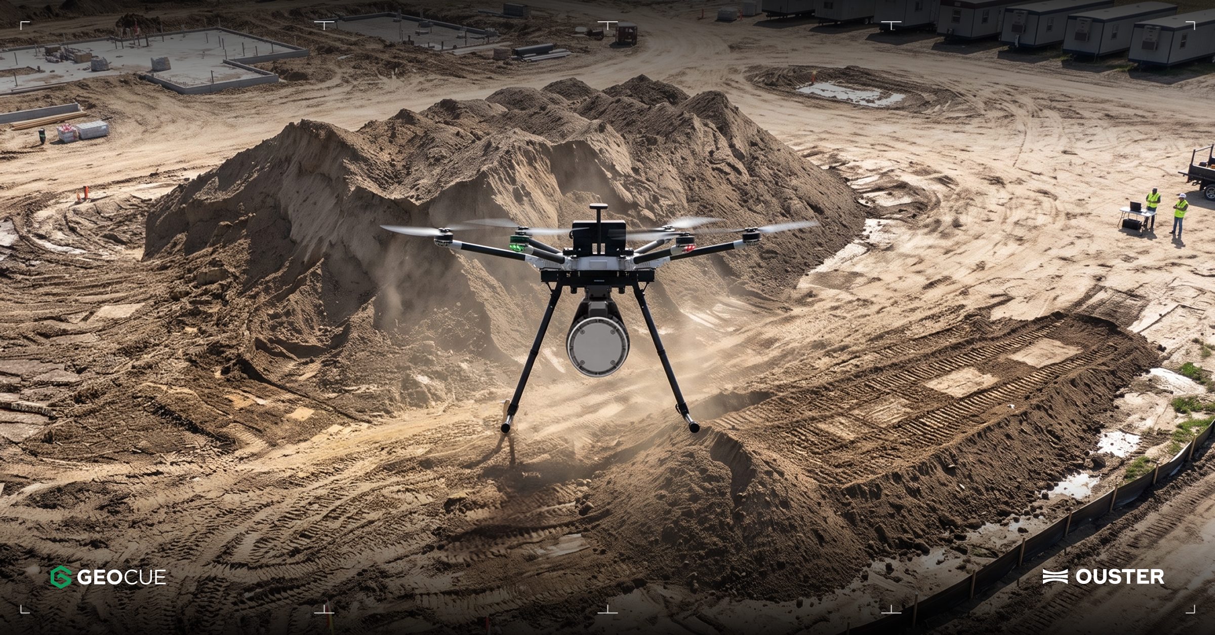
Ouster Partners with Flyability and GeoCue to Enhance Drone Mapping with Lidar Technology
Ouster has announced two significant partnerships aimed at expanding the use of lidar technology in commercial drone operations. The collaboration with Flyability focuses on integrating Ouster's lidar into the Elios 3 drone, which is designed for inspections in confined spaces like mine shafts and wastewater tunnels. Meanwhile, the partnership with GeoCue will see Ouster's Rev8 OS1 Max lidar integrated into TrueView drone mapping systems for utility surveying. These partnerships highlight the growing importance of lidar in enhancing drone capabilities, particularly in challenging environments where traditional GPS and cameras may fail. The Elios 3 drone, equipped with Ouster's compact OS0 lidar, enables real-time localization and collision avoidance, making it suitable for hazardous inspections. Ouster's CEO, Angus Pacala, emphasized the operational value of digital lidar in environments that conventional systems cannot easily access. Looking ahead, Flyability is evaluating Ouster's Rev8 lidar technology for future applications, which promises improved range, resolution, and color data. The companies plan to showcase their advancements at INTERGEO 2026 in Munich, Germany, from September 15-17, demonstrating how lidar is transforming the documentation of complex industrial environments.
Applications Drone News Drone News Feeds Inspection LiDAR News
Japan Accelerates Production of 3D-Printed Interceptor Drones to Mitigate Supply Chain Risks
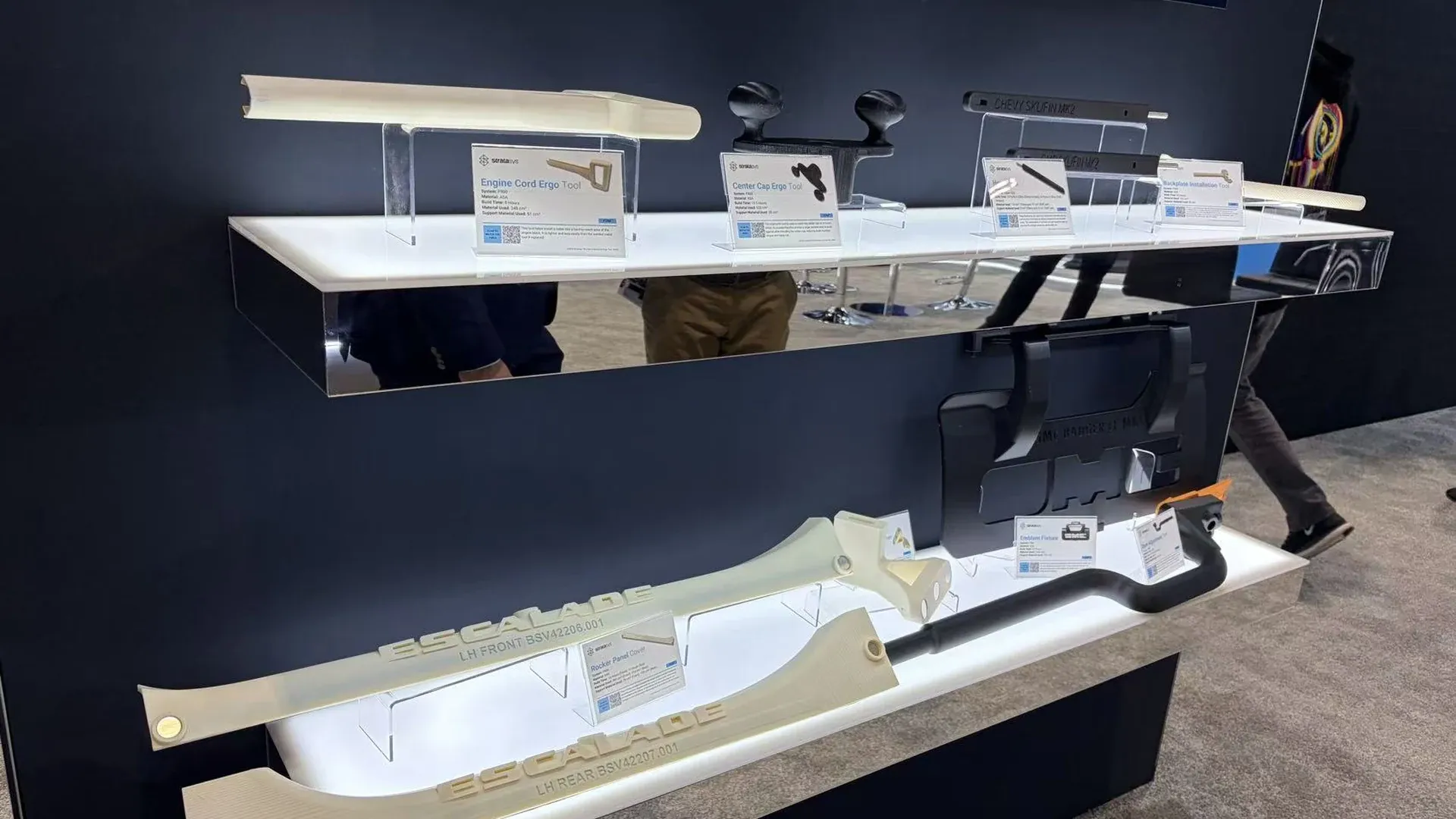
Japan is fast-tracking the production of 3D-printed interceptor drones to enhance its defense capabilities against potential supply chain attacks. This initiative underscores the importance of advanced manufacturing technologies in military applications, particularly in ensuring rapid availability of critical components. The move is significant as it reflects Japan's commitment to strengthening its defense infrastructure amid rising global tensions. By leveraging 3D printing, Japan aims to create a more resilient supply chain for military hardware, which is crucial for maintaining operational readiness in the face of evolving threats. Looking ahead, the focus will be on the successful implementation of these 3D-printed drones within Japan's defense strategy. No further timeline was disclosed at the time of publication.
Military
SimActive's Correlator3D Facilitates Extensive Green Hydrogen Mapping in Southern Chile
SimActive's Correlator3D photogrammetry software has been instrumental in a large-scale mapping initiative for green hydrogen development in southern Chile. Geo4D, a Chilean geospatial firm, utilized the software to process high-resolution aerial imagery over an area exceeding 100,000 hectares, producing essential geospatial products like orthomosaics and digital terrain models. This project underscores the challenges of large-area aerial mapping, particularly in remote regions like Patagonia, where adverse weather conditions hinder data collection. SimActive's Correlator3D proved vital in processing Phase One imagery, enabling Geo4D to deliver accurate mapping products despite difficult image-matching conditions, as highlighted by Geo4D's CEO, Francisco Ramos. Looking ahead, the advancements in Correlator3D, including improved processing capacity and workflow efficiency, will be crucial for future projects. The software's capabilities in handling high-resolution imagery from various platforms, including drones and crewed aircraft, position it as a key tool for geospatial applications in energy and infrastructure sectors.
Applications Canada Drone News Featured - Surveying Mapping News
Florida Firm Haddy Utilizes Robotic Arms for 3D Printed TF-179 Drone Boat Production
Haddy, a Florida-based manufacturing company, has successfully produced the TF-179 Drone Boat using large-format robotic 3D printing. This innovative approach highlights the integration of additive manufacturing into maritime and defense sectors, allowing for faster production and more complex designs compared to traditional methods. The significance of this development lies in the evolving landscape of maritime manufacturing, where digital production technologies enable the rapid creation and modification of specialized vessels. Haddy's use of industrial robotic arms not only enhances production efficiency but also shortens development cycles, which is crucial for adapting to the dynamic requirements of unmanned maritime systems. Looking ahead, Haddy's advancements in robotic manufacturing indicate a growing demand for specialized maritime platforms within the US defense sector. As the company continues to refine its capabilities, the focus will likely remain on producing unmanned vessels that meet the changing operational needs of defense applications. No further timeline was disclosed at the time of publication.
Innovation
Firestorm Labs 3D-prints Over 1,000 Parts and Assembles 12 Drones on USS Essex
Firestorm Labs successfully manufactured over 1,000 components and assembled 12 Squall drones aboard the USS Essex during a two-week trial. This operation took place while the US Navy warship was en route from San Diego to Hawaii for RIMPAC 2026, showcasing the potential for on-site production of military hardware during maritime missions. The significance of this trial lies in its demonstration of the xCell manufacturing platform's capabilities, which allowed for the production of drone components and repair parts despite challenging sea conditions. By reducing reliance on shore-based resupply, the operation enhances combat readiness and supports repairs directly at sea, marking a pivotal shift in military logistics. Looking ahead, the successful deployment of the xCell platform under operational conditions opens avenues for future maritime manufacturing initiatives. Firestorm Labs' ability to produce critical components on demand could revolutionize military operations, particularly in remote or hostile environments. No further timeline was disclosed at the time of publication.
Innovation Military
JOUAV Demonstrates Real-Time Drone Mapping for Landslide Response in Chongqing
On July 17, JOUAV showcased its JOS-P200 drone system in Pengshui County, Chongqing, aiding emergency responders by providing a 3D map of a landslide area. The system delivered high-resolution imagery and a detailed model within an hour, allowing command centers to assess terrain and hazards before deploying personnel. This innovation is significant as it enhances safety and efficiency in disaster response, particularly in challenging environments where traditional access is limited. The JOS-P200's ability to produce real-time maps helps incident commanders make informed decisions regarding resource allocation and risk management. Looking ahead, JOUAV's technology could revolutionize emergency response strategies, especially in larger incidents where their CW-15 VTOL UAV can cover extensive areas quickly. No further timeline was disclosed at the time of publication.
Applications Asia Disaster Response Drone News Drone News Feeds Mapping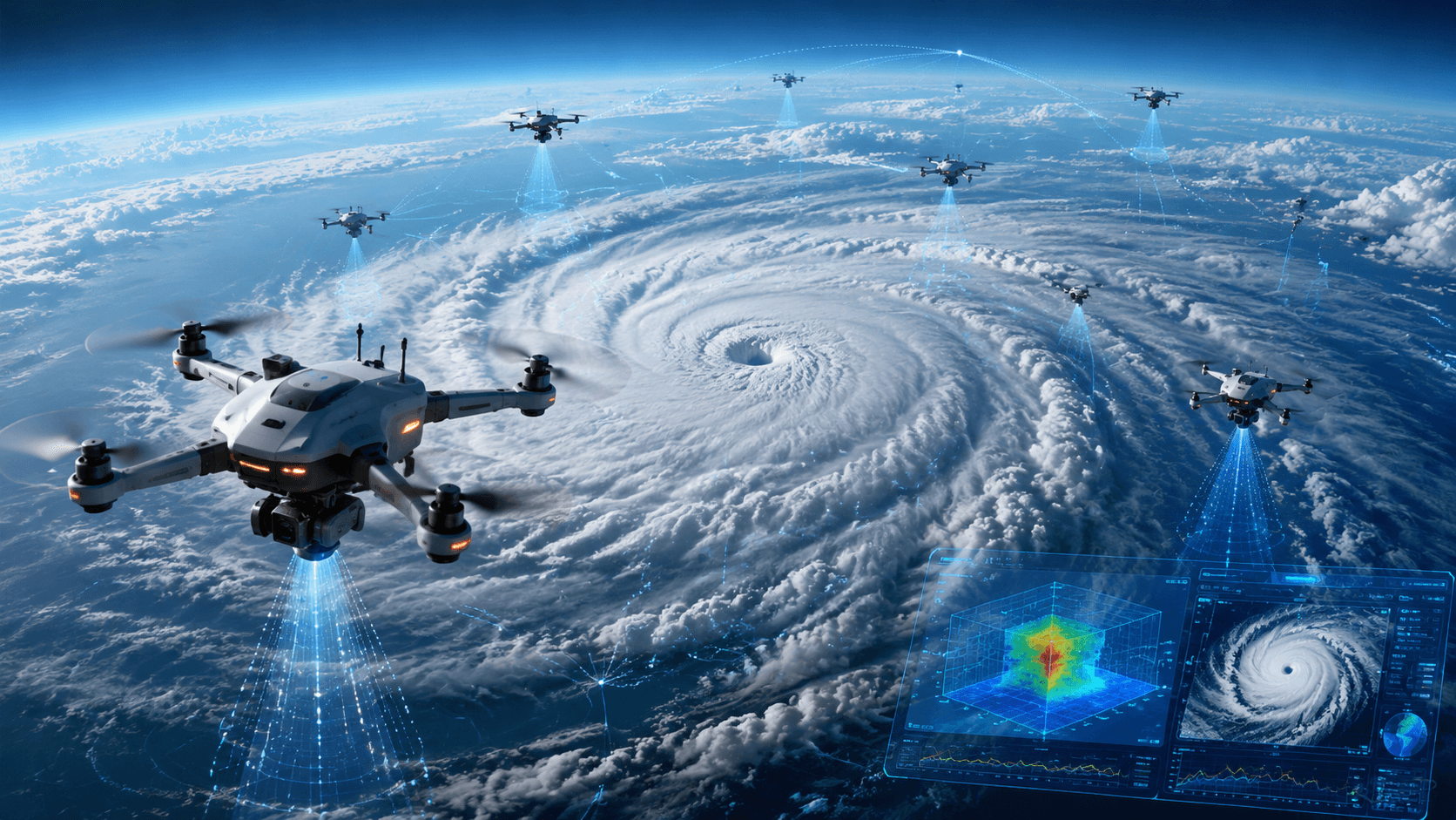
China Meteorological Administration Conducts First Full 3D Typhoon Observation Using Drone Swarm
The China Meteorological Administration has successfully utilized a bee colony drone swarm to conduct the first full-process three-dimensional observation of a typhoon. This coordinated array of unmanned aerial vehicles (UAVs) was deployed to gather critical data on temperature, humidity, wind, and turbulence during the typhoon's landfall. This achievement is significant as it enhances the understanding of typhoon dynamics and improves forecasting accuracy. By capturing data from multiple altitudes simultaneously, the drone swarm provides a comprehensive view of the typhoon's behavior, which is essential for disaster preparedness and response efforts. Looking ahead, the implications of this technology could lead to advancements in meteorological research and operational forecasting. No further timeline was disclosed at the time of publication.
Technology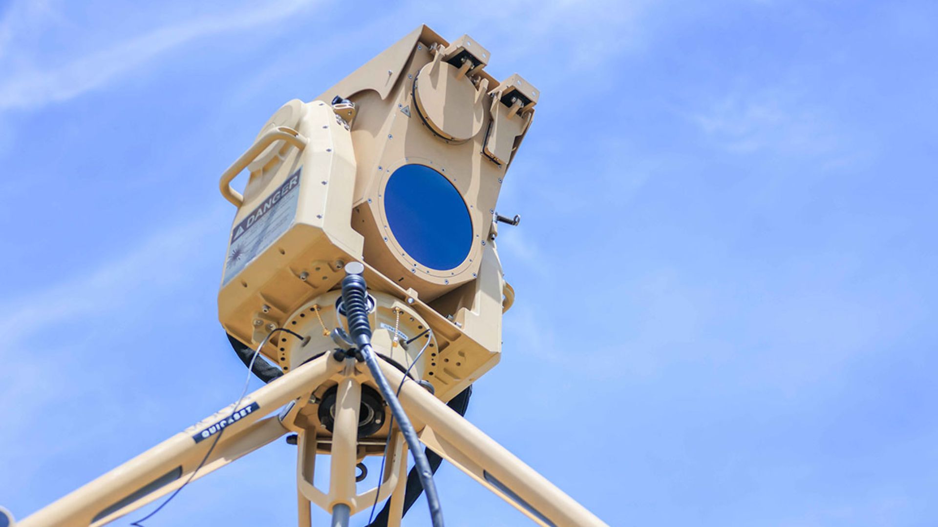
AEye and AB Swiftstrike AI Collaborate on Long-Range Lidar for Drone Detection
AEye and AB Swiftstrike AI are partnering to integrate AEye's STRATOS lidar into Swiftstrike's autonomous counter-drone systems. This collaboration aims to enhance the detection of small aerial threats that operate without conventional radio signals, extending the detection range to nearly one mile. The integration of STRATOS, which boasts more than double the resolution of AEye's Apollo lidar, is significant for identifying small drones. Higher resolution allows for better differentiation between actual aerial targets and surrounding objects, providing precise information on their position and movement. As drone technology evolves, electronic detection becomes increasingly challenging. The STRATOS sensor's ability to actively measure objects using laser pulses offers a viable solution, even when drones do not emit electronic signatures. No further timeline was disclosed at the time of publication.
Military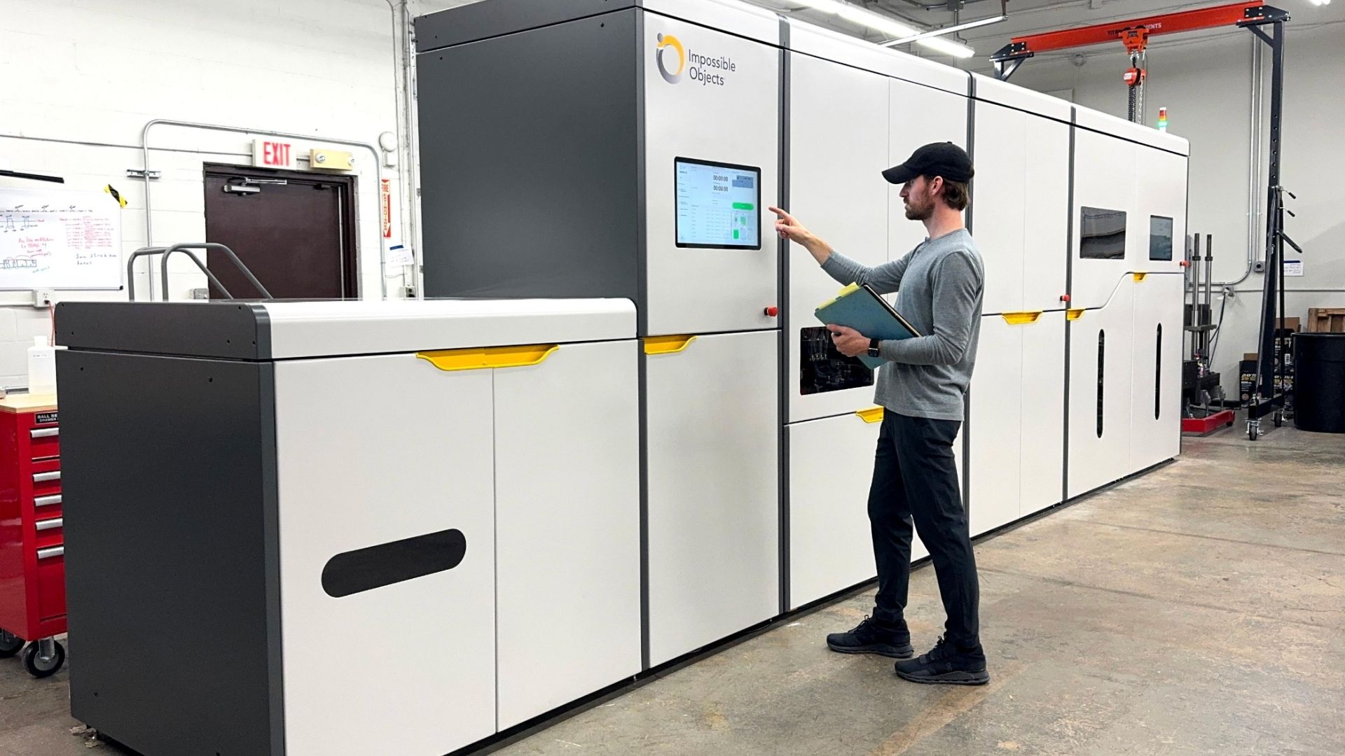
Impossible Objects Secures $40 Million for Carbon-Fiber 3D Printing Expansion
Impossible Objects, an Illinois-based manufacturing technology firm, has raised $40 million in a Series B funding round led by Inflection Equity. This investment aims to enhance the production capabilities of its Composite-Based Additive Manufacturing (CBAM) systems, particularly the CBAM 25, which specializes in carbon-fiber printing for drones and aircraft parts. The significance of this funding lies in its potential to revolutionize industrial-scale 3D printing, traditionally limited to prototyping due to slow speeds and high costs. The CBAM 25 addresses these challenges by enabling rapid production of strong, lightweight components, thereby reducing tooling requirements and lead times, making it competitive with CNC machining and injection molding. Looking ahead, Impossible Objects has already received five orders for the CBAM 25 since its introduction in early 2025. The company aims to deploy its technology across aerospace, defense, and advanced manufacturing sectors. No further timeline was disclosed at the time of publication.
Innovation
DJI Drones Enhance Safety by Mapping Everest's Khumbu Icefall in 2026
DJI's recent case study highlights the use of its Matrice 4E drone and DJI Terra software by Airlift Technology to map the Khumbu Icefall during the 2026 Everest climbing season. This innovative approach provided Sherpas with a detailed 3D map of the hazardous terrain, significantly improving safety for climbers. The Khumbu Icefall is a critical and perilous section of the Everest climbing route, known for its deep crevasses and unstable ice formations. Traditionally, Sherpas would navigate this dangerous area on foot to establish safe paths. However, the drone's ability to survey the icefall in just three and a half hours allowed for a more efficient and safer mapping process. Looking ahead, the repeated drone surveys not only enhance climber safety but also offer valuable data for scientists studying glacier dynamics. This deployment marks a significant advancement in high-altitude expedition planning, with potential implications for future climbing seasons and environmental research.
News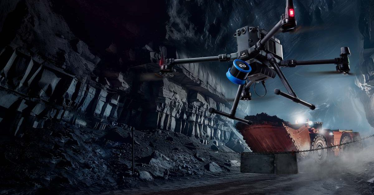
Emesent Secures $17 Million to Enhance AI-Driven Drone Operations and Expand Manufacturing
Emesent, an Australian drone mapping company, has raised $17 million to boost its AI-powered autonomous operations. This funding includes a $7 million venture debt facility from the National Reconstruction Fund Corporation and a $10 million equity round from notable investors such as Main Sequence and QIC Ventures. The investment aims to enhance the capabilities of drones in complex environments with minimal human intervention. The significance of this funding lies in Emesent's strategy to focus on software advancements alongside hardware improvements. The company plans to develop its Cortex AI autonomy software and Aura cloud platform, which will enable drones to operate in GPS-denied areas and process 3D mapping data efficiently. Emesent's existing Hovermap LiDAR payload is already utilized in over 200 mine sites globally, showcasing its established presence in the industrial drone sector. Looking ahead, Emesent intends to expand its manufacturing capabilities in Queensland while pursuing growth in international markets. CEO Charles Miller emphasized the importance of this investment in enhancing AI and autonomy for industries such as mining and defense. No further timeline was disclosed at the time of publication for the anticipated developments from this funding round.
News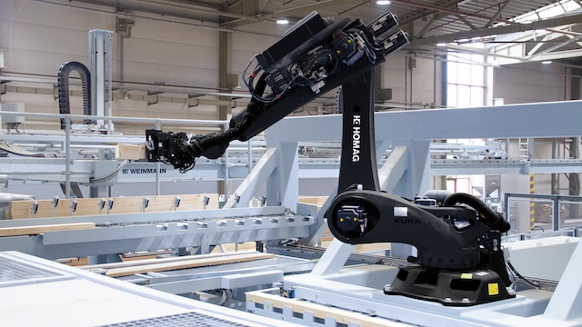
Ouster Expands into Drone Mapping and Autonomous Vehicles with Physical AI Technology
Ouster is advancing its technology that enables machines to perceive and navigate their environments, contributing to the growth of physical AI. The company is entering the drone mapping sector through a collaboration with GeoCue, while John Deere is integrating Ouster sensors into its GUSS autonomous vehicles. This expansion is significant as it highlights the increasing demand for physical AI solutions across various industries. Ouster's CEO, Angus Pacala, emphasized the company's commitment to exploring new markets and addressing the evolving needs for advanced sensing technologies in automation. Looking ahead, industry stakeholders should monitor Ouster's developments in drone mapping and its partnership with John Deere. No further timeline was disclosed at the time of publication.

Continuous Composites Secures Navy Contract for Innovative UAV Component Manufacturing
Continuous Composites has been awarded a Phase II SBIR contract by the U.S. Navy to develop composite aircraft components that integrate electrical power conductors within their structures. This innovative approach aims to reduce the reliance on traditional wiring and connectors in unmanned aerial vehicles (UAVs), transforming structural components into active elements of the aircraft's electrical system. The significance of this project lies in its potential to streamline UAV design and manufacturing. By embedding electrical functions directly into composite materials, Continuous Composites can enhance the efficiency of UAVs while minimizing the complexity associated with conventional wiring systems. The Phase II work will build on successful demonstrations from Phase I, where engineers validated the concept of multifunctional composite parts with minimal impact on structural performance. Looking ahead, the focus will be on developing higher-capacity electrical pathways that can withstand operational loads. Engineers will conduct tests to ensure that electrical conductors are properly isolated within the composite without compromising structural integrity. No further timeline was disclosed at the time of publication.
Military
3D-printed autonomous interceptor aircraft targets hostile drone swarms at 350 mph
Colorado-based SkyDefense has introduced CobraJet, an autonomous interceptor aircraft designed to stop hostile drones before...
Military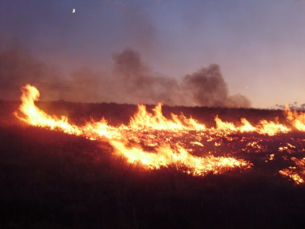
Landair Surveys Uses SimActive Correlator3D for Planned Burns Mapping in Australia
Landair Surveys, an Australian geospatial firm, is utilizing SimActive's Correlator3D software to create orthomosaics from aerial imagery. This initiative is part of their efforts in wildfire prevention and land management, specifically for planned burns mapping projects across Australia. The Montreal-based software developer announced this collaboration, highlighting that the workflow aims to enhance the efficiency of geospatial outputs. The use of advanced aerial imagery technology is expected to improve land management strategies and contribute to effective wildfire prevention measures.
Digital Twins Disaster Response Drone News Drone News Feeds Fire Firefighter
SkyeBrowse makes every photo inside a drone 3D model clickable
SkyeBrowse has announced a significant update to its drone mapping software aimed at enhancing user experience in interpreting 3D models. The update, which is now available to all users at no extra charge, focuses on improving model quality and advancing AI-generated floor plans. Additionally, the newly accessible Image Walkthroughs feature is designed to assist users in better understanding the data captured through drone technology. This update addresses a common challenge faced by users in navigating and analyzing complex 3D representations, thereby streamlining the process of extracting valuable insights from aerial imagery.
News
Australia launches first 3D-printed unmanned drone boat in Southern Hemisphere
Australia has introduced the southern hemisphere's first 3D-printed uncrewed surface vessel, marking a significant advancement in maritime technology. The vessel was unveiled recently as part of the country's efforts to enhance its naval capabilities and promote innovation in defense. This groundbreaking project took place at a facility in Australia, showcasing the nation's commitment to integrating modern technology into its maritime operations. The initiative aims to improve surveillance and reconnaissance missions while reducing costs associated with traditional shipbuilding methods. By leveraging 3D printing technology, Australia hopes to streamline the production process, allowing for quicker deployment of advanced vessels in response to emerging maritime challenges.

BM3D‐Based Optical Flow Tracking for Enhanced Visual Simultaneous Localization and Mapping Systems in Mobile Robotics
The Journal of Field Robotics has recently published an early view article highlighting advancements in robotic technology. This publication, released in October 2023, showcases innovative research that aims to enhance the capabilities of field robots in various applications, including agriculture, search and rescue, and environmental monitoring. The research is driven by the growing need for automation and efficiency in these sectors, as well as the increasing complexity of tasks that robots are expected to perform. The findings suggest that integrating advanced algorithms and machine learning techniques can significantly improve the performance and adaptability of robotic systems in real-world scenarios. This research not only contributes to the academic field but also has practical implications for industries looking to leverage robotics for improved operational efficiency and safety.
RESEARCH ARTICLE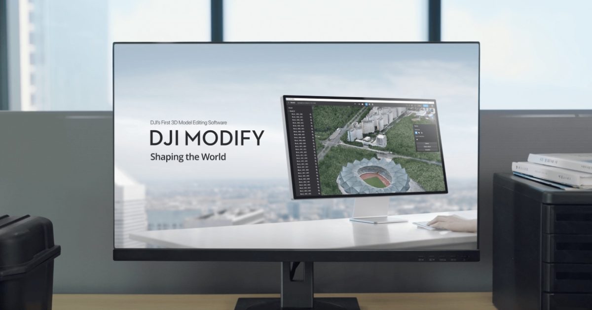
DJI Modify update makes 3D drone data easier to use
DJI has announced a significant update to its DJI Modify software, enhancing its capabilities for users involved in the creation and management of large-scale 3D models. This update, which was released recently, focuses on streamlining workflows to facilitate the processing, editing, and sharing of complex 3D data. By implementing these improvements, DJI aims to address the challenges faced by professionals in various industries who rely on precise and efficient 3D modeling. The enhancements are expected to provide users with a more intuitive experience, ultimately increasing productivity and collaboration in projects that require detailed 3D representations.
News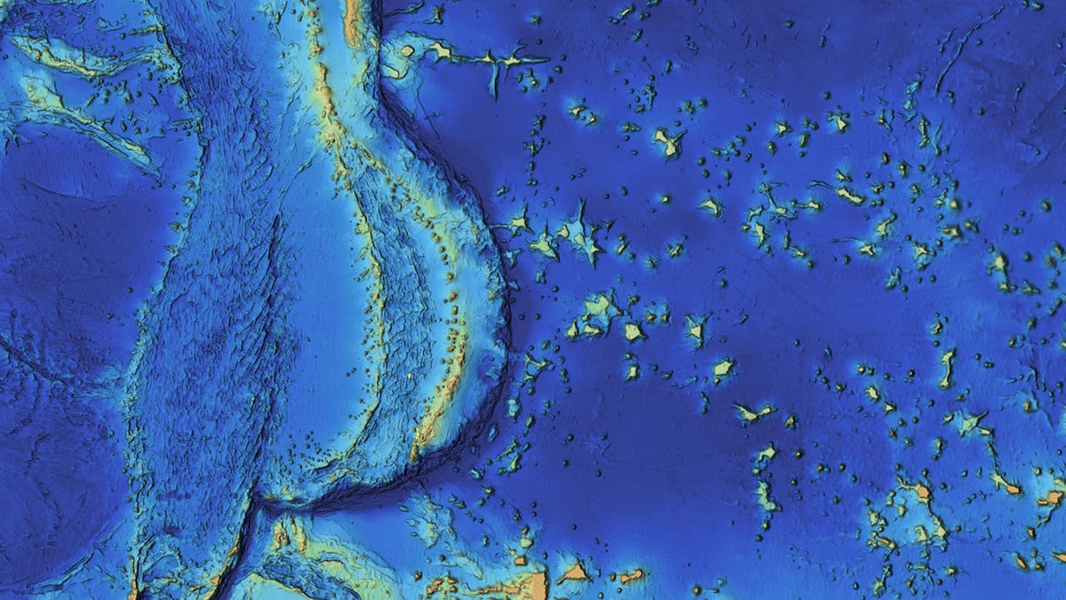
Mapping the Mariana Islands: Saildrone Partners with Woolpert to Survey Critical Maritime Region for NOAA
The Mariana Trench, home to Challenger Deep, the deepest point in the world's oceans at 10,935 meters (35,876 feet), remains one of the least explored and most geologically significant areas on Earth. This underwater marvel, located in the western Pacific Ocean, continues to intrigue scientists and researchers due to its profound depths and unique geological features. Efforts to map and study this region are crucial for understanding oceanic processes and biodiversity, as well as the effects of climate change on deep-sea ecosystems. As exploration technologies advance, researchers aim to uncover the mysteries of the trench and its surrounding islands, shedding light on the fundamental workings of our planet’s oceans.
mapping mariana islands saildrone woolpert survey noaa
3D Mobile Mapping for Digital Twins: Camera Features That Ensure Accuracy
Recent advancements in surveillance technology have transformed urban environments into rich sources of visual data, essential for creating digital twins of cities. These digital replicas rely heavily on high-quality imagery captured by cameras installed in various public spaces, including streets and buildings. However, experts warn that if the visual data collected is inadequate or flawed, the integrity and functionality of the entire digital model can be compromised. This reliance on precise imagery underscores the importance of maintaining and upgrading surveillance systems to ensure accurate representations of urban landscapes. As cities increasingly adopt these technologies, the challenge remains to balance effective data collection with privacy concerns, prompting ongoing discussions among policymakers and technology developers.

Automated Multispectral Terrain Mapping Using Drones and Robotics
Recent advancements in drone technology have significantly enhanced the use of multispectral data, which is increasingly recognized for its role in informing scientific and operational decision-making. Unlike traditional aerial and satellite imaging, drone-based multispectral surveys offer superior detail, flexibility in timing, and improved accuracy. This innovative approach allows researchers and organizations to gather measurable insights more efficiently, ultimately leading to better-informed decisions across various fields. The growing reliance on drone technology for data collection underscores the importance of accurate and timely information in addressing complex challenges.

Saildrone Completes Pioneering Mapping Mission of Cayman Islands’ EEZ
Saildrone, a leader in autonomous deep-water mapping, has successfully completed a mission to map the exclusive economic zone of the Cayman Islands. Over approximately 300 days, the company utilized its Saildrone Surveyor uncrewed surface vehicle to survey around 90,000 square kilometers of seabed, reaching depths of up to 7,000 meters. The mission included over 900 sound-velocity profile casts to ensure the accuracy of the bathymetric data collected. A key focus of the survey was on four significant fishing banks—60 Mile Bank, Lawfords Bank, Pickle Bank, and 12 Mile Bank—which are vital for biodiversity and support local fisheries, tourism, and recreational activities. These areas also serve as indicators of the overall health of the Cayman Islands' marine ecosystem. The successful completion of this mapping mission is expected to enhance understanding and management of the region's marine resources.
saildrone pioneering mapping missionRobotics needs a service framework.
RSF defines a common language for robot service capability, lifecycle operations, certification pathways, and service-provider networks.
Join the RobotToday community on LinkedIn
Daily robotics news, in-depth analysis, conference highlights, and discussions with professionals worldwide.