

Industry Briefing
A single destination for timely, editor-curated robotics news from around the world.
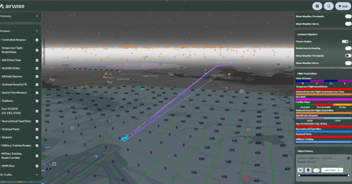
uAvionix and Airwise Solutions Integrate Real-Time Aircraft Tracking into Drone Platform
uAvionix and Airwise Solutions have partnered to enhance drone operations by integrating uAvionix's FlightLine surveillance service into the Airwise drone platform. This collaboration aims to improve safety in shared airspace by providing real-time visibility of cooperative aircraft, which is crucial for Beyond Visual Line of Sight (BVLOS) operations. The integration of FlightLine into Airwise's enterprise platform allows drone operators to access reliable airspace traffic data without the need for additional infrastructure. This development is significant as it supports safer and more scalable drone operations, particularly in complex environments where situational awareness is essential. As the demand for BVLOS operations grows, the partnership is expected to facilitate the deployment of Uncrewed Traffic Management (UTM) capabilities more efficiently. No further timeline was disclosed at the time of publication.
News
New 5G-Based System Enables Real-Time Drone Tracking Using Existing Infrastructure
The United States is testing an innovative method to detect drones by utilizing its existing 5G networks. Lockheed Martin, along with its partners, showcased this technology near Miami in July, demonstrating how commercial wireless infrastructure can effectively support drone detection in busy environments. The system, named NetSense Airspace Awareness-as-a-Service, analyzes radio-frequency disturbances to identify and track unmanned aircraft. This development is significant as it provides airports, hospitals, power plants, and government facilities with an additional layer of airspace protection. The technology not only helps monitor drone activity around sensitive locations but also leverages existing cellular networks, making large-scale deployment more feasible for infrastructure operators. The collaboration of Verizon, ODC, NVIDIA, and Keysight Technologies highlights the potential of integrating various commercial technologies to enhance drone detection capabilities. Looking ahead, the open architecture of the NetSense system allows for future expansions as new technologies emerge. During the Miami demonstration, the system successfully detected a drone and maintained tracking custody, underscoring its effectiveness as the prevalence of drones in populated areas continues to rise. No further timeline was disclosed at the time of publication.
Innovation
BRINC Enhances LiveOps with Wildfire and Smoke Tracking Features for Drones
BRINC has introduced wildfire and smoke tracking capabilities to its LiveOps platform, enhancing support for public safety agencies during fire responses. Announced on August 10, the new features include two map layers that display active fire detections and current smoke conditions, available to all customers at no extra cost since August 7. This integration utilizes data from the National Oceanic and Atmospheric Administration (NOAA). The addition of these features is significant as it provides responders with a comprehensive operational overview without the need to switch between different systems. Fire departments and emergency managers can utilize this information to coordinate wildfire responses effectively, while law enforcement can monitor smoke conditions that may hinder visibility in affected areas. BRINC's CEO, Blake Resnick, emphasized the importance of streamlining information access for agencies stretched thin during wildfire incidents. Looking ahead, BRINC continues to focus on integrating various public safety data sources into its LiveOps platform. The company has previously responded to customer feedback by incorporating features like live traffic information from Google Maps. No further timeline was disclosed at the time of publication.
Applications Drone News Drone News Feeds emergency response Featured – Safety and Security Fire and Police
New Underwater Drone Technology Promises Enhanced Stealth and Tracking Challenges
Recent advancements in military technology have led to the development of a missile-armed underwater drone that is expected to be quieter and harder to track than traditional submarines. This innovation aims to enhance naval capabilities and improve operational effectiveness in various combat scenarios. The significance of this underwater drone lies in its potential to revolutionize naval warfare by providing a stealthier alternative to submarines. With the ability to operate undetected, this drone could change the dynamics of maritime defense and offense, making it a critical asset for military forces. Looking ahead, the integration of such advanced technologies into military operations will be crucial. Continuous improvements in stealth technology and autonomous systems will likely shape future naval engagements. No further timeline was disclosed at the time of publication.
Military
BRINC Enhances LiveOps with Real-Time Wildfire and Smoke Tracking Features
BRINC has introduced two new map layers to its LiveOps platform, providing real-time wildfire and smoke tracking for public safety agencies. Launched on August 7, this feature allows users to access critical information without switching applications, streamlining operations during wildfire responses. The integration of fire detection and smoke condition data from the National Oceanic and Atmospheric Administration (NOAA) aims to enhance situational awareness for fire departments and emergency managers. By displaying this information directly on the existing drone operations map, BRINC facilitates quicker decision-making in challenging conditions, particularly when visibility is compromised. As wildfire response becomes increasingly complex, BRINC's initiative reflects a broader trend towards consolidating operational data. The company aims to transform LiveOps into a comprehensive operational tool, integrating various data sources to support over 1,000 public safety agencies and 20% of US SWAT teams. No further timeline was disclosed at the time of publication.
News
U.S. Air Force Enhances $500M Counter-Drone Shield with New Multi-Sensor Technology
The U.S. Air Force is enhancing its counter-drone capabilities by integrating Teledyne FLIR Defense’s Argus XL platform into AeroVironment’s Titan Multi-Sensor system. This initiative is part of a three-year, $500 million contract under the Domestic Shield Program, aimed at protecting military installations from aerial threats. This expansion is significant as it strengthens the layered counter-unmanned aircraft system (UAS) coverage across domestic sites, addressing the growing concern of small unmanned aircraft that pose risks to sensitive locations. The Argus XL platform enhances detection and tracking capabilities, allowing operators to respond more effectively to potential threats. Looking ahead, the integration of Argus XL is expected to improve operational efficiency and situational awareness for military users. The system's ability to incorporate third-party sensors and adapt to emerging threats will be crucial as drone technology continues to evolve. No further timeline was disclosed at the time of publication.
Military
U.S. Navy Exercise Demonstrates Sonar Network Tracking for Various UUVs
The U.S. Navy's Exercise Lanternfish 26 showcased the capabilities of ThayerMahan's ShorePicket and Outpost systems in detecting unmanned underwater vehicles (UUVs). These systems successfully tracked UUVs ranging from six inches to extra-large sizes, highlighting the importance of distributed acoustic sensors in maritime security. This exercise, involving U.S., British, and Australian personnel, aimed to evaluate emerging undersea technologies in realistic environments. With 50 technologies from 26 industry partners, the event focused on enhancing interoperability under AUKUS Pillar II, emphasizing the need for effective detection methods in the challenging underwater environment. Looking ahead, the integration of ThayerMahan's TransparenSea software with acoustic data processing and AI-assisted analysis will be crucial for real-time maritime situational awareness. No further timeline was disclosed at the time of publication.
Military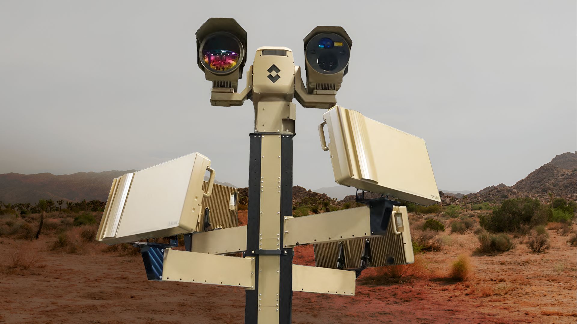
$80.5M US military deal expands Titan-MS system tracking 500+ drone threats at once
The U.S. military has selected the Titan-MS counter-drone system under an $80.5 million award to...
MilitaryRobotics needs a service framework.
RSF defines a common language for robot service capability, lifecycle operations, certification pathways, and service-provider networks.
Join the RobotToday community on LinkedIn
Daily robotics news, in-depth analysis, conference highlights, and discussions with professionals worldwide.







