

Industry Briefing
A single destination for timely, editor-curated robotics news from around the world.

DJI Reveals Winners of the 2026 Enterprise Drone Onboard AI Challenge
DJI has announced the winners of the DJI Enterprise Drone Onboard AI Challenge 2026, which aimed to enhance aerial intelligence. The challenge, launched in early 2026, focused on transforming data collection into actionable insights across various sectors, including agriculture and public safety. This initiative is significant as it seeks to bridge the gap between data acquisition and practical application, fostering innovation in aerial intelligence. The competition featured submissions evaluated by ten experts from the AI and drone industries, culminating in the recognition of five Best Onboard AI Model Award winners and ten Industry Application Excellence Award winners. Looking ahead, the impact of these winning solutions on industries such as transportation and environmental protection will be crucial. No further timeline was disclosed at the time of publication.

Scaling Drone Programs: The Importance of Simplicity for Success
Organizations are finding that the true challenge of drone programs arises after initial success. As demand for drone data increases, the reliance on a few trained experts can hinder scalability. This issue is prevalent in various sectors, including public safety and construction, where the need for accessible technology becomes critical. Bobby Ouyang, CEO of SkyeBrowse, emphasizes that organizations often possess capable personnel and equipment but struggle to produce results that are easily usable by all. The complexity of capture planning and data processing can create bottlenecks, especially when only a few individuals are familiar with the necessary software. This reliance on specialists can stifle growth and efficiency. Looking ahead, organizations must consider how to simplify their drone operations to accommodate a larger user base. Ouyang notes that as the number of users increases, so does the potential for confusion and inconsistent results. No further timeline was disclosed at the time of publication.
Applications DFR DL Exclusive Drone News Drone News Feeds emergency response
DJI FlightHub 2 On-Premises Receives Significant Upgrade for Enterprise Drone Operations
DJI has launched a major update to its FlightHub 2 On-Premises software, version 1.7, aimed at enhancing enterprise drone operations. This self-hosted platform allows organizations to manage their drone data securely on their own servers, addressing the growing demand for data sovereignty and cybersecurity among government and utility sectors. The update focuses on improving livestream performance, simplifying software deployments, and providing deeper integration options for developers. With the introduction of multi-core livestream processing, organizations can now support up to three times the concurrent livestream capacity, which is crucial for operations involving multiple drones transmitting data simultaneously. As enterprises increasingly rely on automated drone missions, the enhancements in version 1.7 are expected to significantly reduce downtime and streamline large-scale deployments. No further timeline was disclosed at the time of publication.
News
FlybyOps Introduces New Platform for Scaling BVLOS and Autonomous Drone Operations
FlybyOps has unveiled an enterprise drone operations platform tailored for large-scale Beyond Visual Line of Sight (BVLOS) and autonomous drone initiatives. This Finland-based company aims to tackle the complexities faced by commercial drone operators as they expand their fleets, requiring effective management of flights, locations, aircraft, and personnel while ensuring regulatory compliance. The significance of this platform lies in its ability to centralize management of flight operations, personnel qualifications, and compliance requirements, thereby enhancing operational control. With features such as role-based access, configurable workflows, and structured compliance processes, FlybyOps is designed to support organizations transitioning to more frequent and autonomous BVLOS flights, creating an auditable record of operations. As the drone industry gears up for larger fleets and increased autonomy, FlybyOps is positioned to facilitate this evolution. The platform is already being utilized globally for BVLOS operations, with potential applications in logistics and infrastructure. No further timeline was disclosed at the time of publication.
Applications Drone News Drone News Feeds News autonomous drones BVLOS
Royal Air Force Launches Storm Chrome and Storm Fire Drone Programs
The Royal Air Force has announced plans to develop two new drones: Storm Chrome, an electronic warfare drone, and Storm Fire, a long-range, one-way attack drone. This initiative was revealed by Air Chief Marshal Harv Smyth, highlighting the RAF's commitment to advancing its drone capabilities. The introduction of Storm Chrome and Storm Fire is significant as it reflects the increasing importance of drone technology in modern warfare. These developments aim to enhance the RAF's operational effectiveness and adaptability in electronic warfare and attack scenarios, ensuring that the UK remains at the forefront of military innovation. Looking ahead, the Royal Air Force's focus on these drone programs indicates a strategic shift towards integrating advanced unmanned systems into their operations. No further timeline was disclosed at the time of publication.
Air Warfare Air Force collaborative combat aircraft Defence Investment Plan Drones Europe
Drone as First Responder Programs Transform Police Situational Awareness and Response
Drone as First Responder (DFR) programs are revolutionizing how law enforcement agencies collect information and respond to emergencies. Former police chief Mike Moulton emphasizes that DFR represents a significant advancement in police situational awareness, akin to the introduction of the police radio. DFR allows for real-time aerial insights, enabling officers to arrive at scenes with a clearer understanding of the situation. The importance of DFR lies in its ability to enhance situational awareness and improve response outcomes. Unlike traditional methods that rely on limited information from callers, DFR provides live video feeds, allowing officers to assess situations more accurately before arriving on the scene. This capability has led to a reduction in unnecessary officer deployments, as evidenced by the Chula Vista model, which has resolved a quarter of its drone missions without dispatching officers. Looking ahead, the continued adoption of DFR programs will likely reshape police operations, particularly for agencies that previously lacked access to aerial support. However, challenges remain, such as operational limitations in terms of launch radius and weather conditions. No further timeline was disclosed at the time of publication.
Applications Drone News Drone News Feeds emergency response Featured – Safety and Security News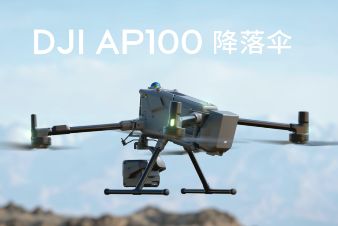
DJI launches AP100 parachute system for Matrice 400 enterprise drone
DJI has introduced the DJI AP100 Parachute, marking its first parachute system tailored for enterprise drone applications. Launched on Wednesday, this new safety feature is specifically designed for the Matrice 400 drone and is priced at 7,488 yuan (approximately $1,100). The AP100, which weighs around 935 grams and boasts an IP55 protection rating, is currently available exclusively through authorized distributors. This development aims to enhance safety measures for drone operations, providing an additional layer of security for users in various industries.
News Feed
AirData UAV and LeoSight Bring Live Drone Data for DFR Programs
LeoSight has announced a new integration with AirData UAV that enables real-time streaming of flight data, telemetry, and operational insights directly into its command software, LeoCommand. This integration aims to enhance collaboration between dispatchers and field teams by providing shared visibility across drone and DFR (Drone First Response) operations. The partnership leverages AirData's status as one of the most widely used platforms in commercial drone operations, allowing public safety agencies to improve their operational efficiency. The integration is expected to streamline communication and data sharing, ultimately enhancing response capabilities in critical situations.
Disaster Response drone fleets Drone News Drone News Feeds emergency response Fire and Police
As Drone as First Responder Programs Scale, Data Management Becomes Mission Critical
A California fire district is facing significant challenges as it expands its public safety drone program, particularly in transforming flight data into actionable intelligence. As agencies increasingly incorporate drones into their operations, the focus has shifted from merely launching aircraft to effectively managing larger fleets and handling increased volumes of data. This evolution necessitates more sophisticated operational strategies to ensure that the drones can be utilized effectively in emergency situations. The growing complexity of these programs underscores the critical importance of data management in enhancing public safety efforts.
Applications Drone News Drone News Feeds Drones in the News Featured – Safety and Security News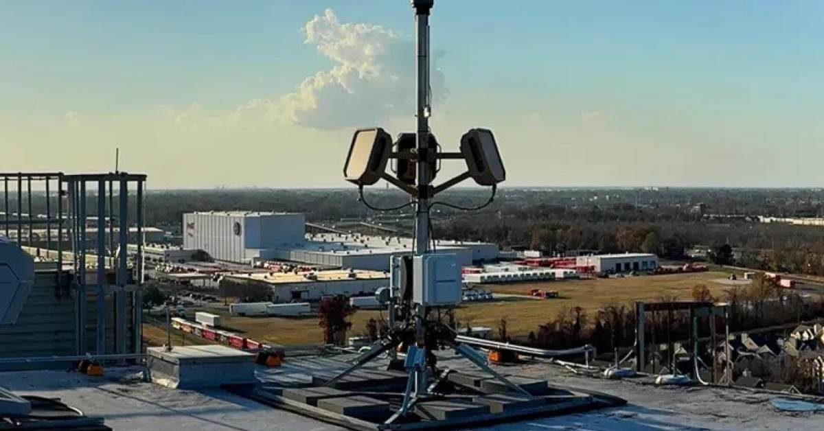
Radar tech could help scale police drone programs faster
As police departments throughout the United States enhance their drone programs, they are facing a growing challenge related to congested low-altitude airspace. The proliferation of both authorized emergency-response drones and unauthorized aircraft operating near critical sites has heightened the need for law enforcement agencies to improve their situational awareness of aerial activities. This development comes as agencies seek to leverage drone technology for various operational purposes, including surveillance and emergency response, while navigating the complexities of airspace management. The increasing demand for drone usage underscores the urgency for effective solutions to monitor and regulate the crowded skies, ensuring safety and security in urban environments.
News
AirData and BRINC Integration Brings Automated Flight Records to Public Safety Drone Programs
AirData has launched a new integration with BRINC to enhance the management of drone flight data for public safety agencies. This collaboration enables automatic capture and organization of flight records from BRINC’s Lemur 2 and Responder drones within the AirData platform. By streamlining this process, the integration aims to reduce the reliance on manual data entry, thereby supporting scalable and auditable drone operations. This development is expected to significantly improve the efficiency of drone programs used in public safety, allowing agencies to focus more on their core missions.
Drone News Drone News Feeds Drones in the News Featured – Safety and Security News AirDataRobotics needs a service framework.
RSF defines a common language for robot service capability, lifecycle operations, certification pathways, and service-provider networks.
Join the RobotToday community on LinkedIn
Daily robotics news, in-depth analysis, conference highlights, and discussions with professionals worldwide.







