Industry Briefing
A single destination for timely, editor-curated robotics news from around the world.

SimActive's Correlator3D Facilitates Extensive Green Hydrogen Mapping in Southern Chile
SimActive's Correlator3D photogrammetry software has been instrumental in a large-scale mapping initiative for green hydrogen development in southern Chile. Geo4D, a Chilean geospatial firm, utilized the software to process high-resolution aerial imagery over an area exceeding 100,000 hectares, producing essential geospatial products like orthomosaics and digital terrain models. This project underscores the challenges of large-area aerial mapping, particularly in remote regions like Patagonia, where adverse weather conditions hinder data collection. SimActive's Correlator3D proved vital in processing Phase One imagery, enabling Geo4D to deliver accurate mapping products despite difficult image-matching conditions, as highlighted by Geo4D's CEO, Francisco Ramos. Looking ahead, the advancements in Correlator3D, including improved processing capacity and workflow efficiency, will be crucial for future projects. The software's capabilities in handling high-resolution imagery from various platforms, including drones and crewed aircraft, position it as a key tool for geospatial applications in energy and infrastructure sectors.
Applications Canada Drone News Featured - Surveying Mapping News
DJI Terra 5.3.0 Update Introduces AI, Thermal Mapping, and 3D Enhancements
DJI has launched a major update to its Terra mapping software, introducing features such as thermal mapping, video-based reconstruction, and an AI assistant. This update aims to enhance the efficiency of creating maps, 3D models, and inspection reports from drone imagery, making it easier for users to analyze data. The significance of this update lies in its ability to streamline workflows for various industries, including solar inspections and firefighting. The new thermal infrared reconstruction allows users to generate 2D thermal maps that integrate visible-light imagery with thermal data, simplifying post-flight analysis by providing comprehensive visual and thermal information. Looking ahead, the integration of video file support for visible-light projects and Rolling Shutter reconstruction will further enhance the capabilities of DJI Terra. No further timeline was disclosed at the time of publication.
News
China Achieves 3D Mapping of Typhoon Noul Using Drone Swarm Technology
China has successfully created a three-dimensional map of Typhoon Noul from its inception to its conclusion using a swarm of drones. This innovative approach marks a significant advancement in meteorological technology, showcasing the capabilities of drone swarms in real-time environmental monitoring. The development is crucial as it enhances the accuracy of weather predictions and disaster response strategies, potentially saving lives and resources during severe weather events. By employing drone technology, China demonstrates its commitment to leveraging advanced tools for better understanding and managing natural disasters. Looking ahead, the implications of this technology could extend beyond meteorology, influencing various sectors that rely on real-time data collection and analysis. No further timeline was disclosed at the time of publication.
AI and Robotics
JOUAV Demonstrates Real-Time Drone Mapping for Landslide Response in Chongqing
On July 17, JOUAV showcased its JOS-P200 drone system in Pengshui County, Chongqing, aiding emergency responders by providing a 3D map of a landslide area. The system delivered high-resolution imagery and a detailed model within an hour, allowing command centers to assess terrain and hazards before deploying personnel. This innovation is significant as it enhances safety and efficiency in disaster response, particularly in challenging environments where traditional access is limited. The JOS-P200's ability to produce real-time maps helps incident commanders make informed decisions regarding resource allocation and risk management. Looking ahead, JOUAV's technology could revolutionize emergency response strategies, especially in larger incidents where their CW-15 VTOL UAV can cover extensive areas quickly. No further timeline was disclosed at the time of publication.
Applications Asia Disaster Response Drone News Drone News Feeds Mapping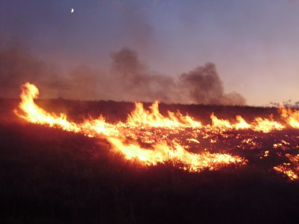
Landair Surveys Uses SimActive Correlator3D for Planned Burns Mapping in Australia
Landair Surveys, an Australian geospatial firm, is utilizing SimActive's Correlator3D software to create orthomosaics from aerial imagery. This initiative is part of their efforts in wildfire prevention and land management, specifically for planned burns mapping projects across Australia. The Montreal-based software developer announced this collaboration, highlighting that the workflow aims to enhance the efficiency of geospatial outputs. The use of advanced aerial imagery technology is expected to improve land management strategies and contribute to effective wildfire prevention measures.
Digital Twins Disaster Response Drone News Drone News Feeds Fire Firefighter
BM3D‐Based Optical Flow Tracking for Enhanced Visual Simultaneous Localization and Mapping Systems in Mobile Robotics
The Journal of Field Robotics has recently published an early view article highlighting advancements in robotic technology. This publication, released in October 2023, showcases innovative research that aims to enhance the capabilities of field robots in various applications, including agriculture, search and rescue, and environmental monitoring. The research is driven by the growing need for automation and efficiency in these sectors, as well as the increasing complexity of tasks that robots are expected to perform. The findings suggest that integrating advanced algorithms and machine learning techniques can significantly improve the performance and adaptability of robotic systems in real-world scenarios. This research not only contributes to the academic field but also has practical implications for industries looking to leverage robotics for improved operational efficiency and safety.
RESEARCH ARTICLE
3D Mobile Mapping for Digital Twins: Camera Features That Ensure Accuracy
Recent advancements in surveillance technology have transformed urban environments into rich sources of visual data, essential for creating digital twins of cities. These digital replicas rely heavily on high-quality imagery captured by cameras installed in various public spaces, including streets and buildings. However, experts warn that if the visual data collected is inadequate or flawed, the integrity and functionality of the entire digital model can be compromised. This reliance on precise imagery underscores the importance of maintaining and upgrading surveillance systems to ensure accurate representations of urban landscapes. As cities increasingly adopt these technologies, the challenge remains to balance effective data collection with privacy concerns, prompting ongoing discussions among policymakers and technology developers.
Robotics needs a service framework.
RSF defines a common language for robot service capability, lifecycle operations, certification pathways, and service-provider networks.
Join the RobotToday community on LinkedIn
Daily robotics news, in-depth analysis, conference highlights, and discussions with professionals worldwide.