

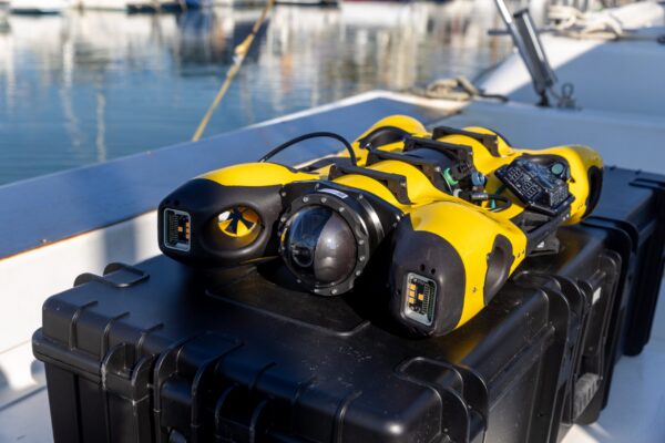
Researchers at the Technical University of Munich (TUM) have developed an autonomous measurement system that utilizes drones and lasers to map volcanic gas concentrations with a low measurement error of approximately 5%. This innovative system aims to enhance volcanic eruption forecasting by tracking the ratio of carbon dioxide to sulfur dioxide, providing insights into subterranean volcanic processes.
The significance of this technology lies in its potential to prevent natural disasters by offering accurate measurements of volcanic gases. Traditional methods have faced challenges due to background emissions and equipment damage from corrosive plumes. TUM's solution involves a ground station that shoots a laser through gas clouds, allowing for precise data collection while keeping equipment safe from harsh conditions.
Looking ahead, TUM plans to further automate the measurement and mapping processes, incorporating artificial intelligence to interpret the data. This advancement could lead to safer volcanic forecasting, particularly on the Aeolian island of Vulcano, which remains in an active degassing phase despite not having experienced a major eruption since the late 19th century.
Editor's Note
The development of this autonomous drone system represents a significant advancement in the field of volcanic monitoring and disaster prevention. By leveraging cutting-edge technology, researchers are addressing the challenges of accurate gas measurement in hazardous environments. This innovation could reshape how we approach volcanic activity assessment and enhance safety protocols for communities near active volcanoes.






















Leave a comment