


Blue Marble Geographics
"GIS Mapping and Geospatial Software That Powers Execution"
Blue Marble Geographics develops GIS and geospatial software including Global Mapper for lidar, drone/UAV and point-cloud processing and analysis.
Contact Blue Marble Geographics
WEBSITE
https://www.bluemarblegeo.com/HEADQUARTERS
United States

Company Facts
Founded
-
Primary Role
Software/Algorithm
Company Size
-
Primary Region
North America
Annual Sales
-
Funding Stage
-
Funding Total
-

LG Electronics Showcases Robotics at 2026 First Global Challenge in Incheon
LG Electronics is actively participating in the 2026 First Global Challenge, an international youth robotics competition taking place at Songdo Convensia in Incheon. The event, which runs from Wednesday to Saturday, gathers youth teams from 185 countries to design and build robots aimed at addressing global challenges, particularly focusing on wildfire prevention and recovery due to climate change. This year's competition, themed “Igniting Innovation,” emphasizes the importance of robotics in tackling pressing issues like wildfires. LG's involvement includes sponsoring the event and showcasing its latest robotics technologies at an exhibition booth. The company also features its humanoid robot, LG CLOiD, allowing visitors to engage with the technology and learn about the innovative solutions being developed by young participants. As LG increases its investment in robotics as a key growth area, it aims to integrate physical AI into its strategy. The company recently launched LG Data Factory to enhance data management for robotics training. No further timeline was disclosed at the time of publication.
All News
Zhiyuan's Data Business Struggles to Support Robotics at $20 Per Hour
Zhiyuan's data business is facing challenges as it operates at a rate of $20 per hour, which is insufficient to sustain the robotics industry. The company is exploring new avenues to enhance its offerings and address the growing demand for data in robotics. This situation highlights the broader issue within the robotics sector, where the cost of data collection and processing is becoming a critical factor. As companies seek to innovate and improve their robotic systems, the financial viability of data services like those offered by Zhiyuan is under scrutiny. Looking ahead, industry stakeholders should monitor how Zhiyuan adapts its business model to better serve the robotics market. No further timeline was disclosed at the time of publication.
Robotics Automation AI
Fudan Team Develops Robot Mat Capable of Harvesting Ground Electricity, Eliminating Battery Needs
A team from Fudan University has developed an innovative robot mat that can harness electricity from the ground, thus removing the necessity for batteries. This advancement could significantly impact the design and functionality of mobile robots, making them more efficient and environmentally friendly. The ability to extract energy directly from the ground is a game-changer in robotics, as it addresses one of the major limitations of mobile robots: battery dependency. This technology could lead to longer operational times and reduced maintenance costs, enhancing the overall performance of robotic systems in various applications. Future developments in this area will be crucial to watch, particularly how this technology can be integrated into existing robotic platforms. No further timeline was disclosed at the time of publication.
Robotics Automation AI
Huawei Unveils XMFS Prototype for Cross-Node Shared Memory at LPC 2026
Huawei presented its XMFS prototype at the Linux Plumbers Conference 2026, showcasing a new approach to cross-node shared memory. This innovative system utilizes POSIX file calls to facilitate memory sharing across different nodes, enhancing performance and efficiency in distributed computing environments. The introduction of XMFS is significant as it addresses the growing need for efficient memory management in multi-node systems. By enabling cross-node shared memory, Huawei aims to improve data accessibility and processing speed, which are critical for applications requiring high-performance computing. Looking ahead, industry observers will be keen to see how XMFS evolves and whether it will undergo further development to achieve mainline review status. The potential impact of this technology on distributed computing and memory management practices will be closely monitored in the coming years.
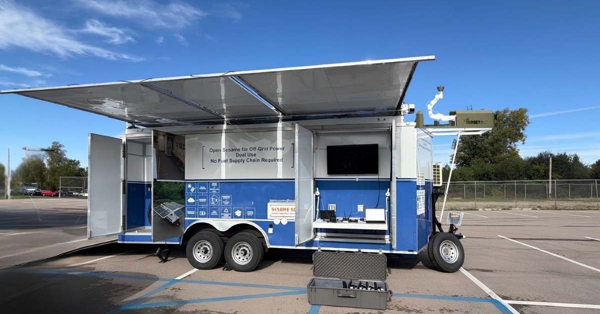
New Mobile System Enhances Drone Operations with Persistent Nanogrid Technology
Three US companies, Sesame Solar, Target Arm, and AG3 Labs, have introduced the first Made-in-USA Persistent Drone Operations Nanogrid. This innovative mobile system integrates power generation, autonomous drone launch and recovery, and configurable small drones to enhance operational efficiency in combat and other environments. The significance of this development lies in its potential to minimize downtime for drones, which is crucial for maintaining continuous operations. By automating the launch, recovery, and recharging processes, the Nanogrid addresses challenges faced by drone teams, particularly in remote or contested areas where conventional fuel resupply is difficult. Looking ahead, the companies anticipate that this system will find applications beyond military use, including border monitoring, search and rescue, and critical infrastructure inspections. No further timeline was disclosed at the time of publication.
News
Xiaomi Expands Apple Device Integration with HyperOS 4 Features
On October 7, Xiaomi announced enhanced integration with Apple devices in HyperOS 4, allowing users to share photos, files, contacts, and web pages seamlessly across both ecosystems. This new functionality includes two-way access to iPhone and Xiaomi cloud photo albums, notification syncing, and the ability to reply to messages without switching devices. The integration supports various Apple devices, including iPhone, iPad, and Mac. Users can view and control their Xiaomi phone through Xiaomi’s connectivity app on Mac and iPad, provided they have compatible software versions, a shared Xiaomi account, and the necessary network connection. This feature aims to enhance user experience by bridging the gap between Xiaomi and Apple ecosystems. HyperOS 4 was initially introduced with the Xiaomi 18 Pro series in September, and a wider rollout is set to commence on October 15. As Xiaomi continues to expand its software capabilities, it will be interesting to observe how this integration impacts user adoption and the competitive landscape between Xiaomi and Apple.
News Feed
IROS 2026 Closing Briefing — Pittsburgh, Sep 27–Oct 1
IROS 2026 closes in Pittsburgh with 1,900+ papers and 186 exhibitor listings. Humanoids, dexterous hands, tactile sensing and robot data led the show.

PTC Onshape at IMTS 2026: AI That Writes Its Own CAD Tools
PTC's Darren Henry shows Onshape's FeatureScript MCP Server turning a supplier PDF into a parametric CAD tool in 34 minutes, and what it means for robots.
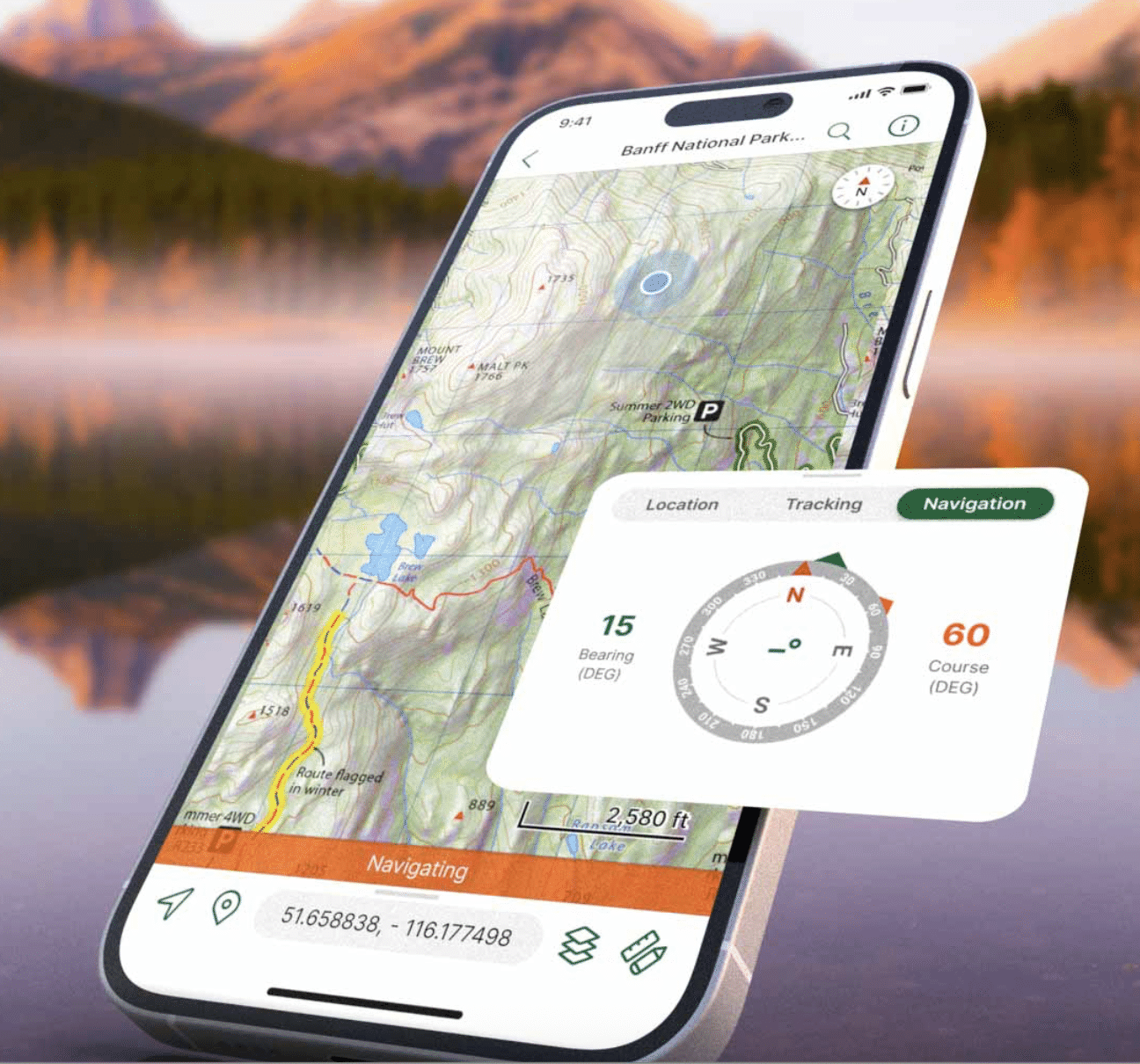
Blue Marble Geographics Enhances Geospatial Workflow with New Subscription Offering
Blue Marble Geographics has launched a new Global Mapper subscription that integrates various applications and services for drone mapping professionals. This offering, available in Essentials, Advanced, and Professional tiers, aims to streamline the geospatial workflow by connecting data collection, processing, and analysis in a single platform. The significance of this development lies in Blue Marble's strategy to create a cohesive geospatial workflow, especially following its merger with Avenza Systems in April 2026. The integration of Global Mapper with Avenza capabilities enhances the office-to-field and field-to-office connectivity, as highlighted by Eric Bogard, Vice President of Marketing at Blue Marble Geographics. Looking ahead, the new subscription levels cater to different user needs, with Essentials focusing on basic data handling, Advanced offering enhanced analytical tools, and Professional providing comprehensive lidar and photogrammetry capabilities. No further timeline was disclosed at the time of publication.
Applications Drone News Drone News Feeds Mapping Mapping Technology News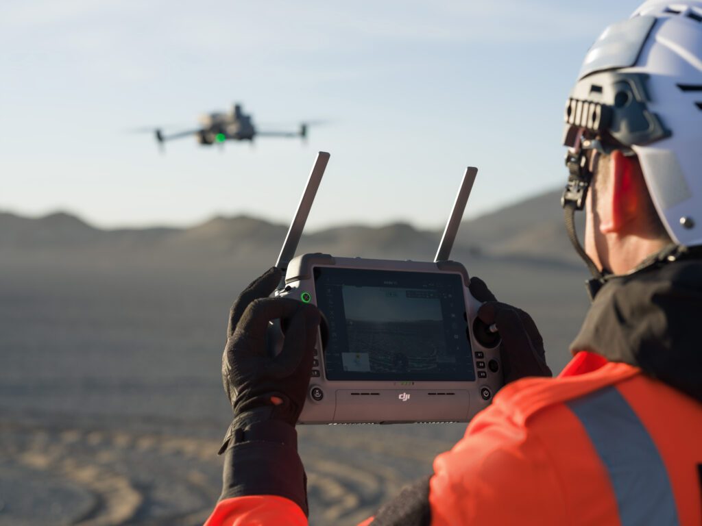
INTERGEO 2026 Highlights Shift from Drones to Geospatial Workflows
At INTERGEO 2026, the focus has transitioned from individual drones to comprehensive geospatial workflows. Drones, once a standalone category, now integrate seamlessly with crewed aircraft, satellites, and ground systems, enhancing data collection methods. Eric Bogard, Vice President of Marketing at Blue Marble Geographics, noted that drones are now viewed as tools within a broader toolkit for data collection, emphasizing the importance of workflow integration. This shift signifies a maturation in drone mapping technology, where the emphasis is on the results rather than the aircraft itself. The integration of drones into existing workflows allows surveyors and photogrammetrists to select the most suitable data collection methods for various scenarios. Customers at the event expressed a preference for how technologies work together rather than focusing on individual innovations, highlighting a collective industry evolution. Looking ahead, the challenge will be determining the appropriateness of drones for specific tasks and how their data can be effectively integrated into larger processes. The trend indicates that drones are now an integral part of the geospatial landscape, reshaping how surveying and mapping work is accomplished.
Applications Drone News Drone News Feeds Mapping Mapping Technology News
Exploring Geospatial Innovations at INTERGEO 2026 in Munich
INTERGEO 2026 is set to take place from September 15 to 17 at Messe München, showcasing advancements in mapping, lidar, photogrammetry, AI, and digital twin technologies. This event will gather the global geospatial community for three days of exhibits and discussions, emphasizing the integration of drones into professional mapping workflows. The significance of INTERGEO lies in its focus on the broader geospatial ecosystem, which includes surveying, GIS, remote sensing, and data analysis. Drones are increasingly being utilized for data collection, but the true value is derived from processing and integrating this data with other geospatial systems. Companies like Flyability and Ouster will demonstrate how lidar technology can enhance mapping in challenging environments, while SimActive will showcase its Correlator3D software for efficient data processing. As the event approaches, attendees should look for insights into how drone mapping is evolving and the importance of data processing in creating valuable geospatial products. The conference will feature sessions in both German and English, covering a wide array of geospatial topics relevant to professionals in the field.
Drone News Drone News Feeds News Blue Marble Geographics Digital Twins drone mapping
Software, Compute and Interaction at WRC 2026
47 WRC 2026 exhibitors supply robot software, compute or interaction — but only 19 call themselves software companies. Five open artefacts, licence-checked.

WRC 2026 Core Components: 137 Robot Parts Suppliers
The third report in the WRC 2026 series. Report 1 mapped all 248 exhibitors by category and Report 2 covered the 139 that build finished robots. This one covers the 137 that build what goes inside them.

WRC 2026 Robot Systems: 149 Companies That Build Robots
149 of the 248 classified WRC 2026 exhibitors build finished robots. 93 build humanoid or legged machines. The audited humanoid sales number is one unit.

Inside Saga Robotics: UVC Light vs. Crop Disease
Saga Robotics CPO Damian Flynn on the Thorvald platform's UVC treatment system, its jump from UK strawberries to California wine grapes, and why he's “incredibly bullish” on applying automation and robotics into industries “most chaotic environment.”

US Restrictions on Chinese Humanoid Robots: The Full Map
Every US restriction on Chinese humanoid robots — NDAA Sec. 163, GUARD Act, the 1260H list — plus the supply-chain math and a 4-tier map of decoupling.

Physical AI Landscape: From Digital Intelligence to the Embodied Physical World
A comprehensive industry analysis of Physical AI — covering Embodied AI, Field AI, Factory AI, VLM, World Model, VLA, and the VLA vs WAM architecture debate. Includes 20+ companies, 28 references, and the RobotToday Physical AI Landscape diagram. July 2026.
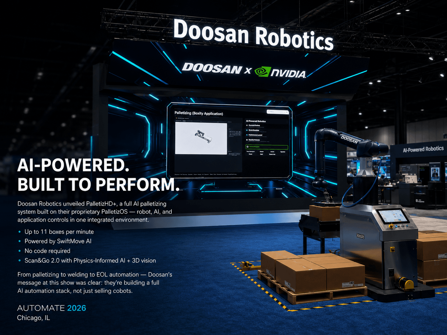
Doosan Robotics Unveils AI Palletizing Solution PalletizHD+ at Automate 2026
Doosan Robotics unveils PalletizHD+ at Automate 2026 — an AI-powered palletizing solution with PalletizOS, SwiftMove technology, and up to 11 boxes per minute throughput for smarter factory automation.

ROBOTTODAY Weekly May 23 – 29, 2026
This week in robotics: the Humanoids Summit debuts in Tokyo, China assigns every humanoid robot a digital ID, Figure signs a Catalyst Brands deployment deal, and Unitree heads to a June 1 IPO hearing. May 23–29, 2026.

Headed to XPONENTIAL 2026? Don’t Miss These Partners, Panels, and Dual-Use Innovations in Detroit
The annual AUVSI Xponential conference is set to take place in Detroit from May 11 to 14, bringing together key players in the global autonomous systems industry. This year's event highlights the growing integration of uncrewed systems, artificial intelligence, advanced manufacturing, and resilient supply chains, which are increasingly important for both commercial and defense sectors. As one of the premier showcases for innovations in these fields, XPONENTIAL 2026 aims to facilitate discussions and partnerships that address current industry priorities.
DL Exclusive Drone News Drone News Feeds News Ascent AeroSystems Autonomous Systems

