Industry Briefing
A single destination for timely, editor-curated robotics news from around the world.
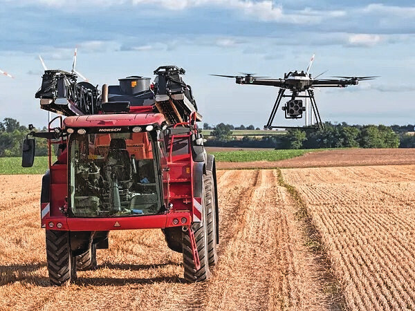
Horsch enters into partnership with application map specialist
Machinery manufacturer Horsch has acquired a strategic stake in German company Sam-Dimension, which specializes in creating application maps for spot spraying against weeds using drone imagery. This partnership, which has been in place since 2019, aims to enhance agricultural efficiency through innovative technology. Sam-Dimension has developed a high-resolution camera capable of capturing images with a precision of 1 millimeter, further advancing the capabilities of precision farming. This investment reflects Horsch's commitment to integrating cutting-edge technology into agricultural practices to improve crop management and sustainability.
Smart farming camera spray technology
Laser micro-perforation with camera: enhancing reliability in packaging films through industrial vision.
In the contemporary flexible packaging industry, achieving excellence extends beyond aesthetics to become a critical functional requirement. The optimization of permeability has emerged as a fundamental pillar in preserving the freshness of products, where every technical detail plays a vital role in extending shelf life and minimizing food waste. Recent advancements in laser micro-perforation technology, combined with industrial vision systems, are enhancing the reliability of packaging films. This innovative approach not only improves product preservation but also addresses the growing demand for sustainable packaging solutions. The integration of these technologies is transforming how the industry approaches packaging efficiency and effectiveness.
À la une IA Industrie Robotique conservation des aliments contrôle qualité automatisé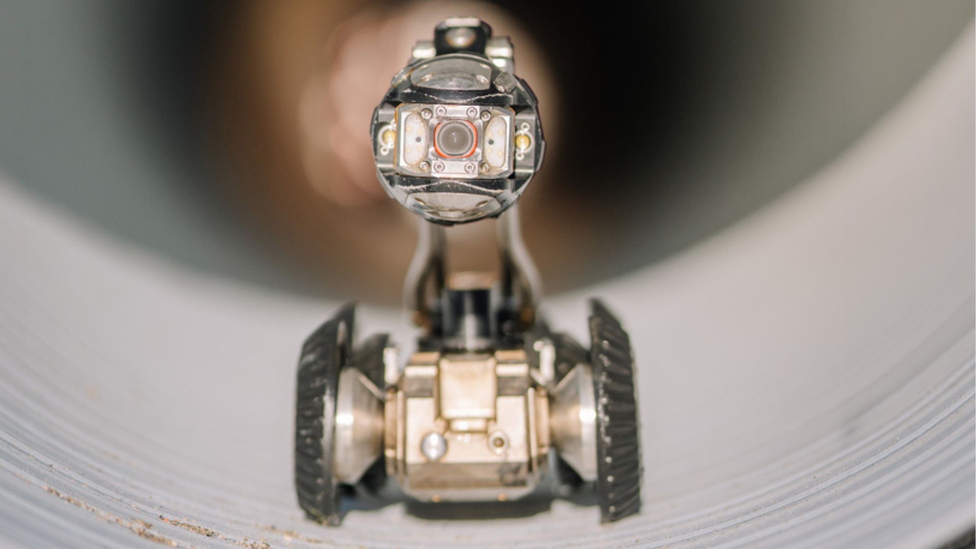
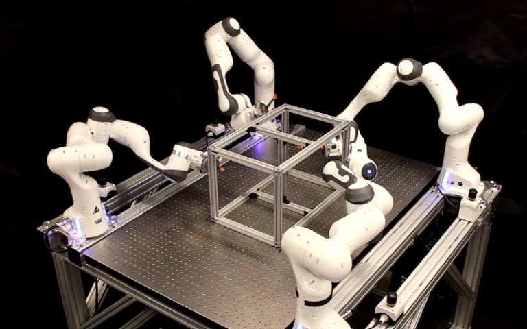
MIT’s 6 mW chip lets tiny drones see and map their surroundings in real time
Researchers at the Massachusetts Institute of Technology (MIT) have unveiled a groundbreaking low-power chip designed to enhance the capabilities of small drones and robots. This innovative technology, introduced in October 2023, aims to facilitate the construction of complex structures by enabling these machines to work collaboratively and autonomously. The development is driven by the need for more efficient and sustainable solutions in various fields, including construction and disaster response. By equipping drones and robots with this advanced chip, the team has demonstrated how these devices can communicate and coordinate their actions effectively, thereby significantly improving their operational efficiency. The research highlights the potential for such technology to revolutionize the way we approach tasks that require precision and teamwork in environments that are challenging for human workers.
Innovation
Malaysia to draft drone industry plan, eyes air taxi services
Malaysia is set to release a national roadmap for its commercial drone industry by the end of this year, with plans to introduce flying taxi services as part of its strategy to become a regional hub for advanced aviation technologies. Transport Minister Anthony Loke announced these ambitions during a forum on June 24, 2026, in Kuala Lumpur. The government aims for a limited commercial launch of these services by 2027, reflecting its commitment to innovation in the aviation sector. This initiative is part of a broader effort to enhance Malaysia's position in the rapidly evolving drone market and to leverage next-generation technologies for economic growth.

Ultraefficient chip could help tiny robots traverse complex environments
Researchers at MIT have developed an innovative chip designed to enhance the navigation capabilities of small, low-power unmanned aerial vehicles (UAVs) as they maneuver through confined spaces, such as industrial HVAC systems, to detect gas leaks. This breakthrough, announced recently, enables these autonomous robots and other battery-operated devices to create detailed three-dimensional maps of their surroundings in real time while consuming minimal energy—approximately the same amount as a single LED light. By utilizing these maps, the robots can effectively plan collision-free routes to their objectives, significantly improving their operational efficiency and safety in complex environments.
Hardware
New chip could help tiny robots traverse complex environments
A team of researchers has developed an innovative method for creating 3D maps to enhance navigation systems, utilizing a combination of an efficient algorithm and specialized hardware. This advancement, which was announced in October 2023, aims to significantly reduce the memory and power requirements typically associated with 3D mapping technologies. By streamlining the mapping process, the researchers hope to improve the efficiency and accessibility of navigation tools, making them more practical for a variety of applications, including autonomous vehicles and mobile devices. The integration of dedicated hardware with the algorithm allows for rapid map generation, which could lead to faster and more reliable navigation solutions in real-world scenarios.
Research Computer science and technology Algorithms Artificial intelligence Machine learning Robotics
SPH Engineering and Vets to Drones Partner to Expand Career Paths for Military Veterans
SPH Engineering has launched a new training initiative in collaboration with Vets to Drones, aimed at equipping military veterans with advanced flight planning skills essential for surveying, mapping, and inspection work in the commercial drone industry. This partnership responds to the growing demand for skilled drone operators capable of managing complex missions. By providing veterans with specialized training, the initiative seeks to expand their career opportunities in a rapidly evolving field. The program highlights the commitment of both organizations to support veterans in transitioning to civilian roles while addressing the industry's workforce needs.
Applications Drone News Drone News Feeds Drones in the News Mapping News
A Review on Search and Rescue Robots in Complex Scenarios: Key Technologies of Simultaneous Localisation and Mapping
A recent study published in the Journal of Field Robotics highlights the advancements in autonomous robotic systems designed for agricultural applications. Researchers from various institutions collaborated to explore innovative technologies that enhance efficiency and sustainability in farming practices. The findings, released in early October 2023, emphasize the growing need for automation in agriculture to address labor shortages and improve crop yields. The research team conducted extensive field tests to evaluate the performance of these robotic systems in real-world farming scenarios. By integrating artificial intelligence and machine learning, the robots demonstrated the ability to perform tasks such as planting, monitoring, and harvesting with remarkable precision. This technological progress aims to support farmers in overcoming challenges posed by climate change and increasing food demand. The study underscores the importance of developing reliable and cost-effective robotic solutions that can be easily adopted by farmers. As the agricultural sector faces mounting pressures, the implementation of these advanced technologies could significantly transform traditional farming methods, leading to more sustainable practices and enhanced productivity.
SURVEY ARTICLE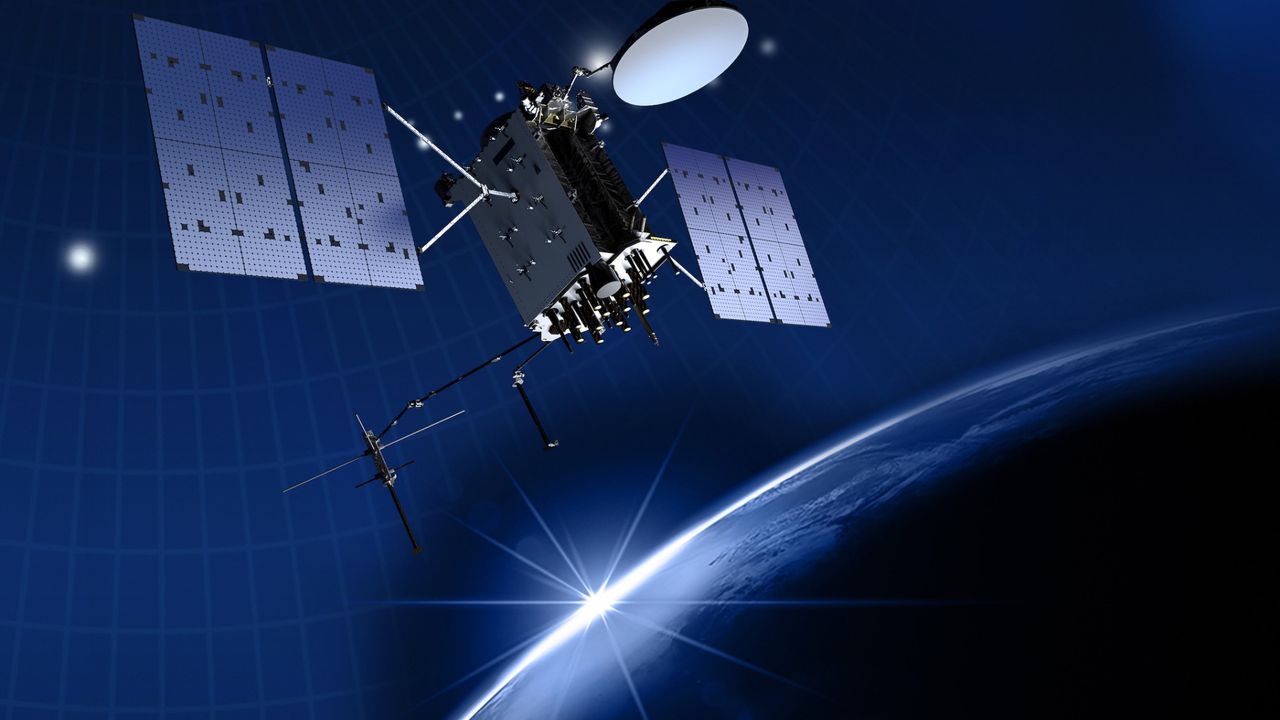
'It's quite a bit more than we expected': Satellite reveals immense scale of GPS signal tampering
An experimental satellite has successfully mapped the extent of GPS jamming across Europe and the Middle East, marking a significant advancement in space-based monitoring technology. This groundbreaking achievement was reported recently, showcasing the satellite's ability to detect and analyze interference in GPS signals from a vantage point in space. The initiative aims to enhance understanding of the growing issue of GPS jamming, which poses risks to navigation and communication systems. By employing advanced sensors and data processing techniques, the satellite collected and transmitted detailed information about the locations and intensity of jamming activities. This development is crucial for improving the resilience of GPS-dependent services and ensuring the reliability of navigation systems in the affected regions.
Satellites Space Exploration
Graitec outlines AI roadmap focused on accountability in engineering and construction
Graitec, a software provider, has announced a comprehensive three-stage artificial intelligence strategy tailored for the architecture, engineering, construction, and operations (AECO) sector. The company emphasizes that the primary challenge facing the industry is not the creation of content through AI, but rather the reliability of these AI-generated results in practical applications. To address this concern, Graitec plans to integrate AI directly into various processes, including engineering, fabrication, and construction. This initiative aims to enhance trust and efficiency within the AECO industry, ultimately improving project outcomes.
Construction News Software AECO AI software architecture and engineering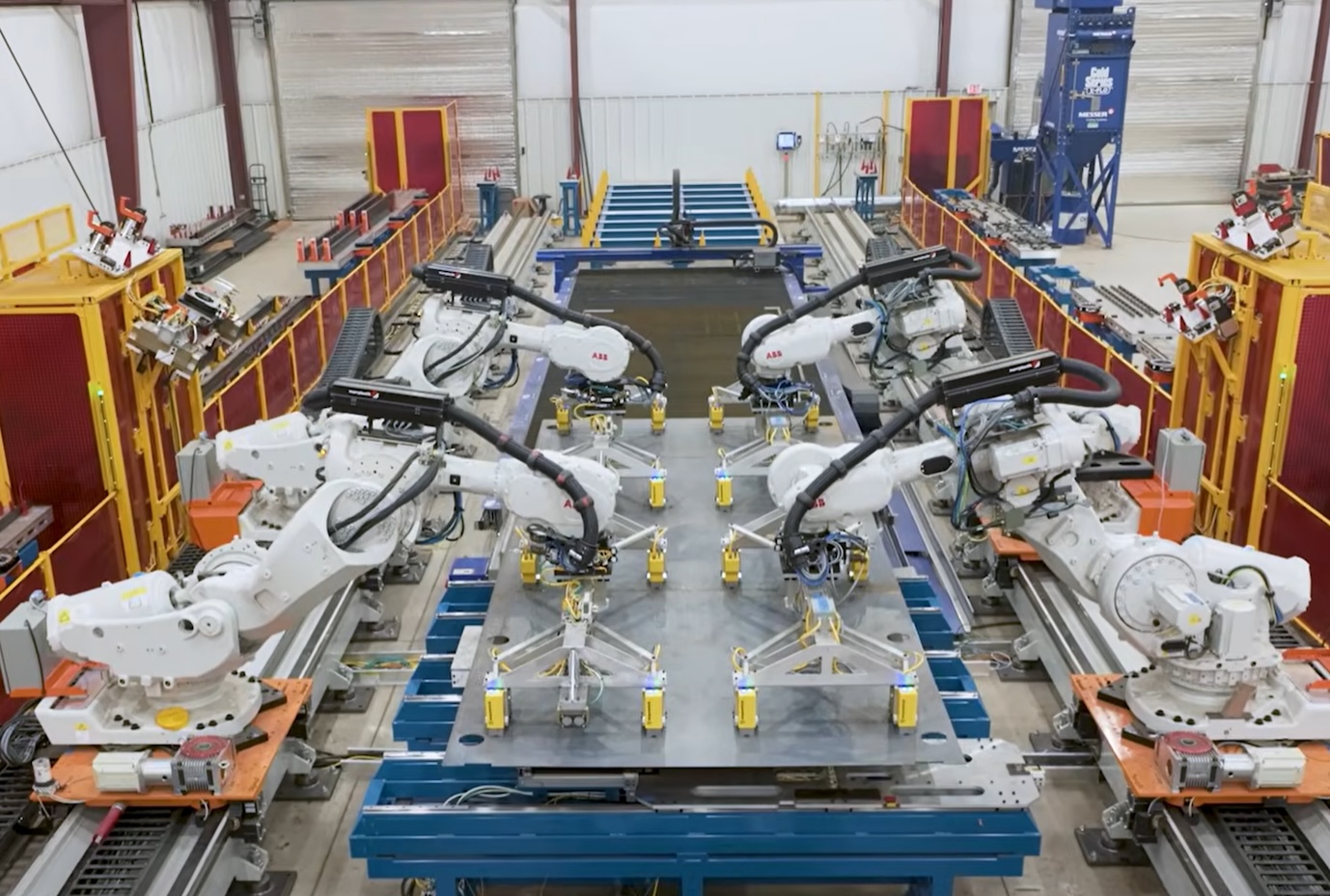
Rheinmetall, Destinus plan new cruise missile with 2,000km range
At Eurosatory 2026 in Paris, Rheinmetall Destinus Strike Systems unveiled plans for a new cruise missile designed to hit strategic targets from distances exceeding 2,000 kilometers. This advanced weapon system is a key component of the company's future roadmap, reflecting its commitment to enhancing military capabilities. The announcement underscores the growing emphasis on long-range strike capabilities in modern warfare, as nations seek to bolster their defense strategies amid evolving global threats. The missile's development aims to provide military forces with a significant advantage in precision and reach, aligning with current trends in defense technology.
News
ASI Releases CEO Playbook for Scaling Autonomy Across Industrial Operations
A new white paper has been released, providing a comprehensive roadmap for organizations looking to transition from pilot programs to full-scale automation. This document, developed by industry experts, aims to guide businesses through the complexities of implementing automated systems effectively. The white paper highlights best practices and strategies that have proven successful in various sectors, emphasizing the importance of a structured approach to automation. Released in October 2023, it addresses the growing demand for efficiency and innovation in the workplace. By outlining key steps and considerations, the white paper serves as a valuable resource for companies eager to enhance their operational capabilities and stay competitive in an increasingly automated landscape.

PUDU Robotics releases video showcasing new cleaning robot feature that instantly updates maps, eliminating task resets.
PUDU Robotics has released a video showcasing its cleaning robot's capabilities in a segment titled "Quick On-site Tes" on its official YouTube channel. The video was published on June 12, 2026, highlighting the robot's efficiency and effectiveness in real-time cleaning tasks. This initiative aims to demonstrate the advanced technology behind PUDU's cleaning solutions and their potential applications in various environments. By sharing this content, the company seeks to engage with its audience and promote the benefits of automation in maintaining cleanliness and hygiene.
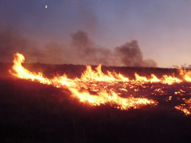
Landair Surveys Uses SimActive Correlator3D for Planned Burns Mapping in Australia
Landair Surveys, an Australian geospatial firm, is utilizing SimActive's Correlator3D software to create orthomosaics from aerial imagery. This initiative is part of their efforts in wildfire prevention and land management, specifically for planned burns mapping projects across Australia. The Montreal-based software developer announced this collaboration, highlighting that the workflow aims to enhance the efficiency of geospatial outputs. The use of advanced aerial imagery technology is expected to improve land management strategies and contribute to effective wildfire prevention measures.
Digital Twins Disaster Response Drone News Drone News Feeds Fire Firefighter
Defining Autonomy for Wellness Robots in Senior Care
A recent examination highlights the potential of socially assistive wellness robots in enhancing senior wellness across seven key dimensions. This analysis, aimed at addressing the escalating senior care crisis, underscores the challenges posed by demographic shifts, workforce shortages, and gaps in daily wellness programming that traditional care models face. The study defines wellness robots distinctly from companion and medical devices, emphasizing their unique features and functions. It introduces a framework for measuring the autonomy of these robots using the Care Robot Autonomy Scale (CRAS), a six-level scale inspired by the SAE J3016 driving standard, which assesses four critical care dimensions. Furthermore, the research outlines a roadmap for achieving full autonomy in wellness robots, detailing necessary technical capabilities, clinical evidence, and a phased approach leading into the early 2030s. This comprehensive analysis aims to inform stakeholders about the transformative role of wellness robots in senior care and the urgent need for innovative solutions in the face of growing demands. A free whitepaper summarizing these findings is available for download.
Type-whitepaper Wellness-robots Autonomous-robots Robotics
Massachusetts awards $4.5 million to 20 local manufacturers
The Healey-Driscoll Administration, in collaboration with the Center for Advanced Manufacturing (CAM) under the Massachusetts Technology Collaborative (MassTech), has unveiled the inaugural cohort of 20 manufacturers selected for the revamped Massachusetts Manufacturing Accelerator Program (MMAP). This initiative, announced recently, aims to enhance the manufacturing sector by offering a combination of capital grant funding, complimentary equipment assessments, expert guidance, and opportunities for peer learning. The program is designed to support manufacturers in improving their operations and competitiveness in the industry.
Business Features Manufacturing advanced manufacturing automation news cnc machining
New imaging system sees through murky waters
A groundbreaking technology known as “Sonar-MASt3R” has been developed to enhance underwater mapping capabilities by integrating sonar and visual data. This innovative system is capable of producing real-time 3D maps, significantly improving navigation and exploration in challenging environments, including cloudy water conditions. The technology was unveiled in October 2023, showcasing its potential to revolutionize marine research and underwater operations. By combining different data sources, Sonar-MASt3R addresses the limitations of traditional mapping methods, offering clearer and more accurate representations of underwater landscapes. This advancement is expected to benefit various sectors, including environmental monitoring, maritime safety, and underwater archaeology, by providing researchers and professionals with reliable tools for better decision-making in aquatic environments.
Research Robotics Computer vision Imaging Sensors Oceanography and ocean engineering
LIO‐RRTNav for Cattle Yard Inspection Robots: Prior Map Aided Relocalization and Goal‐Oriented, Smooth RRT Path Planning
A recent study published in the Journal of Field Robotics highlights advancements in autonomous robotic systems designed for agricultural applications. Researchers from a leading university conducted the study to address the growing need for efficient farming solutions amid increasing global food demands. The research, which took place over the past year, focused on developing robots capable of performing tasks such as planting, weeding, and harvesting with minimal human intervention. The team utilized cutting-edge technologies, including machine learning and computer vision, to enhance the robots' ability to navigate complex agricultural environments. By integrating these technologies, the robots can adapt to varying crop conditions and optimize their performance. The findings indicate that these autonomous systems could significantly reduce labor costs and improve productivity in the agricultural sector. The study's implications are particularly relevant as farmers face challenges related to labor shortages and the need for sustainable practices. By demonstrating the effectiveness of robotic solutions, the researchers aim to encourage wider adoption of automation in farming, ultimately contributing to food security and sustainability efforts worldwide. The research underscores the potential for robotics to transform traditional agricultural practices, paving the way for a more efficient and resilient food production system.
RESEARCH ARTICLE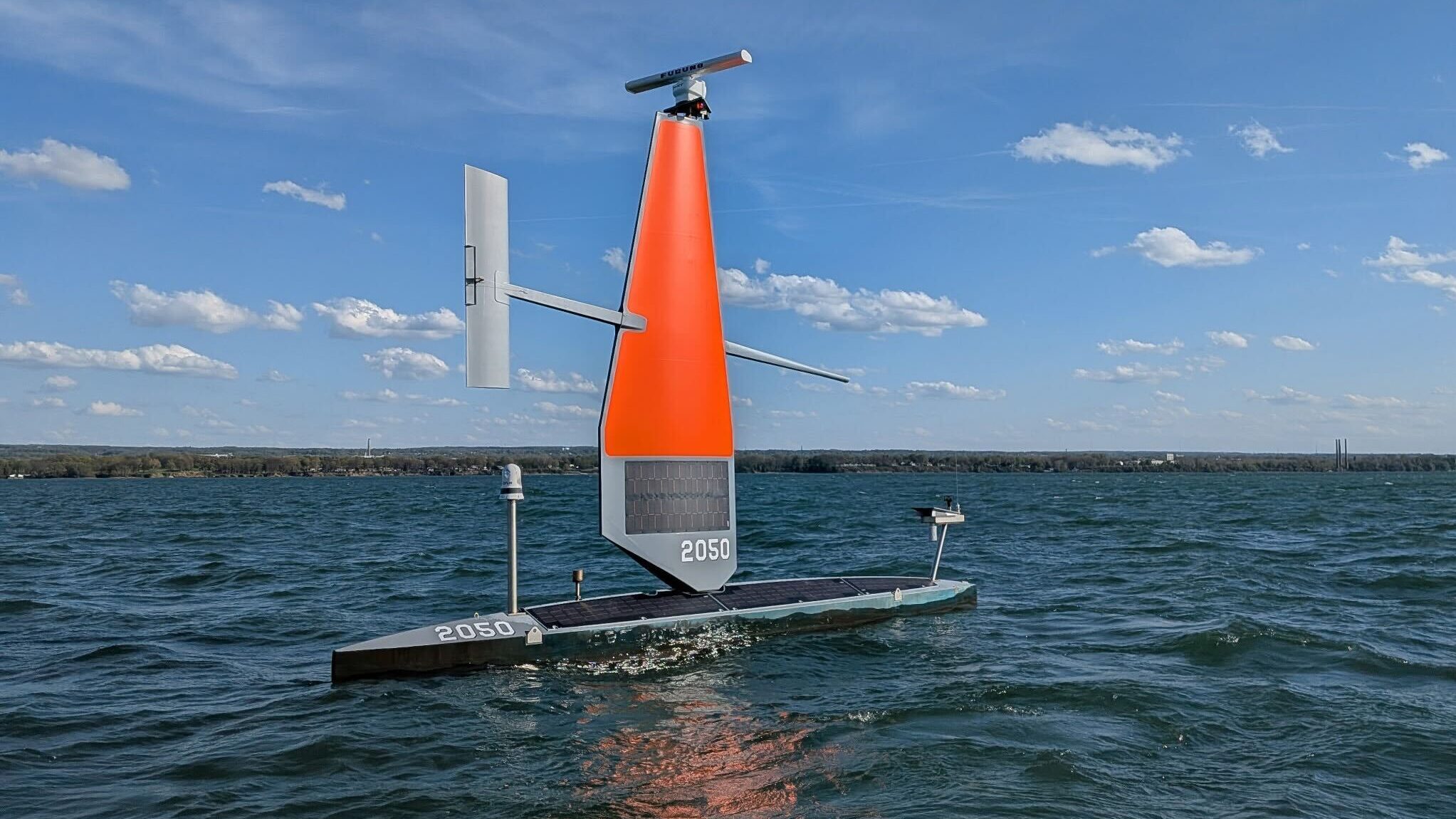
Coast Guard, Saildrone team up in northern waters to boost border security, surveillance
The Voyager, a state-of-the-art surveillance vessel, has been designed to carry out continuous coastal monitoring and nearshore mapping operations. This advanced ship can remain deployed at sea for approximately 100 days, enhancing its capability to gather critical data over extended periods. The implementation of the Voyager is expected to significantly improve maritime security and environmental monitoring efforts, providing valuable insights into coastal ecosystems and aiding in the management of marine resources. With its advanced technology and extended operational range, the Voyager represents a significant advancement in maritime surveillance capabilities.
Naval Warfare border security coast guard Drones Navy Saildrone
Beyond Dexterity: Why Contact May Define the Next Era of Robotics
At the 2026 IEEE International Conference on Robotics (ICRA) in Vienna, AGILINK showcased a captivating demonstration of robotic dexterity by creating a balloon dog, which drew significant attention from attendees. This seemingly playful task is recognized in the robotics community as a complex manipulation challenge due to the balloon's lightweight and highly deformable nature. The demonstration highlighted the intricate balance between motion and contact intelligence, essential for successful robotic manipulation. AGILINK's approach involved mapping the actions of professional balloon artists to robotic hands, allowing the robot to learn both successful manipulation sequences and recovery strategies during failures. This dual focus on motion and contact intelligence is crucial, as maintaining stable interaction with the balloon is as important as executing the correct sequence of actions. In conjunction with the balloon dog demonstration, AGILINK introduced the OmniHand 3 Ultra-M, a dexterous robotic hand designed to enhance contact intelligence through advanced sensing and faster response capabilities. The hand features 20 active degrees of freedom and a direct-drive architecture, enabling precise force regulation and tactile sensing across its surface. The significance of these advancements extends beyond balloon animals, addressing broader challenges in robotics related to unstable and deformable interactions, such as delicate assembly and household tasks. As robotics research increasingly prioritizes interaction dynamics, AGILINK's innovations may pave the way for more effective manipulation in unpredictable real-world environments.
Humanoid-robots Physical-ai Dexterous-hands Direct-drive-actuation Robotic-manipulation Reinforcement-learning
Robots move beyond mapped worlds with advanced lidar sensing
A lidar technology company has partnered with a robotics AI developer to enhance the capabilities of autonomous systems. This collaboration, announced recently, aims to integrate advanced lidar sensing with cutting-edge artificial intelligence to improve navigation and object recognition in various applications, including autonomous vehicles and drones. The partnership is expected to leverage the strengths of both companies, combining precise environmental mapping with intelligent decision-making algorithms. This initiative comes in response to the growing demand for more reliable and efficient autonomous solutions in industries such as transportation and logistics. The companies plan to begin testing their integrated systems in the coming months, with the goal of launching a prototype by early next year.

Summary of Microsoft's "Build 2026" announcement: expanding development platforms, safety measures, and hardware.
At the recent Build 2026 conference, Microsoft announced significant enhancements to its development platform aimed at supporting the creation of autonomous AI agents and ensuring safety controls. The tech giant introduced a new inference model named MAI, alongside high-performance local development terminals and a roadmap for quantum computing initiatives. These advancements reflect Microsoft's commitment to advancing AI technology and improving developer tools, positioning the company at the forefront of innovation in the tech industry.

DJI drone exposes hidden Maya megacities across Guatemala
Archaeologists have long suspected that significant remnants of the ancient Maya civilization lay hidden beneath the dense rainforests of northern Guatemala. However, the thick jungle canopy has made it difficult to uncover these historical treasures. Recently, researchers have turned to advanced drone technology and LiDAR scanning to penetrate the foliage and reveal the hidden structures beneath. This innovative approach is shedding light on what could be one of the most important archaeological discoveries of our time, offering new insights into the Maya world and its extensive urban landscapes. The use of these modern techniques marks a significant advancement in archaeological exploration, allowing scientists to visualize and map ancient sites that were previously obscured from view.
News
New Drone Map feature helps UK pilots avoid airspace conflicts
The Drone Map has introduced a new feature designed to enhance coordination among drone pilots, significantly reducing the likelihood of encountering another operator in the same area. This innovative tool aims to improve safety and efficiency in drone operations, allowing users to check for active flights before arriving at their intended locations. By providing real-time information about other drone activities, The Drone Map seeks to streamline the flying experience and minimize potential conflicts in shared airspace. This development comes as drone usage continues to rise, highlighting the need for better communication and awareness among pilots.
News
Global robotics technology roadmap
Henrik I. Christensen, a professor of Computer Science and Engineering at the University of California, San Diego, has unveiled a comprehensive global robotics technology roadmap. Released recently, this position paper examines the advancements in robotics across Asia, Europe, and America. It provides an overview of the current state of the technology while identifying key opportunities for growth and development in the field. The roadmap aims to guide stakeholders in navigating the rapidly evolving landscape of robotics, emphasizing the importance of international collaboration and innovation to harness the full potential of this transformative technology.

Ardian to invest €5 billion in digital infrastructure in France; Kuaishou creates 189 new jobs, 15 from AI; China allocates
On June 2, 2023, in Beijing, Gaode Map and the Singapore Tourism Board signed a strategic cooperation memorandum, marking the launch of the first collaborative tourism ranking list between a Chinese company and an overseas national tourism board. This initiative will feature the Singapore Street Ranking, utilizing Gaode's advanced aerial street view technology to provide a 360-degree perspective of local attractions, hotels, neighborhoods, and restaurants. The goal is to enhance the travel experience by allowing visitors to assess their destinations before arrival. In a separate development, the Jiangxi National Rare Earth Technology Innovation Center was established with a registered capital of 1.25 billion yuan, focusing on mineral resource exploration and scientific research. Additionally, WeRide and Uber announced plans to introduce Spain's first commercial Robotaxi service in Madrid, expanding WeRide's presence to its twelfth global city. The initiative aims to deploy hundreds of Robotaxis in the city center as operational benchmarks are met. In France, Ardian, a private equity firm, revealed a partnership with Verne to invest up to 5 billion euros in developing a next-generation digital infrastructure park in the Île-de-France region, with a target capacity of 500 megawatts by 2030. Other notable news includes a collaboration between Google and Telstra to build a fiber and submarine cable network in Australia, updates on the recovery timeline for Blue Origin's launch facilities following a recent rocket explosion, and a reduction in fuel surcharges for domestic flights in China starting June 5.

FORT Robotics acquires Mapless AI to expand teleop capabilities
FORT Robotics has announced its acquisition of Mapless AI, a move aimed at enhancing its teleoperation capabilities. This strategic decision, made to diversify FORT's technological expertise beyond traditional industrial environments, leverages Mapless AI's experience in more unstructured settings. The acquisition is expected to bolster FORT's offerings in robotics and automation, allowing for improved operational flexibility and efficiency. The deal reflects a growing trend in the robotics industry to integrate advanced AI technologies to meet the evolving demands of various operational contexts.
Artificial Intelligence Artificial Intelligence / Cognition Automotive Design / Development Financial Markets / Industries
SkyeBrowse makes every photo inside a drone 3D model clickable
SkyeBrowse has announced a significant update to its drone mapping software aimed at enhancing user experience in interpreting 3D models. The update, which is now available to all users at no extra charge, focuses on improving model quality and advancing AI-generated floor plans. Additionally, the newly accessible Image Walkthroughs feature is designed to assist users in better understanding the data captured through drone technology. This update addresses a common challenge faced by users in navigating and analyzing complex 3D representations, thereby streamlining the process of extracting valuable insights from aerial imagery.
News
Pokémon Go creator wants your drone photos to train AI
Niantic Spatial, the spinoff company from the creators of Pokémon Go, is investing heavily in drones and artificial intelligence by partnering with Spexi, the largest decentralized drone imagery network. This collaboration aims to develop intricate 3D maps of the real world, which are intended to enhance the training of future AI systems and robots. The initiative reflects Niantic's commitment to leveraging advanced technologies to innovate and expand its capabilities beyond mobile gaming.
News
SMILE-FX Launches AI Braces System, Bringing Predictive Treatment Planning to South Florida
Dr. Tracy M. Liang, a board-certified orthodontist, has unveiled a groundbreaking orthodontic treatment at SMILE-FX Orthodontic Studio in Miramar, Florida. On April 3, 2026, the clinic launched its AI Braces system, which uniquely combines artificial intelligence with advanced 3D CBCT (Cone Beam Computed Tomography) imaging. This innovative approach aims to enhance the precision and effectiveness of orthodontic treatments by providing detailed, data-informed mapping for each patient's needs. The integration of cutting-edge technology is designed to improve patient outcomes and streamline the orthodontic process, reflecting a significant advancement in the field.
Design Health 3D CBCT imaging 3d printing AI braces AI diagnostics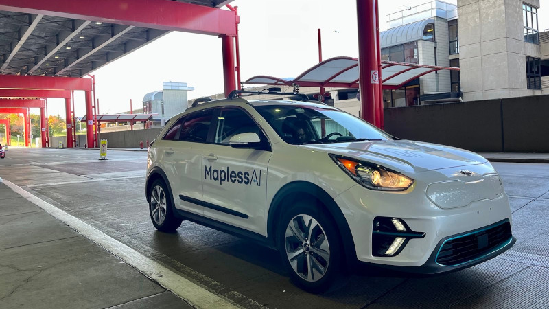
Fort Robotics acquires Mapless AI to expand supervised autonomy and physical AI safety platform
Fort Robotics, a company specializing in trust solutions for physical AI, has acquired Mapless AI, a prominent firm based in Boston and Pittsburgh known for its expertise in vehicle teleoperation and autonomy supervision. This acquisition marks a strategic move for Fort, enhancing its Trust Platform with two essential capabilities: remote human-in-the-loop teleoperation and onboard active safety. By integrating Mapless AI's technologies, Fort aims to broaden its commercial offerings and improve the safety and efficiency of autonomous systems. The deal underscores Fort's commitment to advancing the development of reliable and secure AI-driven solutions in the robotics sector.
Artificial Intelligence Financials & Investments Logistics active safety systems ai robotics automation news
FORT Robotics Acquires Mapless AI to Expand Its Trust Platform with Remote Supervision and Active Safety Capabilities
A recent acquisition has enhanced FORT's capabilities, transitioning its functionality from safe remote control to supervised autonomy. This advancement aims to meet the increasing demands for human-in-the-loop systems and proactive safety measures in the field of physical AI. The integration of these features is expected to significantly improve operational efficiency and safety in various applications, addressing the growing need for intelligent systems that can operate autonomously while still allowing for human oversight. This development marks a significant step forward in the evolution of AI technologies, reflecting ongoing trends in automation and safety in complex environments.
Efficient and Adaptive Autonomous Guidance and Control of Planetary Rover With Improved Traction Controller and Dynamic Cost Map
In June 2026, the Journal of Field Robotics published a significant study highlighting advancements in robotic technology aimed at enhancing agricultural efficiency. Researchers from various institutions collaborated to develop innovative robotic systems capable of performing tasks such as planting, monitoring crop health, and harvesting. This initiative responds to the growing demand for sustainable farming practices and the need to address labor shortages in the agricultural sector. The study, which spans pages 2848 to 2866 in the journal’s fourth issue, showcases how these robots utilize artificial intelligence and machine learning to adapt to diverse farming environments. By integrating advanced sensors and data analytics, the robotic systems can make real-time decisions, optimizing resource use and minimizing environmental impact. The research team conducted extensive field trials across multiple agricultural settings, demonstrating the robots' effectiveness in improving yield and reducing operational costs. The findings are expected to influence future agricultural policies and practices, promoting the adoption of technology in farming to ensure food security in an increasingly challenging climate. This groundbreaking work not only illustrates the potential of robotics in agriculture but also underscores the importance of interdisciplinary collaboration in addressing global challenges.
FIELD REPORT
Watch: The Gap Between Robotics Hype and Manufacturing Reality
Tilman Buchner, a partner and director at the Boston Consulting Group, recently presented insights from the firm’s latest report, which evaluates advancements in physical artificial intelligence within manufacturing environments. The report highlights significant progress in the integration of AI technologies on factory floors, emphasizing their potential to enhance operational efficiency and productivity. This analysis comes at a crucial time as industries increasingly seek innovative solutions to streamline processes and reduce costs. Buchner's findings underscore the importance of embracing these technological advancements to remain competitive in a rapidly evolving market. The report serves as a comprehensive overview of how AI is transforming traditional manufacturing practices, providing a roadmap for companies looking to leverage these technologies effectively.
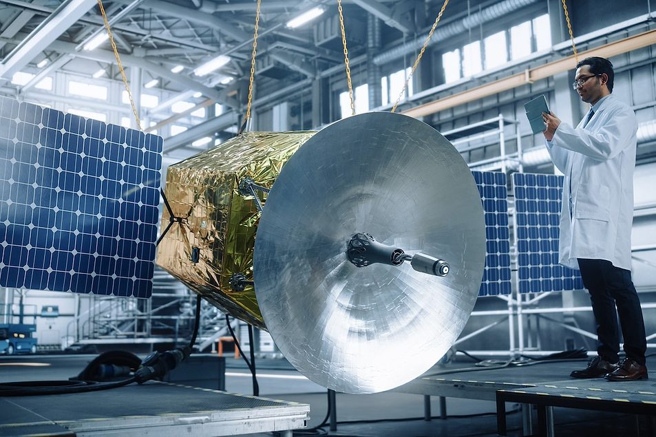
Report: Chinese Suppliers Embedded in U.S. Space Sector
Altana has revealed a significant infiltration of Chinese and Russian suppliers within the U.S. industrial space supply chain. This finding highlights the growing concern regarding foreign influence and potential security risks in critical sectors. The analysis, conducted recently, underscores the need for heightened scrutiny and regulatory measures to safeguard American interests. By mapping the supply chain, Altana aims to inform policymakers and industry leaders about the vulnerabilities posed by these foreign entities, prompting discussions on how to mitigate risks and ensure the integrity of the supply chain.
Robots could learn to predict, plan navigation with new ‘bio-inspired’ framework
A recent study highlights the advanced capabilities of robot vacuums in home cleaning. Researchers observed that when placed in a living room, these devices effectively create detailed maps of their surroundings, allowing them to navigate and clean efficiently. This development comes as more households adopt smart home technology, seeking convenience and improved cleaning solutions. The study, conducted in various residential settings, demonstrates how robot vacuums utilize sensors and algorithms to optimize their cleaning paths. As the demand for automated home care increases, manufacturers are focusing on enhancing these technologies to meet consumer expectations for efficiency and thoroughness.
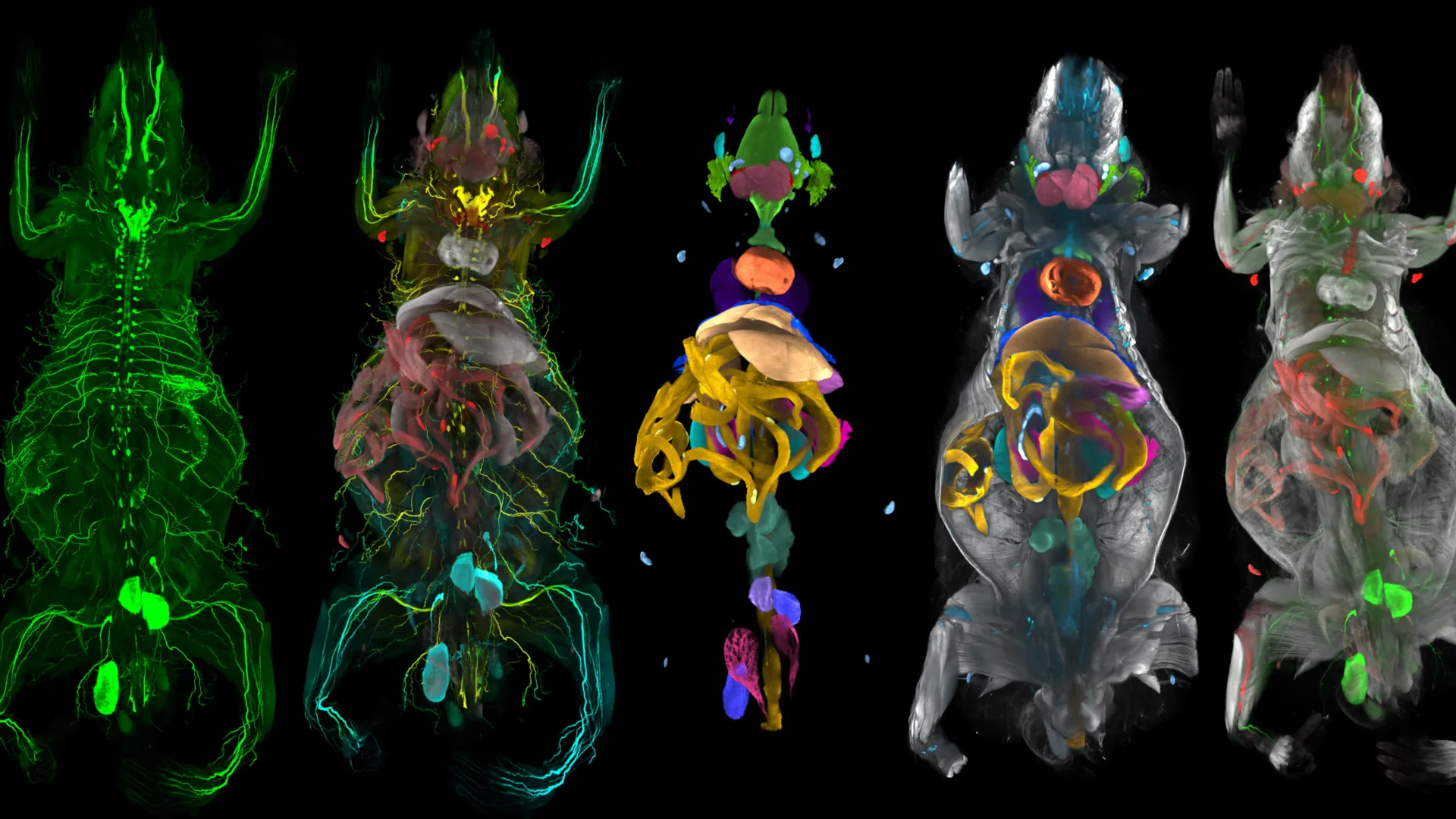
New AI body map reveals obesity’s hidden attack on facial nerves
A team of scientists has developed an advanced AI-powered system capable of scanning and mapping the entire body of a mouse with remarkable precision. This innovative technology has revealed unexpected findings regarding the effects of obesity. In addition to its well-known impact on metabolism, the research indicates that obesity may also harm facial sensory nerves associated with touch and sensation. Furthermore, the study highlights that obesity triggers extensive inflammation throughout the body. These discoveries contribute to a deeper understanding of the health implications of obesity and underscore the potential of AI in biomedical research.
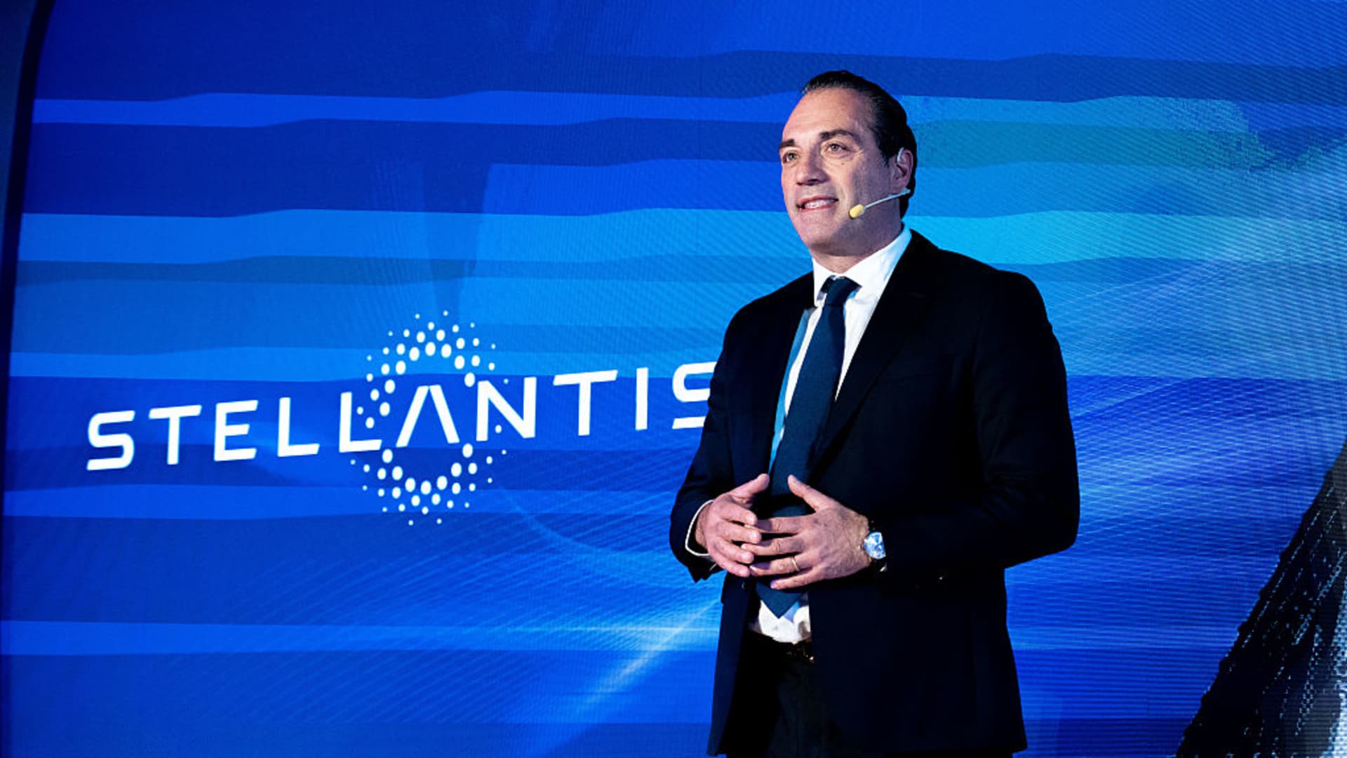
Stellantis unveils $70 billion turnaround plan, targets positive cash flow by 2028
Stellantis CEO Antonio Filosa announced a comprehensive five-year strategic plan on Thursday, aimed at transforming the automotive giant with an investment of 60 billion euros (approximately US$69.7 billion). This ambitious initiative, revealed during a press conference, is designed to enhance the company's competitiveness in the rapidly evolving automotive market. Filosa emphasized the importance of innovation and sustainability as key drivers of the plan, which seeks to address the growing demand for electric vehicles and advanced technology integration. The strategic roadmap outlines specific goals and initiatives that Stellantis intends to implement over the next five years, positioning the company to adapt to changing consumer preferences and regulatory landscapes.

Alibaba's Amap has announced plans to expand its traffic light countdown feature internationally, bringing the service to more countries and regions worldwide.
Alibaba's Amap has unveiled plans to expand its AI-powered traffic light countdown feature globally, currently operational at 500,000 intersections throughout China. This initiative aims to address navigation challenges faced by drivers around the world. The announcement highlights Amap's commitment to enhancing urban mobility and improving traffic management through innovative technology. By leveraging artificial intelligence, the feature is designed to provide real-time updates on traffic light changes, ultimately facilitating smoother and more efficient travel for users. The global rollout is part of Amap's strategy to position itself as a leader in smart transportation solutions, reflecting the growing demand for advanced navigation tools in urban environments.
Technology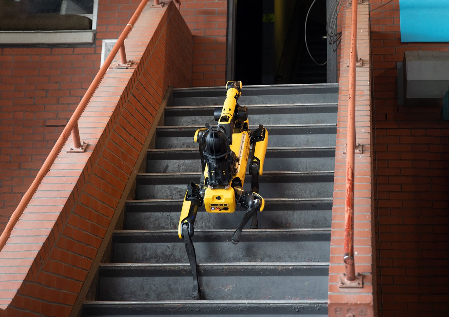
Giving First Responders an Advantage with Autowalk | Boston Dynamics
Public safety agencies are increasingly utilizing Spot, an advanced robotic technology, to enhance their emergency response strategies. By mapping out facilities prior to potential crises, these agencies aim to provide responding teams with critical information and a strategic advantage during emergencies. This proactive approach allows for better preparedness and more efficient management of incidents, ultimately improving safety outcomes. The implementation of Spot's mapping capabilities is expected to streamline operations and facilitate quicker decision-making when emergencies arise.

Open-source framework lets drones dodge obstacles in milliseconds while minimizing travel time
In the wake of a catastrophic earthquake, researchers are exploring the use of unpiloted aerial vehicles (UAVs) to assist in rescue operations by navigating through collapsed structures. These UAVs are designed to create detailed maps of disaster zones, providing critical information that can help rescuers locate and reach survivors more efficiently. However, the implementation of this technology presents significant challenges, as the autonomous drones must be capable of rapidly adjusting their flight paths to avoid unexpected obstacles while maintaining their intended course. The development of such advanced UAV systems aims to enhance emergency response efforts and improve outcomes in disaster scenarios.
Robotics
How agentic AI can enable general-purpose robotic navigation
Researchers are exploring the capabilities of agentic AI to enhance robotic navigation by integrating perception, simultaneous localization and mapping (SLAM), reasoning, and planning. This innovative approach aims to improve the performance of robots operating in dynamic environments. The findings were discussed in a recent article published by The Robot Report, highlighting the potential of agentic AI to transform how robots navigate and interact with their surroundings. By leveraging advanced algorithms and technologies, this method seeks to address the challenges faced by robots in real-world scenarios, ultimately paving the way for more versatile and efficient robotic systems.
Artificial Intelligence Artificial Intelligence / Cognition Autonomous Mobile Robots (AMRs) Cameras / Imaging / Vision Mobility / Navigation Motion Control
Get a systems perspective to scaling humanoids at the Robotics Summit
Giovanni Campanella, the general manager of robotics at Texas Instruments, is set to present a technical roadmap aimed at advancing the development of smarter humanoid robots. This presentation will take place at the upcoming Robotics Summit, where industry experts and enthusiasts gather to explore innovations in robotics technology. Campanella's insights are expected to shed light on the systems perspective necessary for scaling humanoid robots, addressing both the challenges and opportunities in the field. The event underscores the growing interest in enhancing robotic capabilities to better integrate into various applications and environments.
Artificial Intelligence Artificial Intelligence / Cognition Design / Development Events Humanoids Microprocessors / SoCs
New autonomous reef robot follows shrimp snaps and fish calls to map marine life zones
A team of scientists has unveiled an innovative autonomous underwater robot designed to identify and map biodiversity hotspots in marine environments. This groundbreaking technology was introduced during a recent conference held in San Diego, California, where researchers gathered to discuss advancements in ocean exploration. The motivation behind this development stems from the urgent need to monitor and protect fragile ecosystems threatened by climate change and human activity. The robot utilizes advanced sensors and artificial intelligence to navigate underwater terrains, collect data on various species, and create detailed maps of biodiversity-rich areas. By automating the process of exploration, the scientists aim to enhance the efficiency and accuracy of marine research, allowing for more effective conservation efforts. This initiative represents a significant step forward in understanding and preserving the ocean's diverse ecosystems, which are vital for global health and sustainability.
Autonomous seeking and mapping coral reef biodiversity hotspots with a multimodal AUV
In a groundbreaking study published in the May 2026 issue of Science Robotics, researchers have unveiled a new robotic system designed to assist in complex surgical procedures. This innovative technology, developed by a team of engineers and medical professionals, aims to enhance precision and reduce recovery times for patients undergoing surgery. The research was conducted at a leading medical institution, where the team tested the robotic system in a series of simulated surgeries. The results demonstrated significant improvements in accuracy compared to traditional surgical methods, showcasing the potential for robots to play a crucial role in the operating room. The motivation behind this development stems from the increasing demand for minimally invasive surgical techniques that can lead to quicker patient recovery and lower risk of complications. By integrating advanced robotics with surgical practices, the team hopes to address these challenges and improve overall patient outcomes. The robotic system operates through a combination of artificial intelligence and real-time data analysis, allowing it to adapt to the unique requirements of each surgical procedure. This adaptability is expected to empower surgeons, providing them with enhanced tools to perform intricate tasks with greater confidence. As the medical community continues to explore the integration of robotics in healthcare, this study represents a significant step forward in the evolution of surgical practices, potentially transforming the landscape of modern medicine.
Research Article
BM3D‐Based Optical Flow Tracking for Enhanced Visual Simultaneous Localization and Mapping Systems in Mobile Robotics
The Journal of Field Robotics has recently published an early view article highlighting advancements in robotic technology. This publication, released in October 2023, showcases innovative research that aims to enhance the capabilities of field robots in various applications, including agriculture, search and rescue, and environmental monitoring. The research is driven by the growing need for automation and efficiency in these sectors, as well as the increasing complexity of tasks that robots are expected to perform. The findings suggest that integrating advanced algorithms and machine learning techniques can significantly improve the performance and adaptability of robotic systems in real-world scenarios. This research not only contributes to the academic field but also has practical implications for industries looking to leverage robotics for improved operational efficiency and safety.
RESEARCH ARTICLE
Gaussian Splatting Meets Photogrammetry: SimActive Integrates New Capability in Correlator3D
Gaussian splatting, a cutting-edge technique in 3D reconstruction, has gained significant attention for its ability to produce highly realistic and smooth-rendered scenes. This development has prompted discussions within the geospatial industry regarding its potential to extend beyond mere visualization and enhance real-world mapping workflows. In response to this growing interest, SimActive has integrated Gaussian splatting capabilities into its Correlator3D software. This integration aims to leverage the advantages of the technique to improve photogrammetry processes, thereby facilitating more accurate and efficient mapping solutions. The announcement highlights the ongoing evolution of technology in the geospatial field and its implications for practical applications.
Applications Canada Canadian Drone Industry DL Exclusive Drone News Drone News Feeds
GameChange Solar Partners with Raptor Maps to Deliver First Integrated Solar Tracker Monitoring + Robotic Inspection System
GeniusVision and Raptor Maps have announced a strategic integration aimed at enhancing the efficiency of solar asset management. This collaboration, revealed in October 2023, seeks to significantly reduce operational costs while simultaneously improving the long-term performance of solar energy systems. By combining their advanced technologies, the two companies aim to provide solar operators with more comprehensive data analytics and insights, enabling better decision-making and optimized asset performance. The integration is expected to streamline operations, making it easier for solar energy providers to monitor and manage their assets effectively. This initiative reflects a growing trend in the renewable energy sector, where innovative partnerships are increasingly seen as essential for driving down costs and maximizing the potential of solar energy.
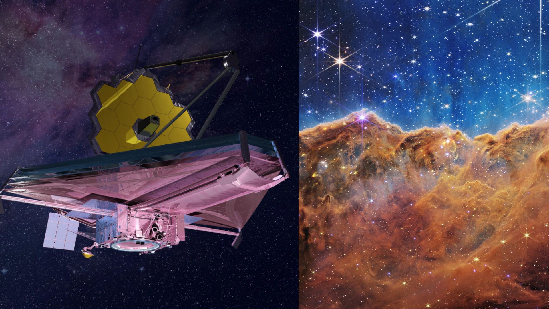
NASA’s James Webb telescope maps most detailed cosmic web across 13.7 billion years
Astronomers utilizing NASA’s James Webb Space Telescope have unveiled the most detailed map of the universe to date, showcasing intricate cosmic structures and phenomena. This groundbreaking achievement was announced on October 15, 2023, as researchers aimed to enhance our understanding of the universe's formation and evolution. The map, generated from extensive observations, highlights various celestial bodies and their interactions, providing insights into the distribution of galaxies, star clusters, and dark matter. By employing advanced imaging techniques and the telescope's powerful capabilities, scientists were able to capture unprecedented details that were previously obscured. This project not only marks a significant milestone in astronomical research but also paves the way for future explorations of the cosmos, as researchers seek to answer fundamental questions about the origins and fate of the universe.

GoLabs Launches Custom Robotics Security Initiative Using Unitree Quadrupeds
GoLabs, a newly established U.S.-based robotics company, has unveiled its innovative robotic security solutions featuring Unitree quadrupeds. Announced on May 8, 2026, these advanced four-legged robots are designed to enhance security measures for businesses by providing 24/7 autonomous surveillance without the burden of international shipping costs. Equipped with high-definition cameras, thermal imaging, and infrared sensors, these robots can operate in complete darkness and navigate challenging environments, including those hazardous to human health. GoLabs aims to streamline security operations by integrating these robots into existing systems, offering programming, setup, and troubleshooting support. Utilizing an integrated 4D LiDAR system and SLAM technology, the robots can create detailed 3D maps of facilities, allowing companies to establish automated patrol paths and checkpoints. This capability enables a wide range of applications, from monitoring AI warehouses to securing large events. GoLabs is committed to bridging innovation with practical applications, providing businesses with efficient and reliable robotic security solutions tailored to meet diverse needs. For more information, visit their website.
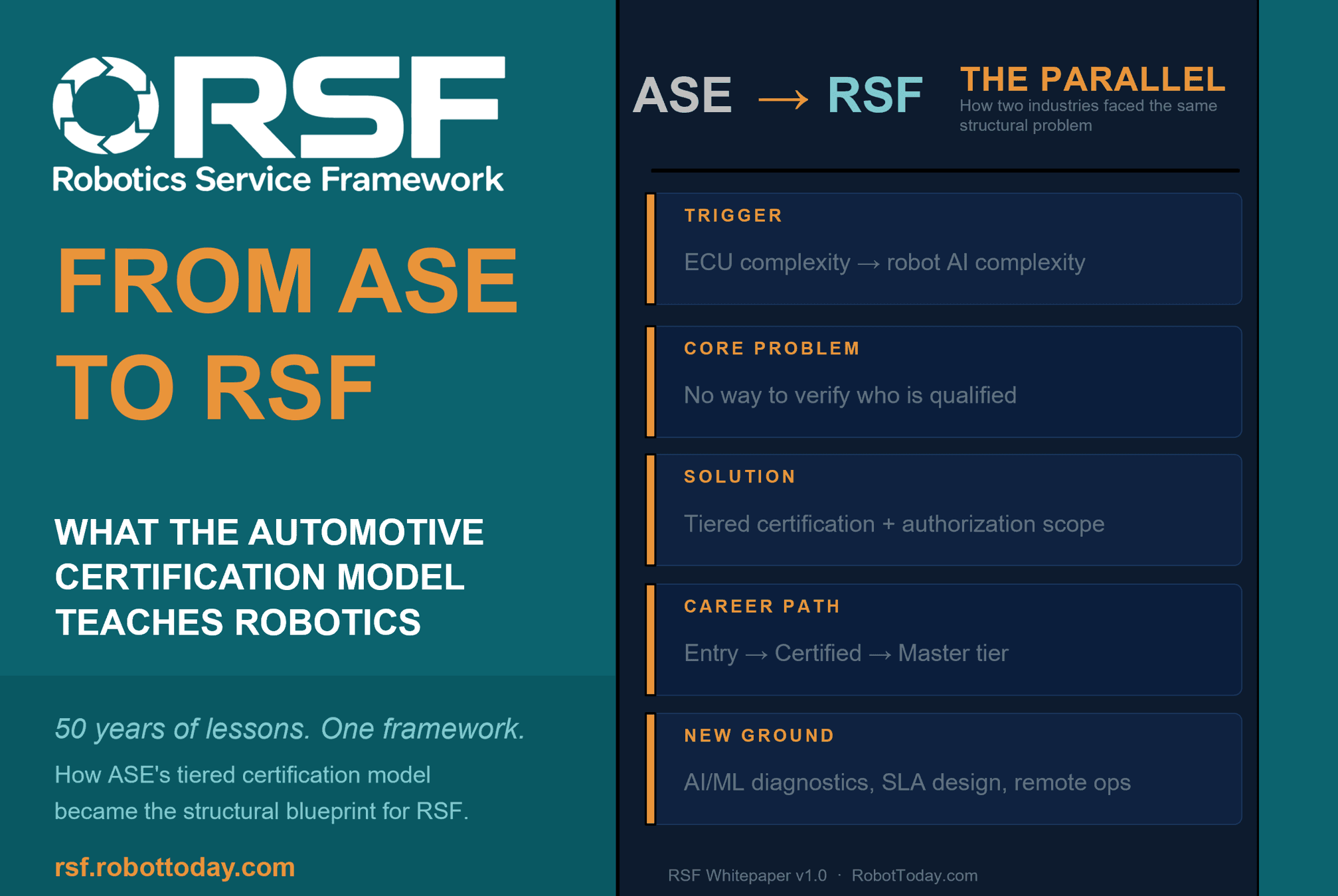
Robotics needs a service framework.
RSF defines a common language for robot service capability, lifecycle operations, certification pathways, and service-provider networks.